


Denver has yet to see any snow this season and the mountains have seen just a little, leading to one of the driest starts to the snowy season in almost a decade.
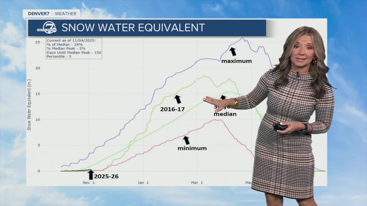
Denver7 Chief Meteorologist Lisa Hidalgo took a look at recent snow water equivalent (SWE) numbers after the Colorado Avalanche Information Center (CAIC) shared the below screenshot from the Natural Resources Conservation Service.
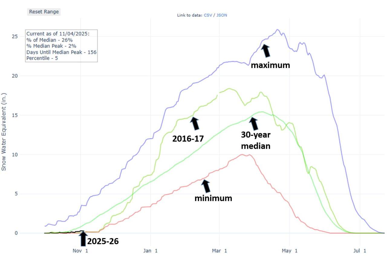
She explained that this graph shows just how dry it is across the mountains right now. At this point, it is the driest start since the 2016-2017 season, illustrated by the green line.
"The good news is we've got quite a few months to make up for it, and we did back in 2016 to 2017 by mid to end of the season," Hidalgo said.
Hear Denver7 Chief Meteorologist Lisa Hidalgo's full in-depth report from Nov. 6 in the video below.
CAIC said while the 2016-2017 season did start slow, it ended up rebounding to peak at 135% of the median SWE.
What is SWE, exactly? In short, it's the measure of the water content of snow. As explained by Avalanche.org, if you take a bucket of snow and melt it down, the water remaining in the bucket afterward is the SWE.
"Although it’s not great for Colorado’s water resources, a lack of early-season snow could be beneficial for future snowpack stability," CAIC posted online. "When we have snowy Octobers with big storms – followed by breaks in snowfall – that layer of snow sits on the ground, faceting and turning into weak, cohesionless snow that is unable to support future loads."

The dry start to the season means that avalanche risk in the mountains has been very low.
Across the mountains, avalanche danger remains small — a 1 out of a scale of 5 — due to this lack of snow, CAIC reported.
"A few inches linger in disconnected patches on upper-elevation slopes, but not enough to pose an avalanche threat," CAIC posted online. "You might find isolated drifts in gullies or along ridgetops, but more of a slipping hazard right now."
The group said a weak base layer of snow can still form, but at this point in the season, they hope that mid-November brings plentiful snow on top of bare ground, instead of on top of a weak layer.
The state's first report of a human-triggered avalanche of the season happened in late October. Nobody was injured.
Hidalgo explained that there is a much better chance of getting some snow accumulation in the mountains by the middle and end of November.
CAIC reports that a deep low-pressure trough will arrive on Thursday, bringing some light snow on Friday starting in the southern mountains and moving north. Total amounts is likely just a few inches, they said.
Denver7 is continuing to monitor a timeline for the season's first significant snowstorm.


