


DENVER — Get ready for temperatures to take a nose dive, Denver. A much colder, wetter system will be arriving late Sunday into Monday, bringing widespread rain, mountain snow, and a sharp temperature drop.
The National Weather Service said a few flakes might even fall along the I‑25 corridor Monday afternoon, but accumulation is unlikely.
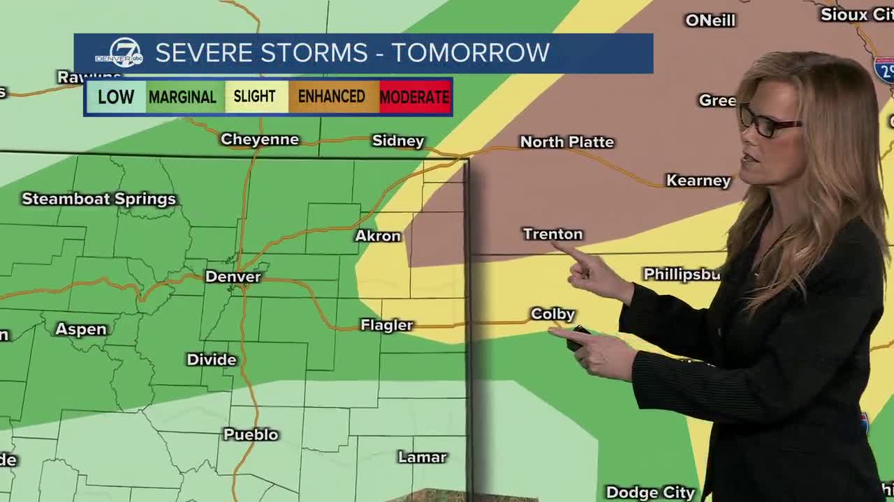
But before we see a return to winter-like weather, Sunday will bring another round of scattered storms with the best chance for severe weather on the far Northeast Plains, where hail will be the main threat.
“Isolated strong to severe storms are possible this afternoon, with the highest risk for severe weather for the eastern plains and the Palmer Divide. Otherwise, expect beneficial rainfall this afternoon through Monday,” the NWS said in an X post.

The barometer will begin to dip late Sunday and into Monday as widespread rain and mountain snow move into the area.
Monday’s highs are expected to drop 20–30 degrees from Sunday, with a morning freeze possible Tuesday morning across the Denver metro area and much of the plains.
The high country will likely see 4-15 inches of snow above 9,000 feet. The foothills are expected to get just a trace.
The northern I‑25 corridor is expecting up to 1.5 inches of rain on Monday.
On Tuesday, highs will climb a bit and stay in the 50s and 60s through midweek, with scattered afternoon showers possible on Tuesday and Wednesday.
A warming trend returns next weekend with highs back into the 70s and low 80s.
MORE: Hourly forecast | Latest forecast | Radars | Traffic | Weather Page | 24/7 Weather Stream
Stream live, current temperatures plus radars across Colorado anytime for free on the free Denver7+ app on your TV or watch from your computer or mobile phone anytime.


