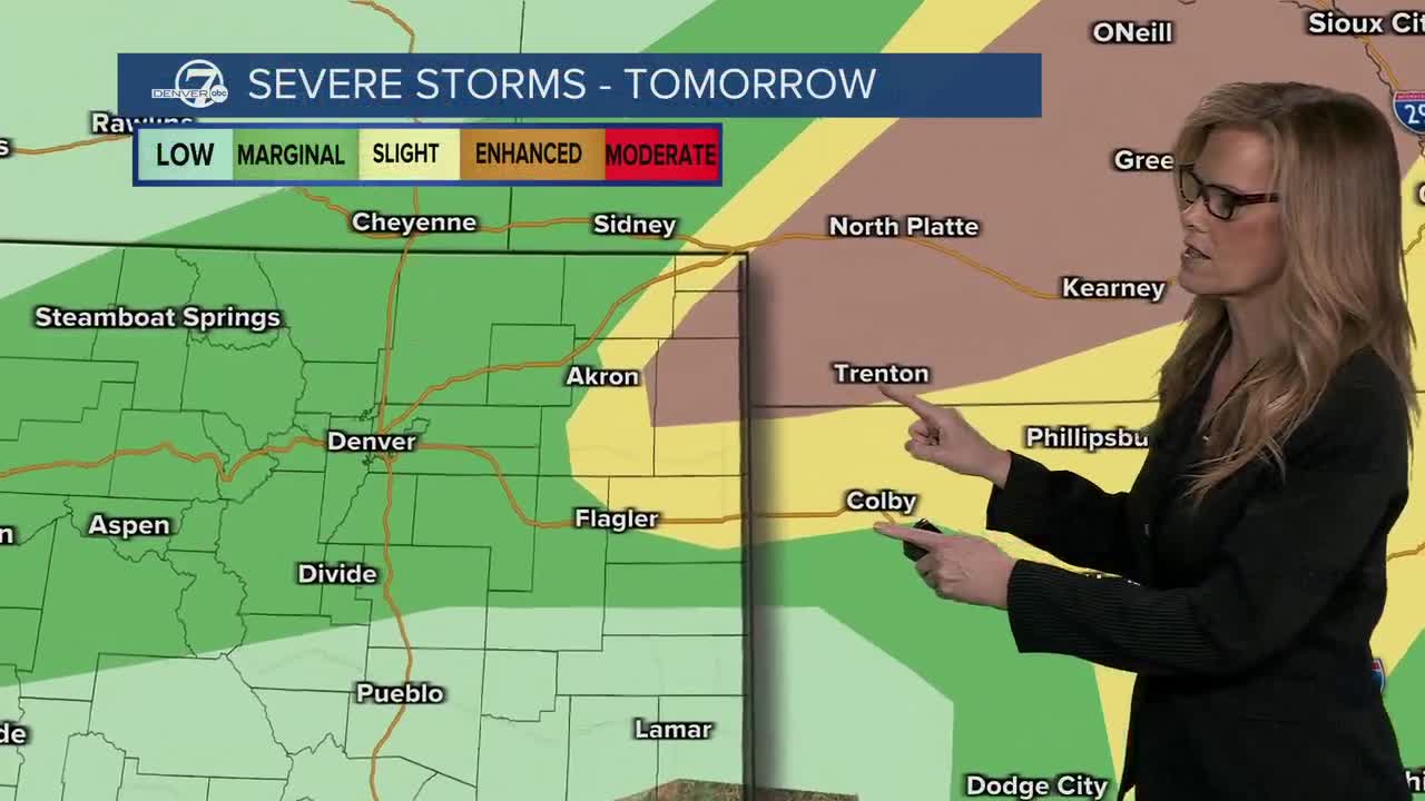


DENVER — Afternoon highs were in the 70s for Saturday afternoon, and they will be even cooler going into Sunday. We have been dealing with strong and severe weather across the plains. A few storms may produce large hail, damaging wind gusts around 70 mph, and even a small chance for an isolated tornado. Other areas may still see storms, but with fewer severe impacts

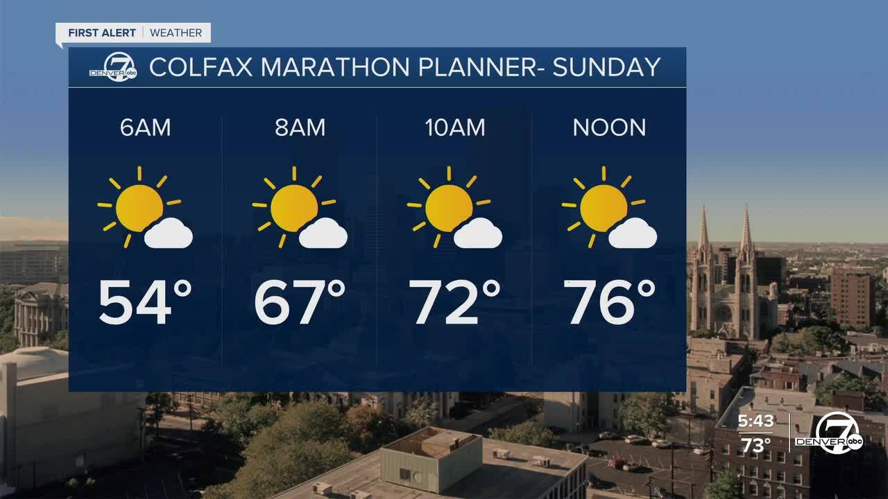
The weather stays unsettled on Sunday as another system moves closer to the region. Showers and thunderstorms are expected again during the afternoon and evening, along with breezy north winds. Forecast confidence is still a bit uncertain because small changes in moisture and front placement could greatly affect storm strength. Even though instability may not be especially high, strong winds higher in the atmosphere could still support a few strong to severe storms.

Rain chances continue into Monday, and this looks like the best opportunity for widespread precipitation across the area. Northern locations, especially near and north of I-70 and I-76, are favored to receive the heaviest rainfall totals. In the mountains, snow levels will gradually fall through the day Monday, allowing rain to change over to snow in some foothill and higher elevation areas. Mountain travel could become difficult at times due to periods of heavier snowfall.
By Tuesday, conditions begin to calm down with only a few lingering rain chances and cooler-than-normal temperatures. After that, the weather trend looks quieter and warmer as the week goes on. Temperatures are expected to slowly rebound through the second half of the week, with highs climbing back into the mid-70s across the plains by Friday.
DENVER WEATHER LINKS: Hourly forecast | Radars | Traffic | Weather Page | 24/7 Weather Stream
Click here to watch the Denver7 live weather stream.
