


Arctic air began to move into Colorado Thursday night and will have a grip on much of Colorado through at least Sunday morning, keeping temperatures below freezing until Monday.
In this live weather blog, Denver7 is tracking the latest update on this cold snap, including the weather warnings and watches, impacts to your day and closures.
MORE WEATHER COVERAGE: Hourly forecast | Radars | Traffic | Weather Page | 24/7 Weather Stream
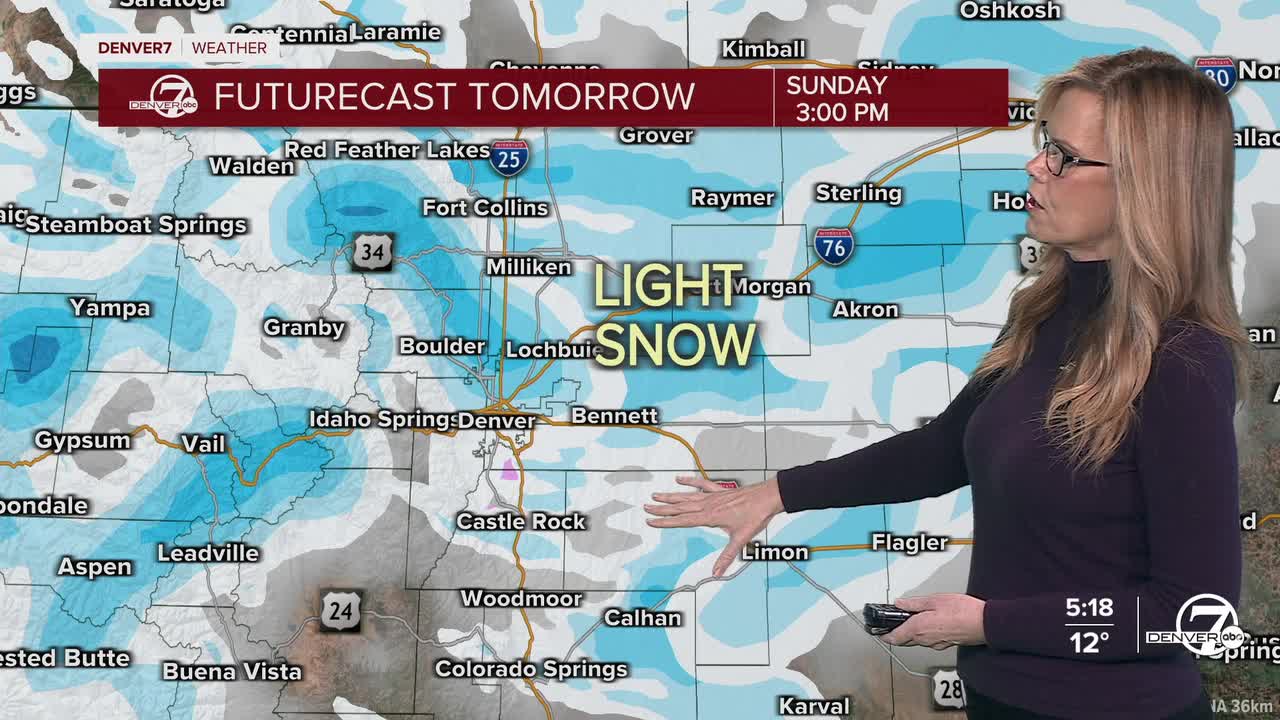
Some flurries are expected on Friday- and becoming more widespread Friday night- and linger into Saturday morning on the eastern plains, where wind chills could dip below zero degrees.
Wondering how much snow Denver is expected to get? Don't get your hopes up. The National Weather Service (NWS) out of Boulder reported that "for snow enthusiasts, the setup leaves a lot to be desired." Estimates hover around less than 1/10 of an inch.
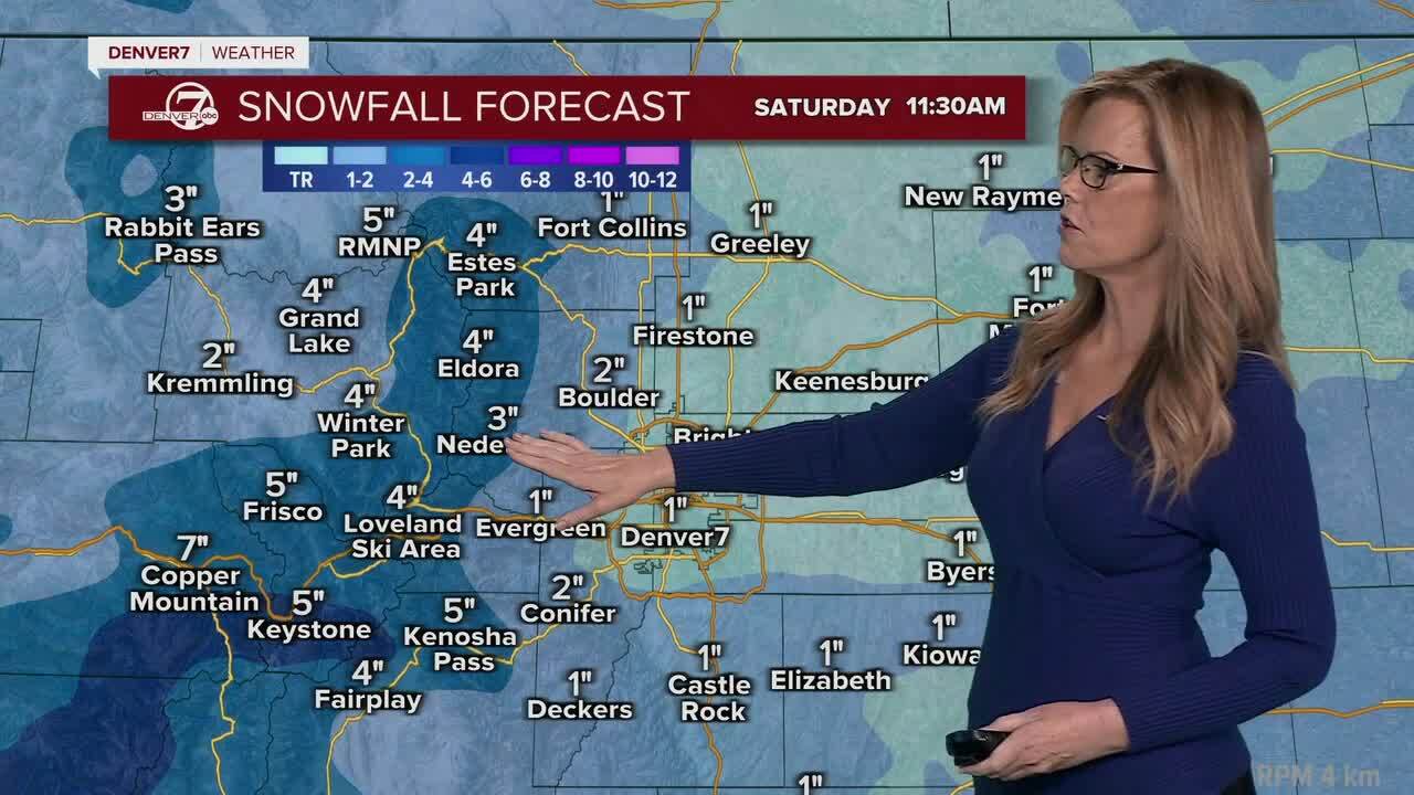
Between four and 12 inches of new snow is forecasted for the mountains, mostly along and south of Interstate 70. Mountain roads may become slick around sunset.
Scroll down for the latest weather updates.
Click here to watch the Denver7 live weather stream.
Denver7's live weather blog
Friday, Jan. 23
5 p.m. | SHELTER | The City of Denver opened an emergency cold weather shelter at a former DoubleTree hotel despite previous objections from some in city council, as sub-zero temperatures settle in across the metro over the next couple of days. Read more in our Denver7 report here.
3:06 p.m. | DENVER ZOO CLOSURE | The zoo will be closed through at least Saturday "due to the extreme cold weather" currently happening in Denver. Temperatures will be below freezing until at least next Monday.
10:46 a.m. | DENVER OPENS MORE SHELTER SPACE | The City of Denver has expanded its cold weather shelter capacity as temperatures dip to the single digits for the next couple of days, bringing with them dangerously-low wind chills plunging to 20 or more degrees below zero.
"All shelter sites are pet-friendly and provide food, showers, and blankets. Transportation will run daily from downtown shelters to cold weather shelter sites. Security will be present at each site, and shelters will deactivate once weather improves," wrote the city in a news release.
Here's additional information from the city on places to find shelter:
- For individual men – Denver Rescue Mission Lawrence Street Community Center, 2222 Lawrence St.
- For individual women – Samaritan House, 2301 Lawrence St.
- For youth/young adults ages 12-24 – Urban Peak, 1630 S. Acoma St.
- For families - Inn at the Highland, 2601 Zuni St. For additional support or questions contact the Connection Center at 303-295-3366.
24/7 shelter is being provided at 2601 W. 7th Ave., 375 S. Zuni St., and 4411 Peoria St.
Additional shelter is now being provided at 4849 Bannock St, and The Aspen shelter at 4040 Quebec St. will open today at 1 p.m.
5:20 a.m. | EMISSION TESTING DELAY | Air Care Colorado Stations will delay opening by at least two hours. When temperatures fall below 15 degrees, stations suspend operations.
Temperatures are not supposed to rise above 15 degrees by 8 a.m.
Thursday, Jan. 22
7:30 p.m. | FORECAST UPDATE | The NWS is reporting some cold temperatures over the next couple days, with wind chills making the real-feel temperature dip below zero. Below is a look at what to expect.

4:46 p.m. | CLOSURE | The Denver Zoo Conservation Alliance said it will close to the public on Friday due to the extreme cold temperatures. Most of the animals will need to remain in their indoor habitats.