



As of Aug. 1, this story will no longer be updated every day. It will be updated with major developments.
DENVER —There has been no fire recent growth on the Ferris Fire burning in Dolores and Montezuma counties and containment is holding, according to updates from the incident management team.
The fire 15 miles northwest of Dolores has charred more than 64,800 acres in southwest Colorado, with containment holding at 97% as of July 29.
The lightning-sparked blaze was first reported in the Glade Area on June 27.
🔥 MORE | Extensive Denver7 coverage of Colorado wildfire season 2026
The fire forced evacuations in both counties, which have been lifted. An interactive evacuation map is available here.
There have been no reports of injuries or structural loss at this time.
Wednesday, July 29
9:59 a.m. | Landowner workshop | The Dolores County Extension Office is hosting a Landowner Burn Area Recovery and Reclamation Workshop Wednesday from 5:30 p.m. to 7:30 p.m. at the Dolores County Public Service Center at 8477 Road 7.7. It will also be available live via Zoom here. The meeting will cover recovery assistance, damage assessment and erosion mitigation.
The San Juan National Forest Ferris Fire Area, Road, Trail and the BLM Emergency Land Closures have been lifted. Both BLM and Forest Service lands near the Ferris Fire are open to the public.
Tuesday, July 28
9 a.m. | Operational update | Fire officials working the Ferris Fire provided the following operational update:
Management of the fire will transition back to local agency leadership on Wednesday, after announcing that today was the last San Juan Team 8 morning briefing for firefighters working on the Ferris Fire.
The fire is 97% contained and remains at 64,881 acres in size.
Monday, July 27
9:15 a.m. | Operations update | The incident management team said with Sunday's rain, localized flash flooding and debris flows likely occurred around the Ferris Fire.
On Monday, crews will assess some of those impacts, which may include clogged culverts and washouts.
An aircraft is scheduled to fly over the fire to look for any remaining hotspots.
Friday, July 24
8:38 a.m. | Acreage latest and containment update | The Ferris Fire remains at 64,881 acres and containment continued to grow to 97%, according to the incident management team.

"There is one area of smoke in the interior northwest portion of the fire. Other than this, there has been no observable fire behavior for many days," the incident management team said Friday morning.
Thursday, July 23
9 a.m. | Operational update | In an operational update Thursday morning, fire officials working the Ferris Fire said the following:
Updates on the Ferris Fire will now be released every other day, with the next update coming on Saturday, July 25.
Minimal fire behavior was observed across the fire area Wednesday, though some smoldering logs persist. Crews continued to assess road conditions and chip away at suppression repair priorities as weather conditions allowed, including mitigating private land flooding, according to fire officials.
On Thursday, fire personnel will proceed with suppression repair project priorities as weather conditions allow on the western side of the fire. Heavy equipment and chippers will continue working on the eastern side of the fire in Division T/R when road conditions improve following recent weather patterns. Fire crews are working closely with Resource Advisors to perform hazard tree assessments and removal of those trees for public and worker safety. .
Erosion control efforts and rehabilitation operations will be continuous across all divisions of the fire, including on roads, ditches, and accessible culverts, fire officials said.
Flash flood risks and debris flows are still a possibility for the area as afternoon thunderstorms develop, according to fire officials. Drier and warmer weather is expected as we move into the weekend.
Wednesday, July 22
5:30 p.m. | Public lands reopen | As the fire nears full containment, the Bureau of Land Management has reopened most previously closed public lands in the Tres Rios Field Office area, according to the incident management team.
The San Juan National Forest fire area remains closed.
9:34 a.m. | Acreage latest and update on containment | The Ferris Fire estimate remains at 64,881 acres while containment has grown to 94%, according to the incident management team.
"The Ferris Fire is being managed under a full fire suppression strategy and yesterday’s work brought containment to 94%, as firefighters accomplished more containment near Glade Ranch," the incident management team reported. "Fire perimeter patrols reported no smoke or new activity."
Tuesday, July 21
9:22 a.m. | Latest on acreage and update on containment | The Ferris Fire is now estimated at 64,881 acres and containment has now grown to 91%, according to the incident management team.
"The fire area still includes many hazards, including the potential for flash flooding, mud slides, and fire-weakened trees," the team reported.
Monday, July 20
7 a.m. | Operational update | In an update Monday morning, San Juan Team 8 Operations Section Chief Lance Martin provided the following update on fire suppression efforts:
Though fire crews saw a few smokes in the Dolores Canyon area, firefighters observed no fire growth on the Ferris Fire Sunday, thanks, in part, to the fire receiving significant amount of moisture, especially in the southern end of the blaze.
Martin said that on Monday, crews would focus on moving all resources to fire suppression and repair across all divisions as firefighters make steady progress securing the fire’s perimeter.
He said firefighters had repaired all fire lines to the south of the fire, and would focus on the western edge of the fire.
"Crews are starting suppression and repair where they can," Martin said in his operational update. "We are having to be really patient over on the west side and east side of the fire."
The operations chief said firefighters on the eastern side of the fire are doing well and continue to do assessments on suppression and repair.
He said that given the work on containment firefighters are doing at this point, operation updates could come every other day or every third day from now on.
By Monday morning, the fire was 89% contained. It remained at 64,881 acres in size.
Saturday, July 18
10:30 a.m. | Containment increases, mop-up continues | "Outstanding progress" continues, as containment rises to 71% and fire behavior remains minimal, according to a Saturday morning update.
Cooler temperatures, humidity and scattered showers have reduced fire activity, and Saturday's work will focus on suppression repair, road rehabilitation and continuing mop up. More rain is expected Saturday and Sunday.
Friday, July 17
9:30 a.m. | 'Outstanding progress' | Crews are making "outstanding progress" on the Ferris Fire, according to a morning update from the incident management team. The fire, which was 29% contained Tuesday morning, is now 59% contained, according to the update.
"Cooler temperatures, higher relative humidity, and consistent afternoon rain showers have greatly reduced fire activity, allowing crews to strengthen containment lines and transition into the next phase of the incident," the update said. The area's severe fire danger index has now dropped to low, the update said.
All evacuation zones have returned to "get ready" status. You can view an interactive evacuation map is available here.
Suppression efforts are winding down, and some personnel and equipment are being released to other fires.
Remaining crews are "patrolling for any remaining hotspots, extinguishing isolated areas of heat, completing mop-up, and conducting suppression repair," the update said.
Thursday, July 16
11:37 a.m. | Operations update | Containment continues around the southern part of the fire. The northern part of the fire has not seen any movement, according to the incident management team.
11:15 a.m. | Evacuation update | All zones for the Ferris Fire that were under mandatory evacuation order have moved back to pre-evacuation.
2:42 a.m. | Acreage and containment update | The Ferris Fire has burned through 64,875.6 acres and 53% contained, according to Watch Duty.
Wednesday, July 15
Noon | Evacuation downgrades | The San Miguel County and Dolores County sheriffs have downgraded a mandatory evacuation for Zone 16, which was issued on Monday, July 13, to pre-evacuation status. They said this includes "a few properties on the Dolores/San Miguel County line approximately one mile east of the Dolores River Canyon rim." Click here for the evacuation map.
10:25 a.m. | Operations update | The divisions around the southern and southwest edge of the fire continue to stay in mop-up mode. There is an unburned area within the perimeter in this area, but that area is looking "good," the incident management team reported.
Toward the northwest and northern section, the team said all indirect lines are in place to protect values at risk.
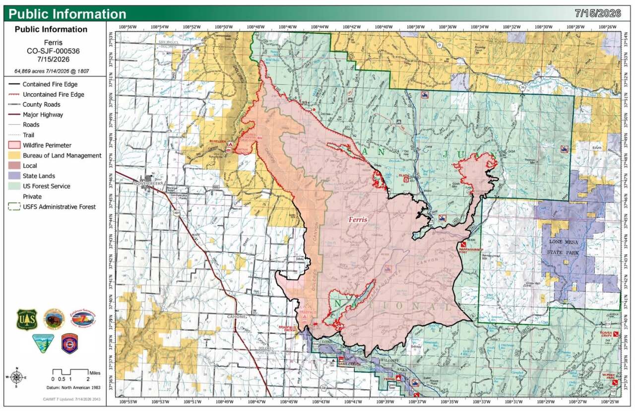
Firefighters are starting to gain more containment along an arm of the fire on the eastern side, near Division T. Mop-up control continues around the southeast side.
Drones are flying over the containment lines so crews can ensure they are still holding strong.
Over the next year days, scattered storms and showers are expected. The incident management team said while this may bring gusty winds and lightning, the increased humidity, cloud cover and "chance for wetting rain should decrease fire activity."
10:19 a.m. | Acreage and containment update | The Ferris Fire remains at 64,869 acres. Containment increased from 29% Tuesday to 43% on Wednesday morning.
Tuesday, July 14
10:15 a.m. | Acreage and containment update | The Ferris Fire grew marginally since Monday, according to the incident management team. On Tuesday morning, the Ferris Fire was estimated to be 64,869 acres in size and still 29% contained.
"Rainfall provided a welcome reprieve on the northeastern portion of the fire, although other areas received little precipitation. Cooler temperatures, increased humidity, and daily chances for showers and scattered thunderstorms are expected to moderate fire behavior throughout the week," the incident management team said.
Isolated gusty winds could produce new spot fires, though, in addition to forecasted lightning in the area.
Monday, July 13
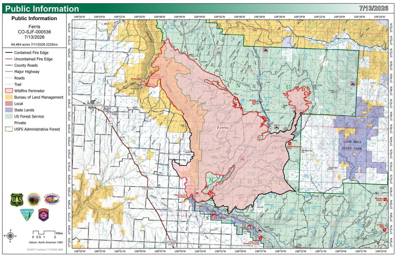
1:45 p.m. | Evacuation updates | Multiple zones in Dolores County have been downgraded back to "Ready" status, according to the Dolores County Office of Emergency Management.
11:21 a.m. | Evacuation center moves | The Dolores County Evacuation Check-In Center has moved to to 8477 Rd 7.7, Dove Creek, CO. Evacuees can pick up re-entry cards, required for landowners and permittees.
9 a.m. | Acreage update | The Ferris Fire is now estimated to have burned 64,661 acres, but has jumped to 29% containment, according to the incident management team.
Sunday, July 12
1:57 p.m. | New evacs | Due to changing fire behavior, the San Miguel and Dolores county sheriffs have issued an evacuation order for Ferris Fire Evacuation Zone 16, which includes several properties along the Dolores-San Miguel county line about a mile east of the Dolores River Canyon rim.
An interactive evacuation map is available here.
Saturday, July 11
3:00 p.m. | New pre-evac notice | The San Miguel County Sheriff's Office issued an elevated pre-evacuation notice "SET" level for Ferris Fire Evacuation Zone 15.
Here's the full notice:
Due to changing fire behavior, the San Miguel County Sheriff is issuing an elevated PRE-EVACUATION notice from the current “READY” status to the “SET” level for Ferris Fire Evacuation Zone 15, which is from the Dolores River Canyon west to Hwy 141 and from the county line north to the top of Slick Rock Hill. See link to evacuation map below. The “SET” pre-evacuation level means you should be prepared to leave immediately if this status is elevated to “GO,” which is a mandatory evacuation order.
If you choose to leave your home now, you must check into the evacuation center at the Dolores Senior Center in Dove Creek at 8540 Rd 7.2 to provide contact info to receive critical information. If you need transportation assistance, you should arrange for that now in the event mandatory evacuation is ordered. Call 970-729-3497 to arrange ADA compliant transportation assistance. If you have livestock or other large animals, consider removing them from the hazard area now. Large animals can be taken to the Montezuma County Fairgrounds at 30100 US-160 Cortez, CO. Call 970-759-2231 or 970-769-0005 to arrange."
Read more on the sheriff's office Facebook page. Check the fire evacuation map.
10:00 a.m. | Acerage latest | The fire has burned 63,271 acres and containment remained at 19% as of Saturday morning.
▶️ In the video player below, Denver7 breaks down each Colorado wildfire update as of Saturday AM.
Friday, July 10
6:50 p.m. | Increase in fire activity | Fire officials said there "was an increase in activity" in the northwestern area down into Dolores Canyon, so the Dolores County Office of Emergency Management ordered evacuations for Zones 14A and 14B. Zone 15, which also includes part of San Miguel County, is on pre-evac status. Here is the Ferris Fire Evacuation Map for zone parameters.
The fire has not crossed the westernmost bend of the Dolores River and has stayed within containment lines, the incident management team reported.

1:22 p.m. | Evacuations | Zone 14A (Dolores County Road H.6 north to County Road E and County Road 8.7 east to Canyon Rim) must evacuate. Zone 14B was ordered to evacuate a few minutes prior. Zone 15 in San Miguel County is now in "Ready" status, meaning residents should prepare for evacuations. Here is the Ferris Fire Evacuation Map for zone parameters.

This update in evacuations is due to "fire behavior and operations related to the Ferris Fire," the incident management team reported.
"Depending on weather conditions later today, fire officials may initiate a strategic fire as part of firefighting operations," the San Miguel County Sheriff's Office said. "If this occurs, residents may see flames or smoke within Zone 15. This is an intentional firefighting tactic and does not necessarily mean the Ferris Fire has grown or moved closer."

9:18 a.m. | Operational update | North winds over the Ferris Fire Thursday night contributed to the fire pushing about a half mile above Road 219, the incident management team said Friday morning.
9:09 a.m. | Latest on acreage and containment update | The Ferris Fire was measured at 62,916 acres Friday morning, according to the incident management team, and remains 19% contained.
Thursday, July 9
9:50 p.m. | Fire behavior moderates | The incident management team said fire behavior moderated Thursday after higher humidity and less wind, but the forecast in the coming days could lead to an increase in fire activity.
11:30 a.m. | Operations update | Joe Tieso, operations section chief, said outflow winds from storms overnight stopped the crews from completing their firing operations along the fire's southwest section, but nothing came outside of the containment lines.

9:24 a.m. | Acreage update and latest on containment | The Ferris Fire now totals 60,105 acres and is 19% contained, as of Thursday morning.
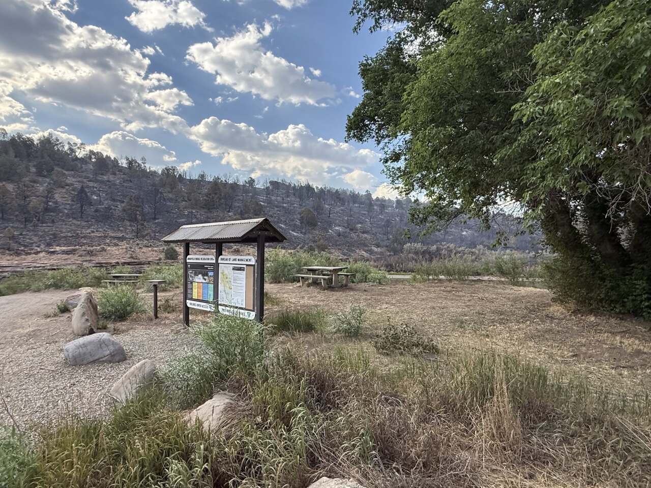
Fire has reached the Bradfield Bridge Campground, but now structures have been impacted. When conditions allow, firefighters will strategically remove unburned fuels between the Ferris Fire and control lines to limit fire spread to the south. Along the western edge of the fire Thursday, personnel will continue monitoring, holding and improving control lines.
Wednesday, July 8
5:54 p.m. | Mandatory evacuations lifted | Zone 9 has reopened and residents may go home, according to the Ferris Fire Information Facebook page.
4:40 p.m. | Disaster emergency | Colorado Gov. Jared Polis has declared a disaster emergency in response to the Ferris Fire.
9:20 a.m. | Operations update | The incident management team provided an update on the fire's activity on Tuesday.
"Extreme fire behavior occurred yesterday afternoon and continued overnight on the west side of the fire near Bradfield Bridge Campground, throughout Dolores Canyon and its side canyons," they reported. "As fire activity increased, Zone 9 was evacuated overnight between County Road 15 and Highway 491 due to fire encroachment. Firefighters conducted strategic firing operations along the Dolores River side canyon near County Roads 3 and 15 and around Bradfield Bridge Campground. Crews successfully held the fire within planned containment lines, working through the night to strengthen and defend those positions."

The fire's run yesterday went through Glade Canyon and Big Springs Gulch drainage.
On Wednesday, crews will continue to strengthen containment lines while "aggressively engaging any spot fires or slopovers as early as possible during favorable conditions."
Critical fire weather continues Wednesday.

9:14 a.m. | Operational update | California Interagency Incident Management Team 7 said Wednesday morning that around 9:45 p.m. Tuesday night, erratic winds kicked in from the east, pushing the fire line toward bulldozer lines the day shift had established.
While it triggered evacuation warnings for Zone 9, the wildfire was kept within containment lines and no additional structures were lost overnight.
However toward the north, the fire progressed overnight from the Sheep Mountain Point.
8 a.m. | Community meeting today | A public meeting is scheduled for today at 6 p.m. at the Dolores County Public Service Center at 8477 Road 7.7 in Dove Creek. It will be livestreamed on the Ferris Fire Facebook page.
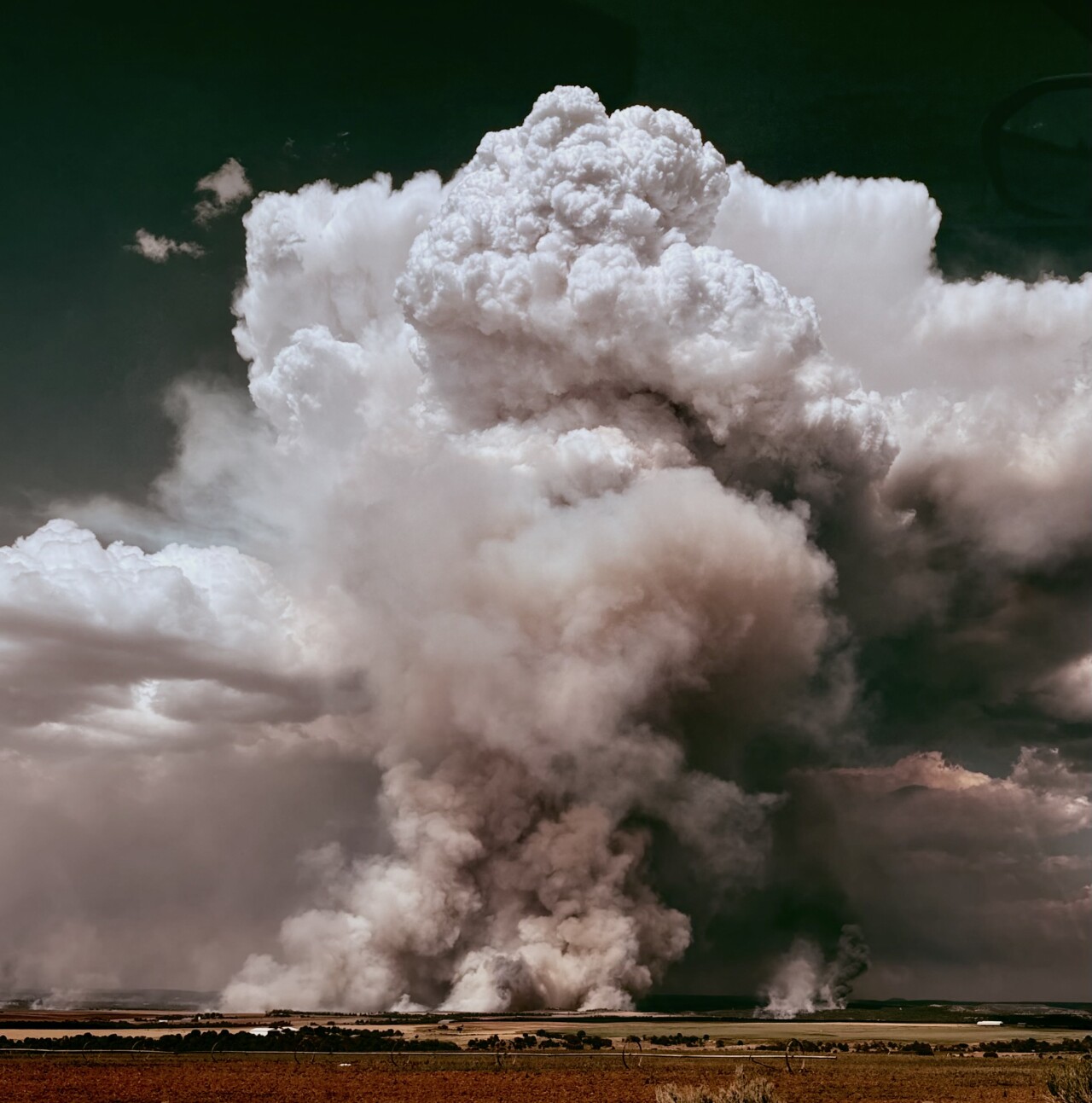
7:30 p.m. | Updated map | Below is a map showing current evacuations and the fire's perimeter, as of Wednesday morning. This map is courtesy of Watch Duty.

6:15 a.m. | New evacuations | Zone 9 has been ordered to evacuate. This includes County Road H.6 south to County Road P, and County Road 12 east and Highway 491 east below County Road M.
Tuesday, July 7
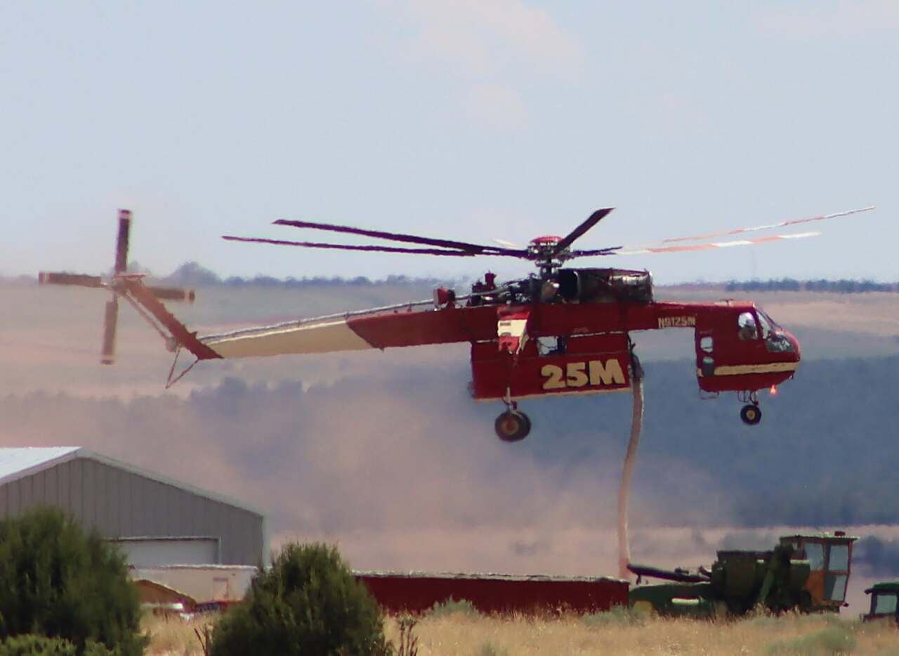
6:57 p.m. | Acreage update | The Ferris Fire is now 57,356 acres and 19% contained, according to the incident management team. Large air tankers flew over the fire earlier in the day to help with containment along its northern edge, south of Forest Forest 504. "Super scooper" plans also flew north of Benchmark Lookout.
3:32 p.m. | Community meeting | California Interagency Incident Management Team 7 will host a community meeting at 6 p.m. on Wednesday. Members from Team 7, the San Juan National Forest, and additional cooperating agencies will be on hand to provide information. The meeting will be at the Dolores County Public Service Center at 8477 Road 7.7, Dove Creek.
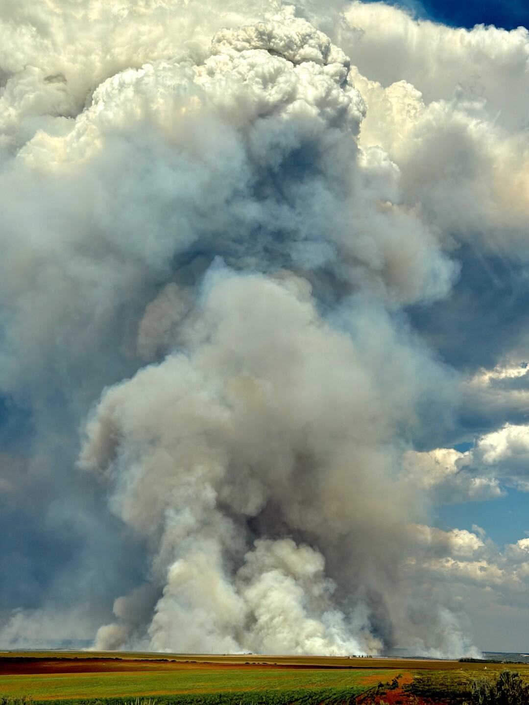
10:45 a.m. | Acreage and containment update | The Ferris Fire has grown to 51,622 acres, but firefighters have now reached 22% containment, the Ferris Fire Information Facebook page said.
10:36 a.m. | Community meeting plans | The Ferris Fire Information Facebook page announced the California Interagency Incident Management Team 7 will host a community meeting on Wednesday, July 8, at 6 p.m. at the Dolores County Public Service Center.
The meeting will also be livestreamed on the San Juan National Forest Facebook page and the California Incident Management Team 7 YouTube channel for those unable to attend in person.
Monday, July 6
9:30 p.m. | Fire management change | Residents in the area will start seeing more California fire vehicles, according to the Ferris Fire Information Facebook page, as the local San Juan National Forest Type 3 Incident Management Team 8 turns management of the Ferris Fire over Tuesday morning to California Team 7, a Complex Incident Management Team.
They are moving the command post from the fire station in Dolores to Cortez High School. The San Juan National Forest Team Team 8 said it will now be on standby to respond to any new fires in the coming days and weeks, if needed.
7:49 p.m. | Fire suppression efforts | Firefighters installed sprinkler systems in evacuation zones 7 and 8, as well as removed low limbs and other flammable material surrounding homes.
Winds from passing storms increased fire behavior dramatically, according to the Ferris Fire Information Facebook page.
2:28 p.m. | Planned power outage | Residents east of County Road 15 were advised to expect a power outage from 2:45 p.m. until approximately 9 p.m. while firefighters worked to suppress the Ferris Fire, the Dolores County Office of Emergency Management said on Facebook.
8:37 a.m. | Acreage and containment update | The Ferris Fire has now burned 47,780 acres and is at 21% contained, according to the Ferris Fire Information Facebook page. It's at 21% containment, mostly on the southern and eastern edges of the fire perimeter.
Firefighters worked to prevent significant impacts to critical infrastructure and private property along the west side of the Dolores River Canyon.

Along the northeastern edge of the Ferris Fire, crews have made efforts to protect the Glade Ranch subdivision.
Monday's potential for possible thunderstorms in the area are unlikely over the fire, according to the Ferris Fire Information Facebook page. However, winds from passing storms could fan the fire and result in increased smoke.
Denver7 is tracking the latest information on each of the wildfires burning in Colorado. If you'd like to catch up on coverage from last week, check out stories from Monday, Tuesday, Wednesday and Thursday through the weekend.
◼️ MORE | Extensive Denver7 coverage of other Colorado wildfires



Denver7 is committed to making a difference in our community by standing up for what's right, listening, lending a helping hand and following through on promises. See that work in action, in the videos above.