


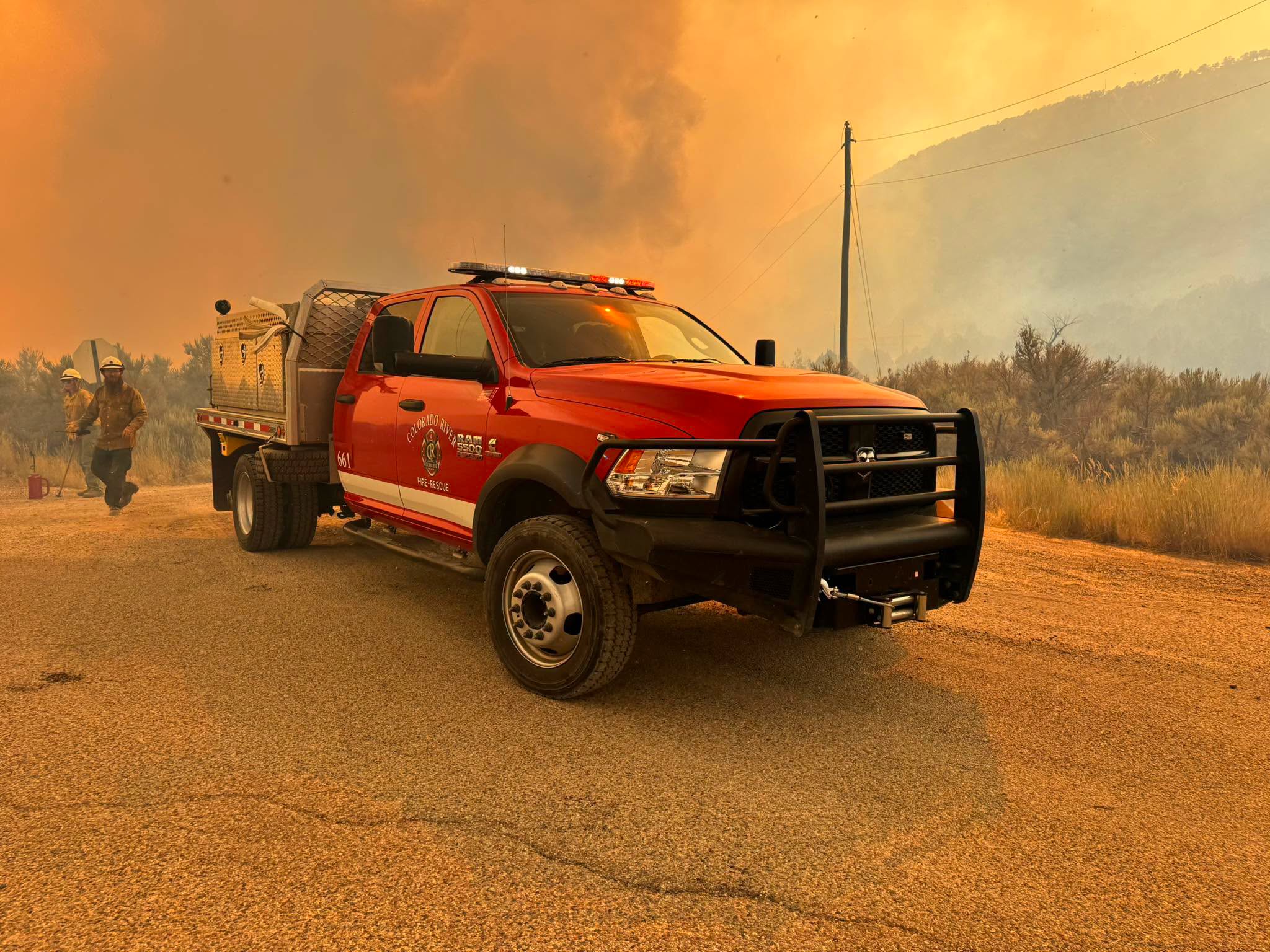
Colorado's wildfires have burned more than 80,000 acres since last week and Tuesday will bring another day of prime conditions for more fire growth.
Denver7 is tracking the latest on all of these large and destructive wildfires in this story.
First, here's a look at Tuesday's forecast: The National Weather Service (NWS) is reporting that critical fire conditions will continue in Colorado's higher terrain Tuesday afternoon into the early evening hours. Sustained winds may reach 15 to 25 mph, with gusts up to 40 or 50 mph. Any wildfires will likely spread rapidly under these conditions, the NWS warned. Tuesday will likely be "the strongest day for fires" due to these winds, the NWS said. Winds may back off this weekend into early next week.
A red flag warning is in effect for almost the entire western two-thirds of the state until Tuesday evening.
Fire restrictions are in place for almost every county in the state. Check yours here.
The below map from NOAA shows smoke plumes impacting much of Colorado.

All of the below information on Colorado's wildfires will be updated as we learn more. All fire perimeter maps below are courtesy of Watch Duty.
Snyder Fire/Snyder Mesa Fire
- 📍Mesa County on Colorado-Utah border
- Size: 30,208 acres (as of Tuesday, 6:30 a.m.)
- Containment: 0% (as of Tuesday, 6:30 a.m.)
- Start date: Late June 26 or early June 27
- Cause: Lightning
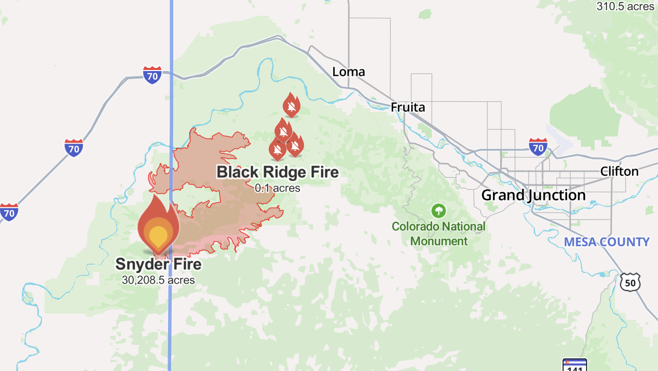
Three firefighters died fighting the Snyder Mesa Fire, also called the Snyder Fire, which is burning in Mesa County on the Utah-Colorado line. Watch Duty reports it has burned more than 30,000 acres.
The Upper Colorado River Interagency Fire Management Unit reported that lightning started this fire.
Pre-evacuations have been in place for the same area since June 28. It includes south of the Colorado River to BS Road (in the Glade Park area) and west of the Kingsview subdivision off Highway 340. A map of this area is below.

Emergency closures are in place along the Colorado River downstream of Fruita until the Utah state line. Anybody floating the Colorado River must end their trip at the Fruita boat ramp, as there are no river takeout points between Fruita and the Utah state line. This closure is expected to last through the Fourth of July weekend.
Mesa County Sheriff Todd Rowell stressed during a press conference on Monday that "this is not the time to start human-caused fire" as the Fourth approaches.
"We're going to have natural fires — we can't have human-caused fires," he said. "So, save your fireworks."
Rowell also said that drivers should make sure their vehicles aren't dragging chains, as that can also spark a wildfire.
Colorado Gov. Jared Polis verbally declared a disaster emergency in response to this fire on Saturday, June 27.
Gold Mountain Fire
- 📍Ouray County
- Size: 8,277 acres (as of Tuesday, 8:42 a.m.)
- Containment: 0% (as of Tuesday, 8:42 a.m.)
- Start date: June 27
- Cause: Unknown; possibly a tree fell on a power line

Ouray County declared a state of emergency on Sunday, June 28 for the Gold Mountain Fire, which originated on U.S. Forest Service land two miles northeast of the City of Ouray. The wind-driven fire is burning in extremely steep and rugged terrain.
According to the incident management team, the fire has burned more than 8,000 acres as of 8:40 a.m. Tuesday. Conditions are expected to be worse on Tuesday compared to Monday, said Ouray County Manager Antonio Mendez during a Ouray County Board of Commissioners emergency meeting on Monday.

"The fire exhibited extreme fire behavior over the past two days under Red Flag conditions," the management team posted online. "It spread primarily to the east and northeast, into the Cow Creek drainage, up steep canyon walls, and north and northwest of Highway 550. During the night shift, firefighters reinforced firelines around Lake Lenore and County Road 14A. The fire remained active in several areas into the night and quieted down around midnight."
On Tuesday, firefighters will work around the southern edge to construct and reinforce fire lines to prevent the fire from spreading farther toward Ouray and the Lake Lenore area. They also plan to do the same on the western front to slow the fire's march toward Highway 550.
A community meeting is scheduled for Tuesday at 7 p.m. at Ridgway Elementary School, located at 1115 W. Clinton St.
Multiple fire crews — both on the ground and in the air — have been ordered to assist. A U.S. Forest Service fire investigator responded to this wildfire to determine the cause.
Evacuations have been in place since Sunday for:
- Lake Lenore and Panoramic Heights areas
- Redstone Road
- Peck’s Trailer Park
- Cedar Hill Cemetery, east of Highway 550
- Anybody recreating in the area of Cow Creek on U.S. Forest Service land past the intersection of County Road 12
A pre-evacuation notice is in place from Whispering Pines to Black Lake neighborhood along County Road 17, according to the county.
An evacuation center has been set up at the Ridgway Secondary School, located at 1200 Green St. in Ridgway.
A two-mile stretch of Highway 550 is closed north of Ouray due to this fire.
The Ouray Volunteer Fire Department is responding to this fire and is accepting donations here.
A red flag warning goes into effect at noon Tuesday and will last through 9 p.m. Windy, dry and hot conditions will "result in moderate to extreme fire behavior throughout the course of the day," the incident management team reported.
Colorado Gov. Jared Polis verbally declared a disaster emergency in response to the Gold Mountain Fire on Sunday.
Willow Fire
- 📍Lake County, west of Leadville
- Size: 1,919 acres (as of Tuesday, 6:30 a.m.)
- Containment: 0% (as of Tuesday, 6:30 a.m.)
- Start date: June 28
- Cause: Unknown
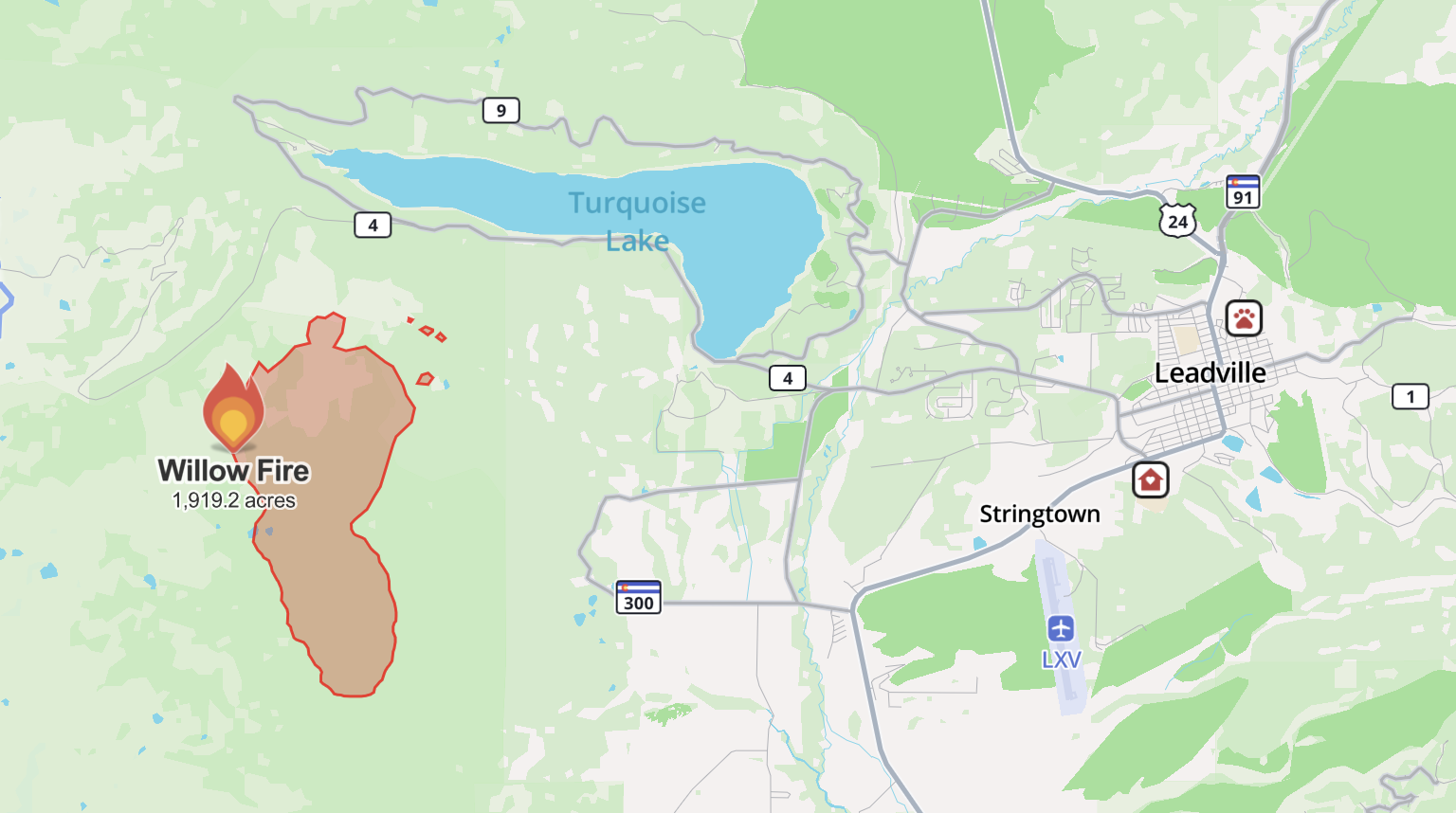
On Sunday afternoon, the Lake County Office of Emergency Management announced evacuations for the Willow Fire, which is burning on U.S. Forest Service land south of Turquoise Lake and west of the City of Leadville. It is about two miles northwest of the Leadville Fish Hatchery.
Mandatory evacuations are in place Tuesday for the following locations:
- County Road 4, 9, 9D, 5A, 48, and 99
- All trails from the Fish Hatchery
- All campgrounds around Turquoise Lake
- All trails up to treeline and Colorado Trail sections in this area (search and rescue teams helped with this effort)
- Hagerman Pass
Pre-evacuation orders apply to homes in the Grand West area, Mountain View East and West, Turquoise Lake Estates, Silver Hills Subdivision, and homes on County Roads 9, 17, and 4. Another pre-evacuation zone was added for northeast Leadville.
A map of current evacuations is here. A screenshot is below and shows evacuations as of 7:50 a.m. Tuesday.

Large animals can be brought to the rodeo grounds on McWethy Drive.
The fire's burn area has increased to 1,919 acres after an overnight flight mapped out the perimeter, the U.S. Forest Service said. The increase reflects the growth seen late Monday afternoon.
During a press conference Monday afternoon, Gov. Jared Polis said it is "quite likely or possible" that part of or all of the City of Leadville will be told to evacuate, depending on wind behavior in the afternoon. When Denver7 asked Lake County Sheriff Heath Speckman about this during a Monday evening press conference in Leadville, he said fire officials believed the fire would move toward Leadville on Monday, but it actually moved "in the complete other direction."

Dawn Sanchez, public information officer for the Willow Fire, said about 90 people are assigned to this fire, with more crews coming in on Tuesday.
Multiple roads are closed in the area for first responders, including Turquoise Lake Road, Highway 300 at County Road 5 and County 5A (Fish Hatchery Loop), County Road 9 and County Road 99 intersection (Leadville Junction), and County Road 4 and County Road 48 (Turquoise Lake Dam entrance).
Firefighting aircraft could not fly Monday for some time due to the strong winds, but later in the afternoon, they were able to take off, said Tim Ross, incident commander for the fire on Monday evening.
Colorado Gov. Jared Polis verbally declared a disaster emergency for this fire on Monday morning. Sign up for emergency alerts here.
Aspen Acres Fire
- 📍Custer County
- Size: 22,827 acres (as of Tuesday, 8 a.m.)
- Containment: 0% (as of Tuesday, 8 a.m.)
- Start date: June 29
- Cause: Unknown
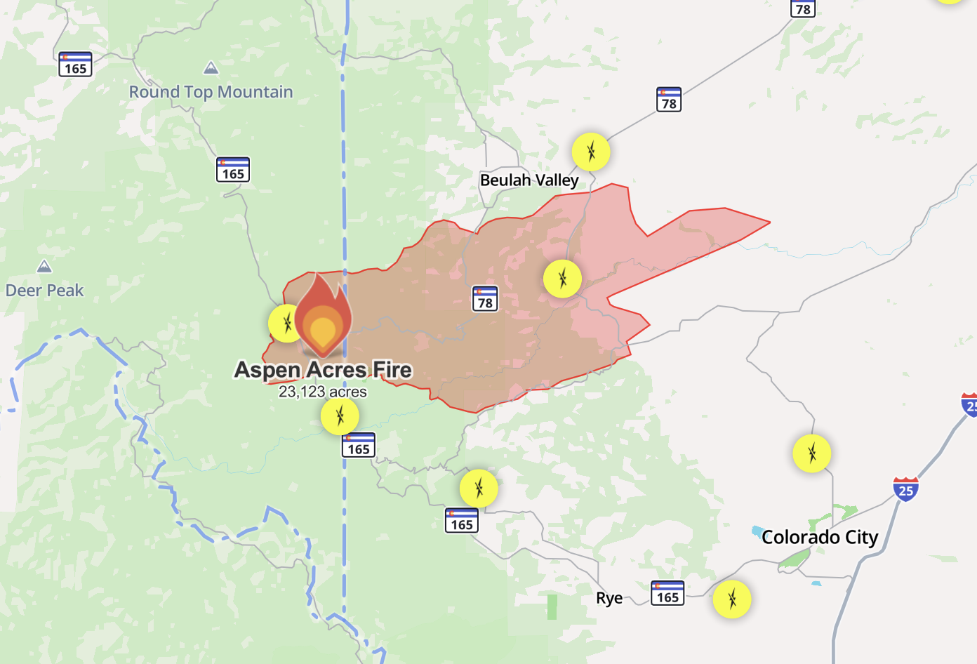
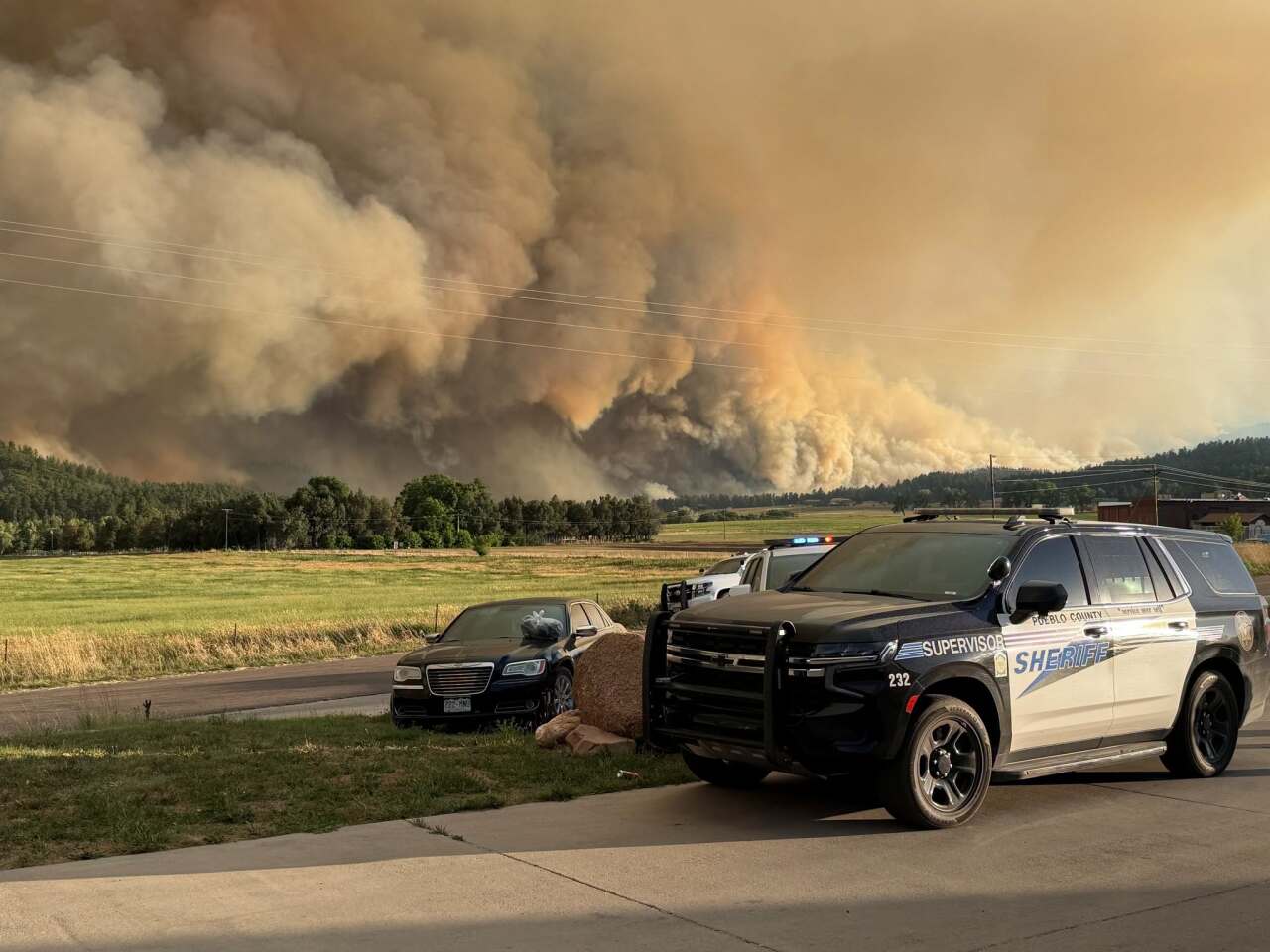
The Pueblo County Sheriff's Office reported on Monday morning that several agencies had responded to a wildfire near Aspen Acres in Custer County, which has since spread into Pueblo County. This is about 15 miles northwest of Colorado City.
In an update Tuesday morning, fire officials said the Aspen Acres Fire has burned 22,827 acres and remains 0% contained.
The fire has destroyed structures in both counties, the Custer County Sheriff's Office reported, though few other details about this are available.

The area is under a red flag warning on Tuesday from 10 a.m. until 10 p.m. It will likely be under the same warning on Wednesday, according to the National Weather Service out of Pueblo.
"Extreme fire behavior is likely as the day heats up and the winds increase," the Aspen Acres Fire 2206 Facebook page reads. "Short-range spotting is likely in areas where the fire moved downslope last night and the backing fire became a head fire with the southeast and slope winds."
The following areas remain under an evacuation order, as of Tuesday morning:
- Lazy Acres
- Bishops Castle
- 12 Mile road
- S. Pines Drive
- San Isabel
- Rye
- Beulah
- 3R Road to Crow cutoff
- 3R Road East to Water Barrel Road
- Burn Mill Road to I-25
An evacuation center is set up at the Pueblo County Recreation Center, located at 1650 Cooper Place. Pets are permitted. The center is in need of items for pets, including blankets, towels and wet cat food.
An evacuation site for large animals is set up at the Colorado State Fairgrounds. Rescue trucks are available to help — call 719-251-0245 for assistance. Donations of buckets and headlamps are welcome.
Highway 165 is closed from Highway 78 to the Pueblo County line at Lake Isabel.
Colorado Gov. Jared Polis verbally declared a disaster emergency for this fire on Monday morning. Later that evening, FEMA authorized the use of federal funds to help with firefighting costs for this fire.
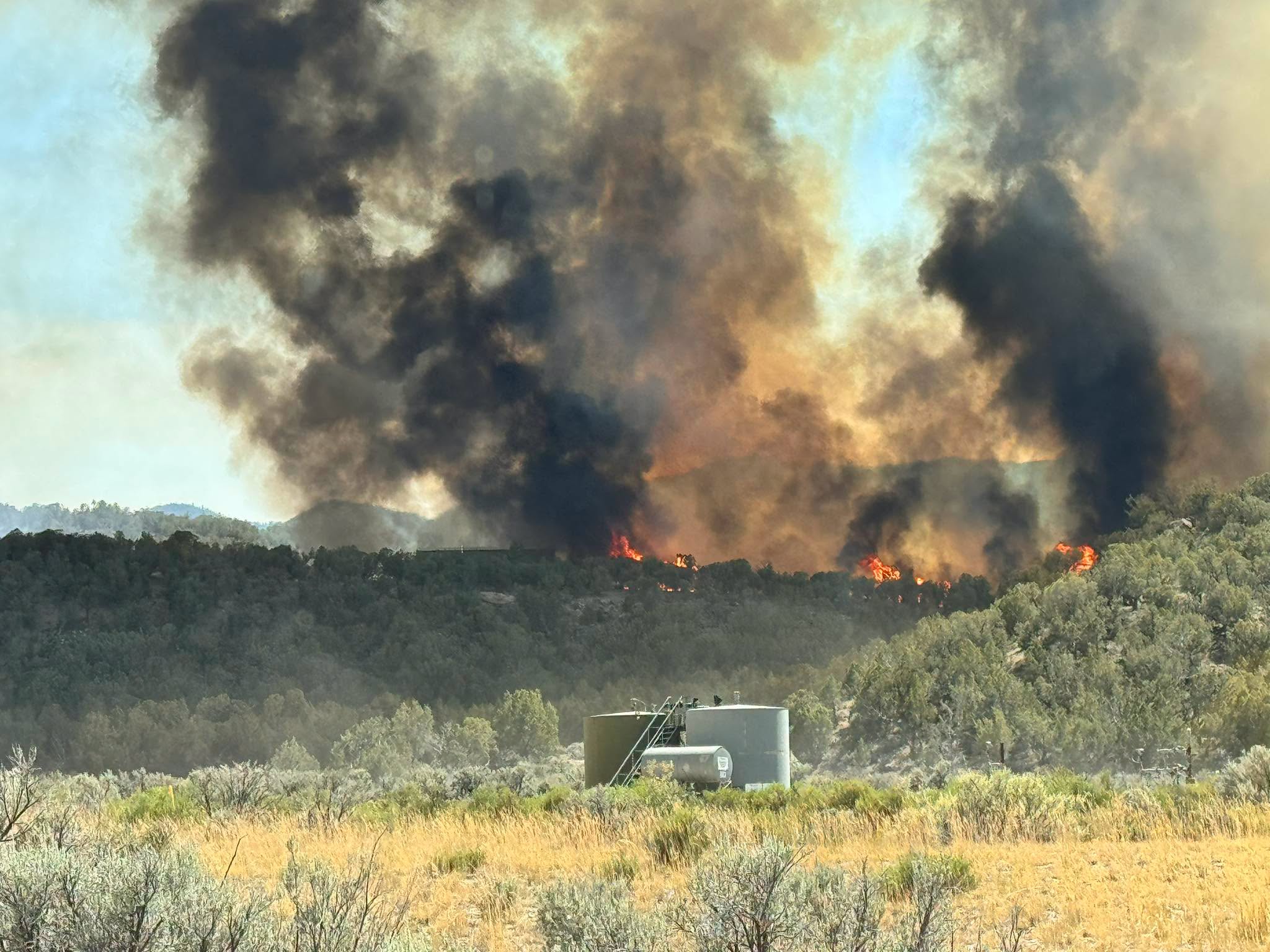
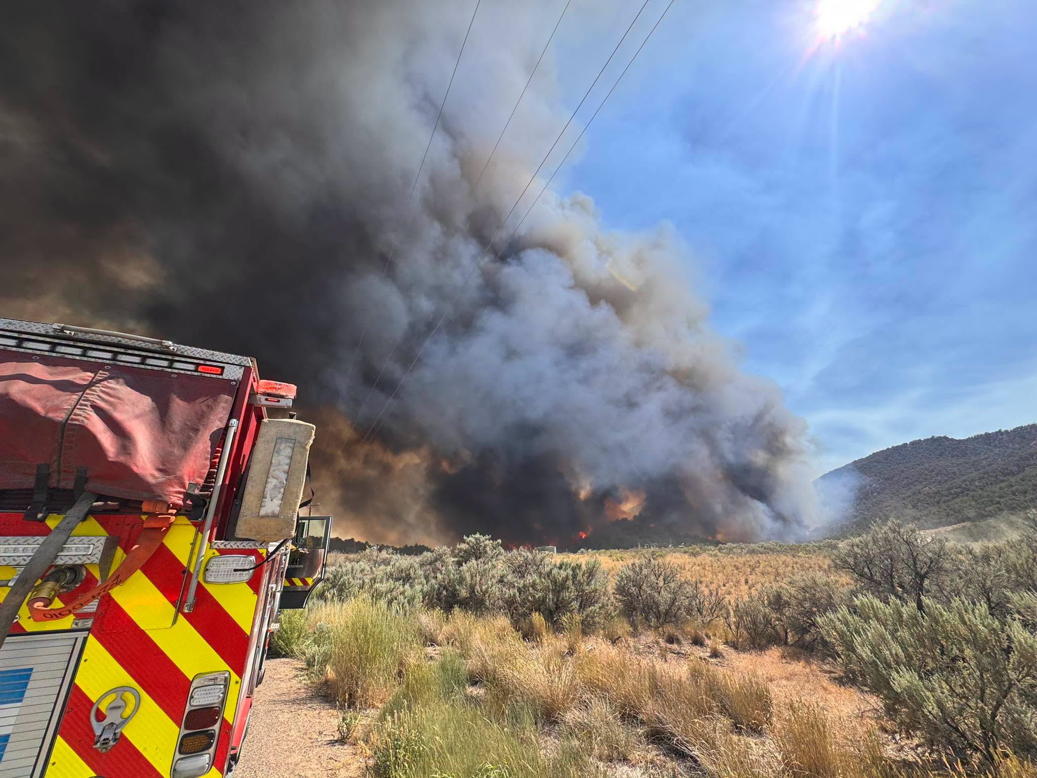
Ferris Fire (includes Far Draw Fire & Doe Canyon Fire)
- 📍Montezuma and Dolores counties (Dolores Ranger District of the San Juan National Forest)
- Size: 20,561 acres (as of Tuesday, 9:29 a.m.)
- Containment: Unknown, but fire line was constructed Monday on the east side
- Start date: June 27
- Cause: All three suspected to have been started by lightning
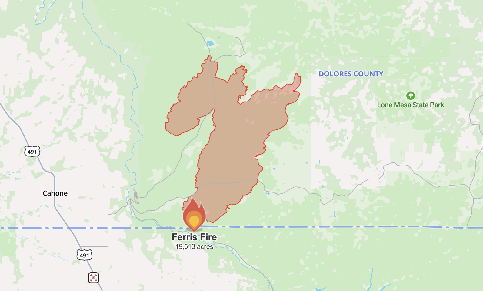
The Ferris Fire began burning in the Glade Area near Narraguinnep Canyon, about 15 miles northwest of Dolores, on June 27. As of Tuesday morning, fire officials posted online saying it has burned 20,561 acres.
The nearby Doe Canyon Fire and Far Draw Fire merged with the Ferris Fire, so the blaze is now being managed as the Ferris Fire. The suspected cause of the fire is lightning, according to the U.S. Forest Service.

Fire officials said a fire line was constructed on the east side of the Ferris Fire on Monday, but exact details are not available yet. There was less activity Monday on the fire's northeast edge.
The Lone Dome Road, Bradfield Campground, the campground down Highway 504 to the McPhee Dam and Glade Ranch subdivision are all under evacuation orders. Anybody who evacuated is welcome to come to the Pleasant View Fire Station at 15235 Road CC.

The fire has not reached any private lands or the Lookout Tower as of Monday evening.
Strong winds are expected around the fire Tuesday, but officials said firefighters will engage directly with the edge of the fire where it is safe to do so.
Dolores Volunteer Fire & Rescue is responding to this fire and is accepting donations.
Stage 2 fire restrictions will go in place for the San Juan National Forest, meaning all campfires are prohibited, starting July 1.
11 Fire
- 📍 Fremont County
- Size: 102.9 acres (as of Tuesday, 6:30 a.m.)
- Containment: 0% (as of Tuesday, 6:30 a.m.)
- Start date: June 28
- Cause: Unknown

The 11 Fire began burning on the morning of June 28 around High Park Road and County Road 352A in Fremont County.
All evacuation orders and road closures for this fire were lifted at 6:40 p.m. Monday, the Fremont County Sheriff's Office said.
A red flag warning will impact this area from 10 a.m. until 10 p.m. Tuesday, and likely again on Wednesday, according to the National Weather Service.
Big Sheep Fire
- 📍 Moonshine Ranch near County Road 531
- Size: 1,000 acres (as of Tuesday, 9:37 a.m.)
- Containment: 30%
- Start date: June 29
- Cause: Unknown

The Big Sheep Fire is burning west of Big Sheep Mountain and north of La Veta Pass in Huerfano County. It started on Monday.
The Huerfano County Sheriff's Office said multiple crews are on scene.
The sheriff's office said Monday evening that the area "between the fire and Highway 69 and to Farisita" is under a pre-evacuation notice as a precaution. A map of the evacuation zone is not available.
The sheriff's office told the public to "not be alarmed" if more information isn't released until Tuesday evening or Wednesday.
Click here to sign up for alerts for this fire.
Dry Creek Fire (fully contained)
📍 South of Rifle
Size: 316 acres
Containment: 100%
Start date: June 23
Cause: Unknown
The Dry Creek Fire, which started burning on June 23, is fully contained. All evacuation orders were lifted on June 28 as of 8 p.m., according to Watch Duty.
▶️ Denver7 took a look at the reality of year-round wildfires in our special "Burned Out" in November. Watch it below and read our in-depth story here.