




DENVER — Despite recent rainfall, severe drought is persisting across Colorado, and the state climatologist is warning that "the stage is set" for a dangerous wildfire season and a difficult year for agriculture and river flow.
After a wet week for much of the state, Denver7 spoke with Colorado State Climatologist Russ Schumacher, also a Colorado State University professor to learn more.
▶️WATCH: Our full interview with the Colorado state climatologist below.
People tend to focus on recent memory and what they see before their eyes, he said. This week, that has meant rain.
"You get a good week of rain and it's very natural to think, 'Oh, the drought's over, those concerns are in the past now,'" he explained. "But the impacts of drought really build up over time. They don't go away, you know, with one week of good rain."
It's difficult to know when conditions may start looking up in a meaningful way.
"What's going to happen as we get into the summer?" he said. "We've kind of had the stage set for these bad conditions with the snowpack being so awful this year, and all that warmth and dryness in the winter and early spring. Are we going to get bailed out a bit by better weather as we get later in the summer, or are things going to get a lot worse before they get better?"
▶️WATCH: Denver7 Chief Meteorologist Lisa Hidalgo and Colorado Public Radio host Ryan Warner sat down for their May 2026 climate conversation, where they talked about drought, recent rain and signing up for weather alerts.
Recent rain and our record bad winter
"Mountain snowpack was — if we look at it kind of aggregated up over the whole state — was the worst that it's ever been since snowpack has been measured," Schumacher said.
This water year, starting in October 2025, has been the warmest on record by a large margin statewide, he said.

Environment
A look into Colorado's Water Year in Review for 2025
"December was the warmest December on record, warmest February, warmest March," he said. "So, it was brutal through that entire period."
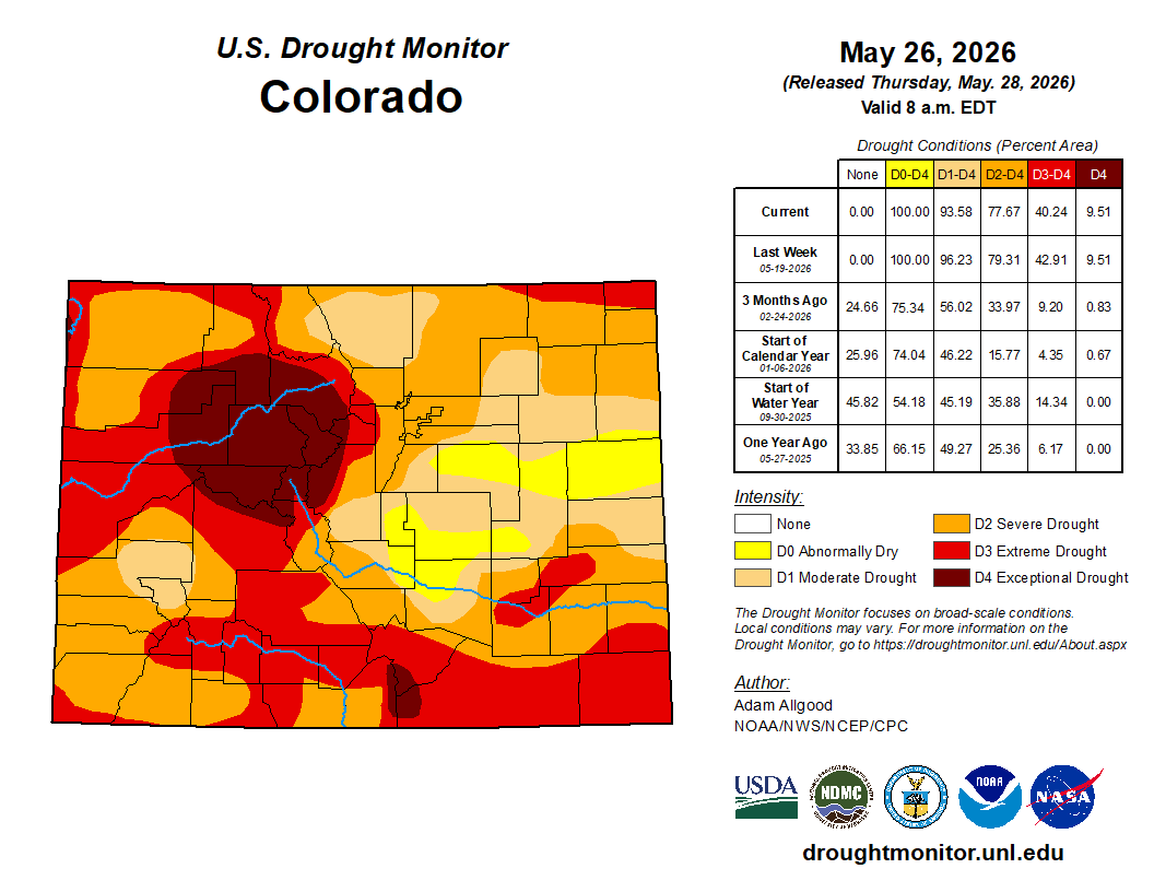
A change of pace came in May, with temperatures hovering closer to normal and an increase in precipitation. Northern Colorado, particularly Routt and Moffat counties over to North Park and the northern Front Range, saw improvements.
"Parts of the eastern plains have had some heavy rainstorms in the last week or two as well," he said." In those areas where we've had 100% to 150% — close to double the average May precipitation — that's put a real dent in the drought conditions in those areas."
But big deficits remain.
Rivers
For Colorado's river systems, winter and spring snowpack is what matters most — not spring rainstorms. The poor snowpack and early melting means that river flows this summer, especially in July and August, will stay low.
"Because the snowpack was so low at its peak, the water supply in most of those river systems is going to be really low this year, even keeping in mind that we've had some wet conditions recently," he explained. "It's just hard for spring and summer rainstorms to make up for the amount of water that comes in those big snowstorms that in most winters we get quite a few of, and this winter we really didn't."
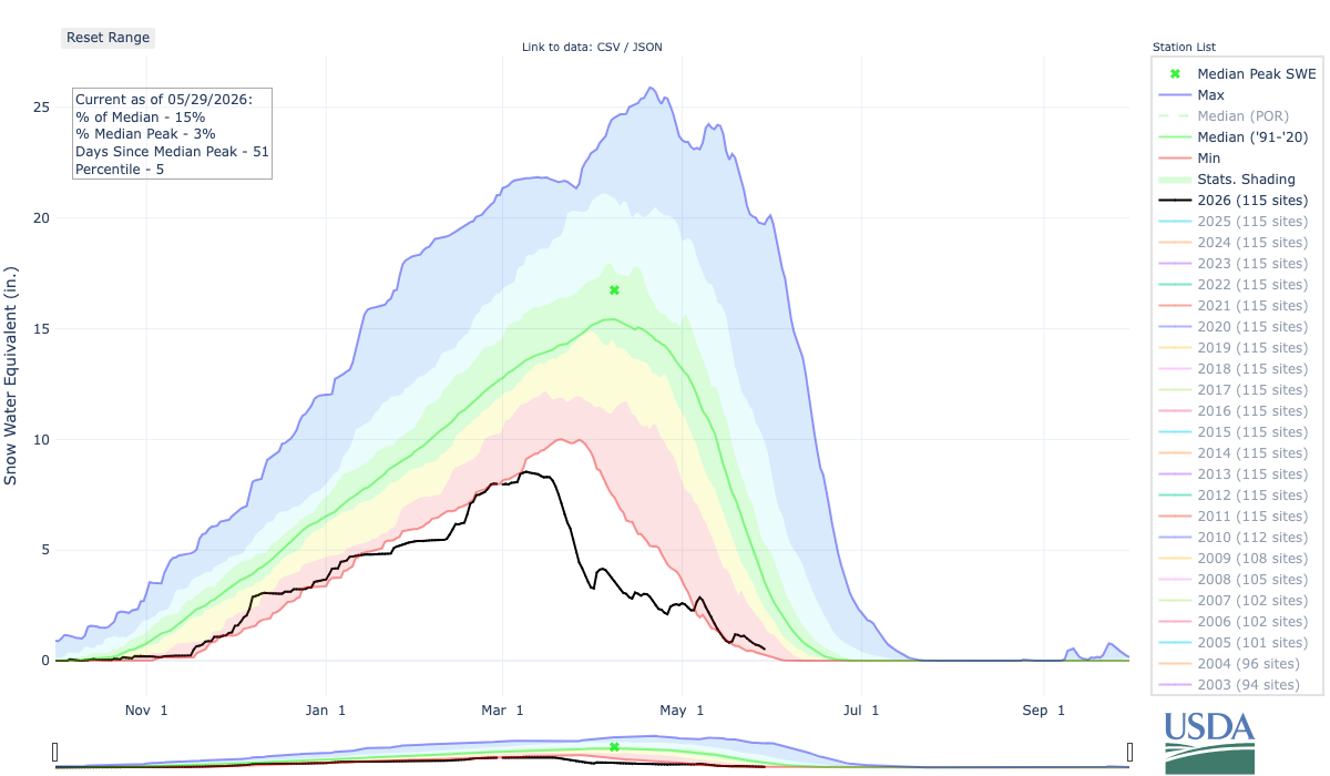
Most rivers east of the Continental Divide, like the Poudre or Big Thompson, typically reach peak flow in the first week of June, but many have already reached that point, he said. If a second peak is coming, it likely will not be a big one.
This will likely mean outdoor recreation, like fishing and rafting, will see changes.
▶️WATCH: Denver7's Adria Iraheta reports on how rafting outfitters are tackling the challenges amid the state's ongoing drought this year.
Agricultural producers who use irrigation are already seeing impacts since their water, either directly or indirectly, comes from rivers. That will only become more apparent as the year continues, since producers need that irrigation water in the heart of the summer.
"If the water is flowing in May, but not in July and August, then that has a big impact there, especially for ag producers that don't have access to reservoir water," he said. "So, if they're relying on flows in the river, there's very likely to be not much there when we get to July and August."
That, paired with increased hay prices, is putting heavy stressors on the producers, he said.
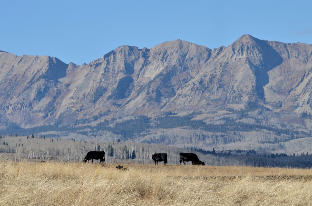
"Obviously, the impacts of drought are wide-ranging and goes well beyond just agriculture, but farmers and ranchers are typically the first ones to get hit when a drought emerges," he said. "And we've had a lot of bad years in Colorado in terms of drought over the last couple of decades. And so those ag producers have had a lot more lean times than good times in the last couple of decades."
Reservoirs
Reservoirs in the Denver metro area were in good shape coming into this spring thanks to normal precipitation last year, he said.
But they will feel a strain as people continue to draw on a smaller supply.
"So that's why, along the Front Range, a lot of the big municipal water providers still are having water restrictions in place, even though we've had good rain lately," he explained. "So, the benefit of the rain we've had lately is it brings down the demand, right? People aren't having to water their lawns as much, but it doesn't go all that far to boosting the supply back up."
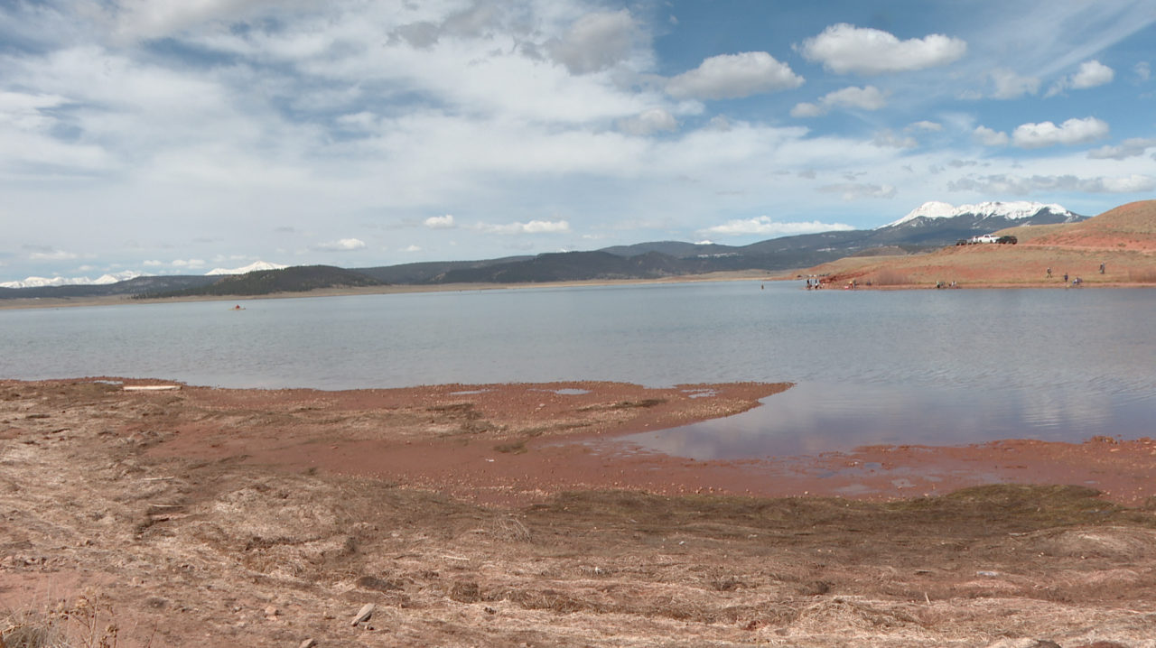
The state's reservoirs hinge on how much snow falls in the mountains each winter and can buffer against one or two bad years, almost like a savings account. But repeated bad winters will start to deplete the reservoirs, and summer rainfall alone is usually not enough to get them back to a healthy level. It can take years to fill them back up, even with normal snowpack.
Colorado's reservoirs are relatively small compared to the ones farther downstream on the Colorado River, like Lake Powell and Lake Mead.
"They're going down to record or near-record low levels again," he said. "There's huge concerns about that because the river flows into those big reservoirs are going to be bad again this year, and so, there's that issue of those huge reservoirs being depleted."
Wildfire
Bad snowpack does not necessarily mean Colorado will see a severe wildfire season, Schumacher said. It is a common misconception.
But "the stage is set that the fire season could be bad," he continued, adding that the recent wet conditions in northern Colorado should at least help reduce risk of fires in the short-term.

Wildfire
Colorado boosts firefighting resources ahead of risky wildfire season
He emphasized that wildfires are one of the few weather-related hazards that people have some control over.
"A lot of wildfires are started by people, and if people don't start those fires, then those fires don't get started, even if the weather would support fast fire growth," he said. "It's just important for people to be really careful with fire in their activities, if they're camping or whatever, to make sure that those big fires that have the potential to grow don't get started in the first place."
As Denver7 reported on Thursday, a new outbreak of mountain pine beetles is currently spreading in ponderosa pine forests that are already at high risk of wildfires. This second consecutive year of above-average temperatures and below-average precipitation has aided those insects in their spread across Colorado's forests, and they are leaving dead and dying trees in their wake.

Environment
New outbreak in pine beetles on Front Range causes dramatic increase in damage
The possibility of a "Super El Niño"
In mid-May, the National Oceanic and Atmospheric Administration (NOAA) published an update on the status of an incoming El Niño pattern.
"El Niño is likely to emerge soon (82% chance in May-July 2026) and continue through Northern Hemisphere winter 2026-27 (96% chance in December 2026-February 2027)," NOAA reported.
While there's no formal definition for a "Super El Niño," climate scientist Kris Karnauskas said based on current forecasts, this year’s El Niño could be the fifth strongest since 1982 if it develops as predicted.
Karnauskas is with the Cooperative Institute for Research in Environmental Sciences at the University of Colorado Boulder.
“The fuel for a big El Niño is there,” Karnauskas said in a CU Boulder article. “It's a question of whether that heat bubbles up to the surface, or if it stays lurking below the surface, out of sight.”
RELATED STORIES:
- Record-breaking El Niño possible, bringing extreme weather, experts warn
- Forecast calls for below-normal Atlantic hurricane season amid El Niño conditions
- Next El Niño likely to push global temperatures to new highs
Schumacher explained that the ocean temperatures off the coast of South America are unusually warm during El Niño and if they get extra warm, that would develop the so-called "super El Niño." This trend then alters weather in other places across the globe, resulting in stronger heat waves, and worsening drought in some areas while other spots may see more intense floods.
"The changes in the ocean temperatures in the Pacific affect where the thunderstorms are in the Pacific, which alters where the jet stream goes, and then that's how it ends up affecting our weather here in North America," he said. "In Colorado, the correlations between El Niño and our weather are not as strong as they are to our north and to our south."

In past years when Colorado has seen El Niño conditions, wetter weather tends to move in in the fall and can extend through the winter and following spring.
He said he believes conditions will improve once that El Niño arrives, though it is still too early to tell if June and July will bring rain, or if that precipitation will come later.
"I don't think we're going to have month after month after month of this punishing drought like we've seen going forward through the end of the year or next winter," he said.
