


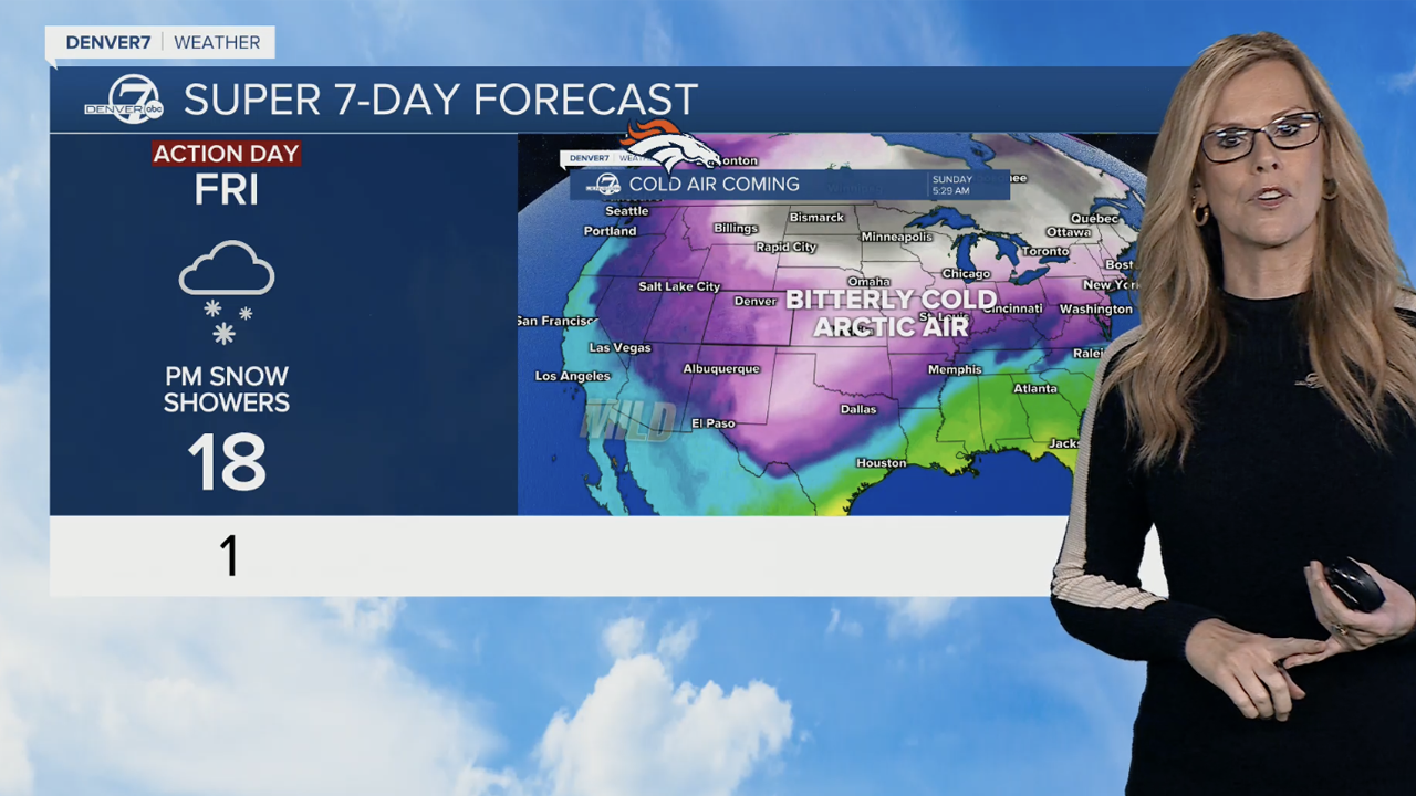
DENVER — Winter might really feel like it has finally arrived as a sharp drop in temperatures with lows dipping to around zero degrees and light snow arrives in Denver’s weather forecast potentially impacting the Friday commute.
For at least 48 hours, Denver’s temperature will remain below freezing with snow picking up late Friday and overnight into Saturday then lingering through the morning hours.
National Weather Service (NWS) forecasters in Boulder predicted overnight lows on both days of the weekend could drop to below zero as the arctic cold spreads across Colorado.
Portions of the High Country could see from around 4” to 10” of snow as a winter weather advisory goes into effect.
“This extremely cold arctic air is going to push down into central U.S. over next couple days and we are in on that as we go through Friday and Saturday, our temperatures will drop into the teens for afternoon highs,” said Denver7 meteorologist Stacey Donaldson, who said considering wind chill factors it will feel even colder.
“It will actually be warmer in the High Country that it is in the Denver metro over the next couple of days.”
Check latest Colorado winter weather alerts
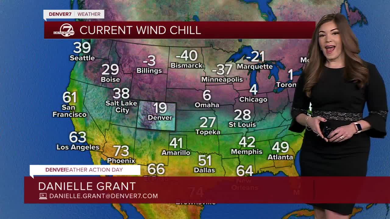
The NWS in Boulder also issued a cold weather alert for northeastern Colorado, "for wind chills as low as 20-below. That’s from 3 a.m. Friday until 9 a.m. on Sunday,” said Donaldson.
The graphic below is the NWS’ latest temperature outlook through the weekend for communities across northeast Colorado.

COLORADO WEATHER TIMELINE, SNOW IMPACTS
Friday will remain dry with mostly sunny skies across the Front Range before the big change arrives Friday.
“Friday morning we see snow from Aspen back toward Telluride and then it starts to push up into the Front Range and northeastern Colorado by 11 p.m. Friday,” she said.
Denver7’s Futurecast shows snow arriving in the Denver metro area sometime late Friday evening. “11 o’clock Friday night, we’ll see that snow really kick in and it will last until Saturday, early morning, and then move out,” added Donaldson.
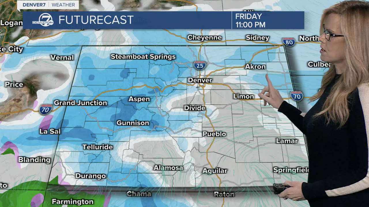
As for snow totals, Donaldson said to expect a “short period of snowfall” that should be “pretty light” for Denver and the Front Range.
As of Thursday morning, Denver is not under any winter weather watch. Here are links to cold weather shelter information and other resources for Denver metro communities.
- Arapahoe County
- Arvada
- Commerce City
- Denver
- Douglas County
- Fort Collins
- Jefferson County
- Littleton
- Lakewood
- Longmont
- Westminster
“With breezy winds across the eastern plains, wind chill readings could be as low as -20F, which means frostbite would be possible in less than 30 minutes. Dress warmly in several layers of clothing, including a hat and mittens, and avoid prolonged outdoor exposure,” added NWS forecasters.


DENVER WEATHER LINKS: Hourly forecast | Radars | Traffic | Weather Page | 24/7 Weather Stream
Click here to watch the Denver7 live weather stream.