


DENVER — Colorado’s first fall cold front is sweeping in with rain, wind, and mountain snow Monday into Tuesday morning.
The fall blast will bring temperatures in Denver to just the mid to high 70s on Monday, as winds pick up out of the north and could gust up to 30 mph.
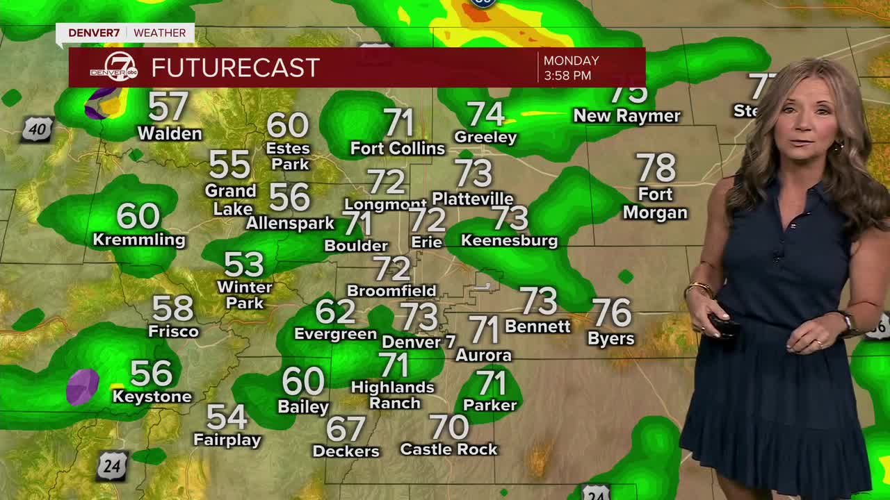
◼️ The hourly forecast below show when to expect the front to impact the Denver area

Denver will also see a good chance of thunderstorms, especially in the afternoon and evening. Overnight showers are expected to persist, with light to moderate rainfall anticipated.
However, this outbreak of fall weather will resemble winter in the high country, with mountain snow likely overnight on Monday and into Tuesday, which could result in slick conditions for mountain passes on Tuesday morning.
“Snow levels could reach down to 9000 ft. (with the potential for 8500 ft.) by Tuesday morning. As of right now, the northern portions of the Front Range mountains will receive the bulk of the snow due to favorable upslope flow and better moisture availability. However, if the upper level trough begins to track more southwesterly, the southern portions of the Front Range could receive more snow," National Weather Service forecasters wrote.
Higher elevations could see up to a foot of snow, while lower elevations may experience 2-6 inches.
Tuesday will be the coolest day of the week, with highs in the upper 50s and lower 60s in Denver, and temperatures in the 30s-50s across the mountains and valleys, accompanied by widespread rain showers.
Expect temperatures to slowly return to seasonal norms on Wednesday and Thursday, before above-normal temperatures resume by Friday.
DENVER WEATHER LINKS: Hourly forecast | Radars | Traffic | Weather Page | 24/7 Weather Stream
Click here to watch the Denver7 live weather stream.


