


DENVER — Colorado's high country will see a powerful winter storm arrive late Friday night, with the heaviest snow and strongest winds expected overnight and through much of Saturday. Travel could be difficult or impossible at times.
A winter storm warning is in effect for much of the mountains for the next 24 hours starting at 11 p.m. Friday.
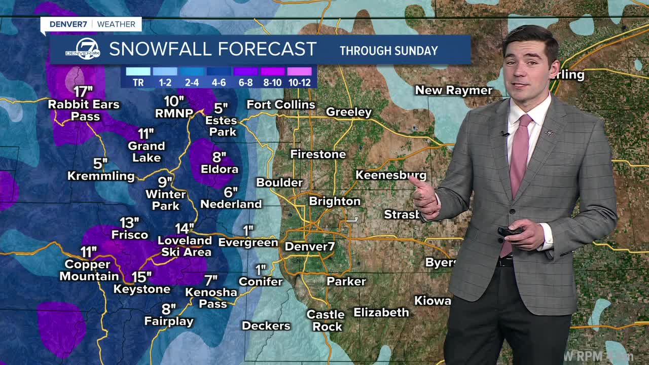
Colorado's northern mountains, including Rabbit Ears Pass and the Park Range, could see 1-2 feet of snow fall between Friday and Sunday.
The I-70 corridor should generally expect 7-15 inches of snow, while some spots in the highest elevations could see up to 20 inches.

Combined with 55-60 mph wind gusts, blowing snow is expected to be a widespread issue on Saturday. Mountain snow will linger into Sunday and eventually taper off.
As for the Denver metro and the Eastern Plains, Saturday could bring some scattered snow or rain showers, but with little accumulation expected. High temperatures will reach the mid-40s Saturday, with just a slight cooldown expected for Sunday.
Next week, we'll see even milder temperatures, with the metro reaching the mid-50s.
DENVER WEATHER LINKS: Hourly forecast | Radars | Traffic | Weather Page | 24/7 Weather Stream
Click here to watch the Denver7 live weather stream.
