


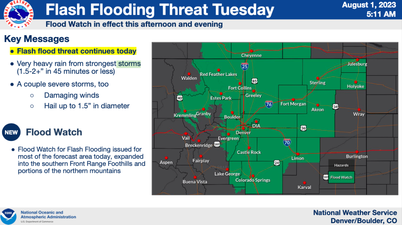
DENVER — A large portion of Colorado, including the Denver metro area are under a flash flood watch from Noon Tuesday until midnight as a monsoonal flow is again bringing widespread thunderstorms across the Front Range.
Strong storms that form could produce rainfall up to 2 inches in 45 minutes, according to the National Weather Service in Boulder, triggering problems for the afternoon commute.
“It’s going to be a lot of rain on a ground that’s already really saturated from yesterday’s showers,” said Lisa Hidalgo, Denver7 morning meteorologist.
Click to see all the communities under Tuesday's flash flood watch and check all Colorado weather alerts here.
Along with the threat of flooding, a few severe storms could form bringing brief, damaging wind and small hail. “These storms could also pick up some steam tonight. We could see some larger hail and damaging winds out on the eastern plains,” said Hidalgo.
The latest weather timeline shows storms should begin to form earlier than Monday. Higher elevations and Colorado’s burn scar areas could see heavy rain beginning around Noon through midnight.
Storms will spread across the urban corridor, the Denver metro area and across Colorado’s plans from 4 p.m. through midnight.
The NWS said the main threat of flooding along the I-25 corridor will be between 3 p.m. and 8 p.m.
A ‘significant’ flooding threat remains in Colorado for Wednesday, although in its early morning update, the NWS said slightly less atmosphere instability combined with quicker moving storms could potentially slightly limit some flooding.
For Thursday, thunderstorm frequency should slightly diminish in Colorado’s lower elevations but the flood threat remains. The NWS said a weak trough will bring some drying to the atmosphere in the morning before moisture returns increasing the storm threat during the day, particularly bringing a flood threat to the plains late into the afternoon and evening.

Drier weather should finally arrive by Friday but while the threat of flooding will drop a few afternoon storms will still be possible.
A cool down arrives in Denver this weekend as Saturday’s afternoon high temperature is expected to be around 79 degrees with afternoon storms. Temps drop further Sunday with the high only reaching 73 degrees and more storms before warming back into the low 80s on Monday.
WEATHER LINKS: Hourly forecast | Radars | Traffic | Weather Page | 24/7 Weather Stream
Click here to watch the Denver7 live weather stream.