
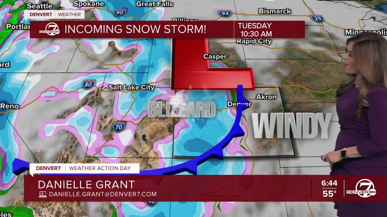


DENVER – Winter returns in a big way through Colorado’s High Country Tuesday with weather forecasters warning of potential snow squalls, or periods of “quick and intense” snow and wind which could create potentially dangerous driving conditions in the mountains.
Up to 2 feet of snow is possible for west Jackson and west Grand Counties in areas above 9,000 feet where a winter storm warning goes into effect at 2 a.m.
“Snow and blowing snow will reduce visibility to a quarter mile or less, with potential for sudden snow squalls to bring quick intense bursts of snow and rapidly reduced visibility. Snow and ice covered roads will make travel very difficult at times,” wrote forecasters with the National Weather Service (NWS) in Boulder.

Also under the winter storm warning:
- Elkhead and Park Mountains (10-20 inches of snow expected; wind gusts as strong as 60 mph)
- Grand and Battlement Mesas, west Elk and Sawatch Mountains, including Crested Butte, Marble, Monarch Pass and McClure Pass (10-20 inches of snow expected; wind gusts as strong as 70 mph)
- Gore and Elk Mountains and Central Mountain Valleys, including the Flat Tops, Aspen, Snowmass, Vail Pass and Minturn (8-16 inches of snow expected; wind gusts as strong as 65 mph)
- Northwest and southwest San Juan Mountains including Telluride, Ouray and Silverton (10-20 inches of snow expected; wind gusts as strong as 70 mph)
- Eastern Sawatch Mountains and eastern San Juan Mountains, both above 11,000 feet (8-24 inches of snow expected; wind gusts as strong as 70 mph)

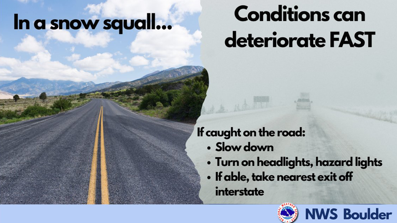
Snow squalls, which the NWS said typically last less than 3 hours, can quickly reduce visibility and bring a “potential for chain-reaction accidents.”Here’s what to do if you encounter a snow squall on the roads, according to the NWS.
- Slow down
- Turn on headlights, hazard lights
- Take the nearest exit off the interstate, if able.
A snow squall warning could be issued for localized areas, so be sure to keep the Denver7 mobile app with you as we will update the latest winter weather alerts as they happen Tuesday.
Check latest Colorado weather alerts
In addition to the winter storm warning, the NWS has issued a winter weather advisory for the following areas:
- Jackson, Grand and Summit counties below 9,000 feet, including North Park, Grand Lake, Fraser, Kremmling, Dillon and Granby (5-10 inches of snow expected; wind gusts as strong as 55 mph)
- Rocky Mountain National Park, Medicine Bow Range, mountains of Summit County, Mosquito Range and Indian Peaks (5-12 inches of snow expected; wind gusts as strong as 70 mph)
- Upper Yampa River Basin, including Steamboat Springs (4-8 inches of snow expected; wind gusts as strong as 45 mph)
- Upper elevations in the La Garita Mountains, Lake County, western Chaffee County, western Mosquito Range, Rio Grande Valley and eastern San Juan Mountains (4-12 inches of snow expected; wind gusts as strong as 75 mph)
- Sangre de Cristo Mountains (up to 6 inches of snow expected; wind gusts as strong as 85 mph)

Weather News
Heavy snow expected in CO mountains, elevated fire danger along Front Range
As for the Denver metro area and Colorado’s northeastern plains, mild temps along with dry conditions and strong winds will combine for a critical fire danger on Tuesday.
A red flag warning goes into effect at 10 a.m. Tuesday through at least 7 p.m. for the I-25 corridor and across northeastern Colorado
“Conditions will be favorable for rapid fire spread. Avoid outdoor burning and any activity that may produce a spark and start a wildfire,” added the NWS.The winds are expected to pick up overnight, including in the Denver metro area.

Fierce winds over Colorado
Denver7 meteorologist Danielle Grant breaks down what’s called ‘Bora winds’ which happen in winter in Colorado. Here’s what it means.
“This is the effect. As the storm system cruises in, it dumps all of that snow west of the Divide and then those strong winds race down the foothills and the east slopes of the Rocky Mountains – typically after a cold front – and that is what brings us these strong winds,” said Grant. “We’re going to be looking at 50, 60 and 70 mph wind gusts coming down with this storm which could easily bring down power lines and trees.”
Here's a look at possible wind gusts across Colorado from the NWS. Denver7 will publish a weather blog Tuesday morning tracking the latest alerts and impacts.


DENVER WEATHER LINKS: Hourly forecast | Radars | Traffic | Weather Page | 24/7 Weather Stream
Click here to watch the Denver7 live weather stream.