


DENVER — Tonight, things stay pretty calm across Colorado. Skies will be quiet around the Denver area should remain smooth, with light winds and no major weather issues. But don’t get too used to it, this is basically the calm before a much more active and intense stretch of weather.

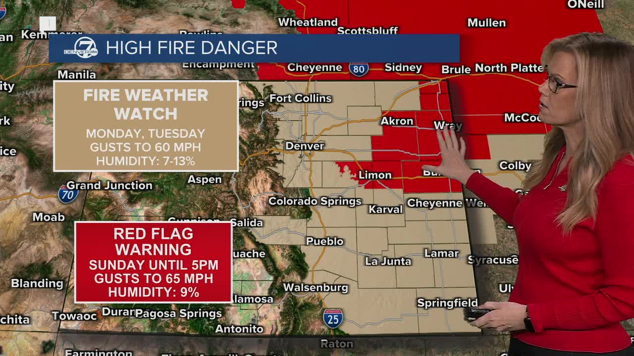
By Sunday, fire danger ramps up, especially out on the eastern plains. It’ll be warmer, very dry, and breezy, with gusts strong enough to help fires spread quickly. Humidity levels will be extremely low, and that’s why a Red Flag Warning is in effect for parts of the plains. Monday looks even more concerning, particularly along and south of the I-25 corridor, including areas near Denver. Winds will pick up again, and depending on exactly where the strongest gusts set up, critical fire weather conditions could cover a large chunk of eastern Colorado.

Tuesday is the big day to watch. A strong storm system moving in from the West Coast will crank up the wind dramatically across the foothills and all of the eastern plains. We’re talking very strong gusts that could exceed 50 mph in some spots, possibly even stronger in the mountains. It will stay very dry on the plains, so extreme fire danger is possible. This could be one of those days where any spark becomes dangerous fast.
While the plains deal with wind and fire danger, the mountains will see snow return early Tuesday. Moist, Pacific air combined with powerful winds will bring accumulating snow, and even though totals may not be huge at first, the wind is the real problem. Gusts in the high country could exceed 75 mph in some areas, leading to blowing snow and whiteout conditions. Travel over mountain passes on Tuesday could become very dangerous, with sudden drops in visibility and slick roads.
After Tuesday, we don’t completely calm down. Wednesday will be a little cooler, but still windy and dry enough for continued fire concerns on the plains. The mountains may get another round of snow midweek, possibly with better accumulation as colder air moves in. Through the rest of the work week, expect ongoing fire weather concerns on the plains and periodic snow and wind in the mountains, an active and potentially hazardous stretch of February weather across Colorado.
DENVER WEATHER LINKS: Hourly forecast | Radars | Traffic | Weather Page | 24/7 Weather Stream
Click here to watch the Denver7 live weather stream.
