


DENVER – It's been an active day of weather across the Front Range with rare overnight severe storms and another round this afternoon. Baseball-sized to quarter-sized hail battered portions of northeastern Colorado Tuesday.

Milliken residents were jarred awake early Tuesday morning when large hail stones hammered neighborhoods. Denver7 reporter Allie Jennerjahn talked to residents and showed windshield damage to cars and tree branches strewn across the street.

We're in for a few more lingering showers, but the severe threat is low for the rest of the evening along the Urban Corridor and Eastern Plains. Look for skies to gradually clear overnight with the possibility of a bit of morning fog along the plains. Temperatures will drop into the low 50s by Wednesday morning.
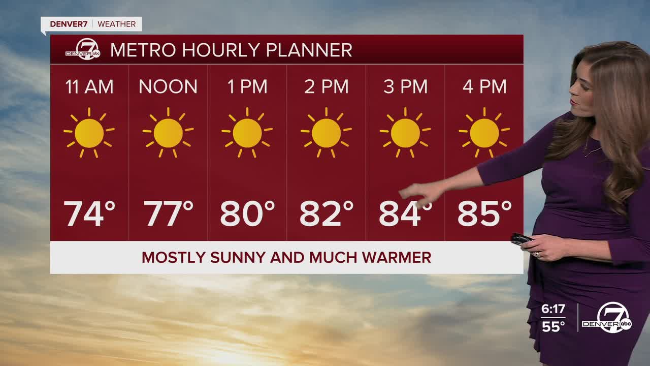
Say so long to the storms, and hello to the summertime heat! A strong ridge of high pressure will move into Colorado starting Wednesday and amplify through the weekend. Look for mid 80s Thursday afternoon under mostly sunny skies.
Temperatures soar into the 90s Thursday with potential 100s by Friday, the first day of the summer season. Cooler temperatures and scattered storms make a comeback early next week.

Stay with Denver7 for the latest weather updates.

DENVER WEATHER LINKS: Hourly forecast | Radars | Traffic | Weather Page | 24/7 Weather Stream
Click here to watch the Denver7 live weather stream.