


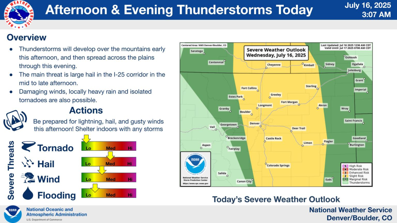
DENVER – Widespread rain is expected to settle across northeastern Colorado on Wednesday bringing the threat of severe storms to the Denver metro with the risk of large hail and damaging winds. An isolated tornado is not out of the question.
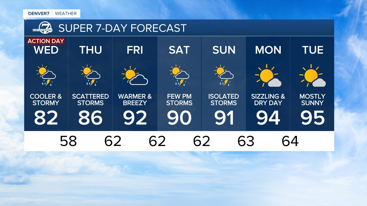
“More moisture, more instability in the atmosphere and we have a risk of a few severe-warned thunderstorms. We’ve issued a Denver7 Weather Action Day to get you prepared,” said Denver7 weather forecaster Katie LaSalle. “Most of the metro will stay dry for the next several hours and it’ll stay cooler-than-average with upper 70s and low 80s for the Denver area Wednesday.”
Communities along the I-25 corridor are under a slight risk (level 2 of 5) of seeing severe storms.
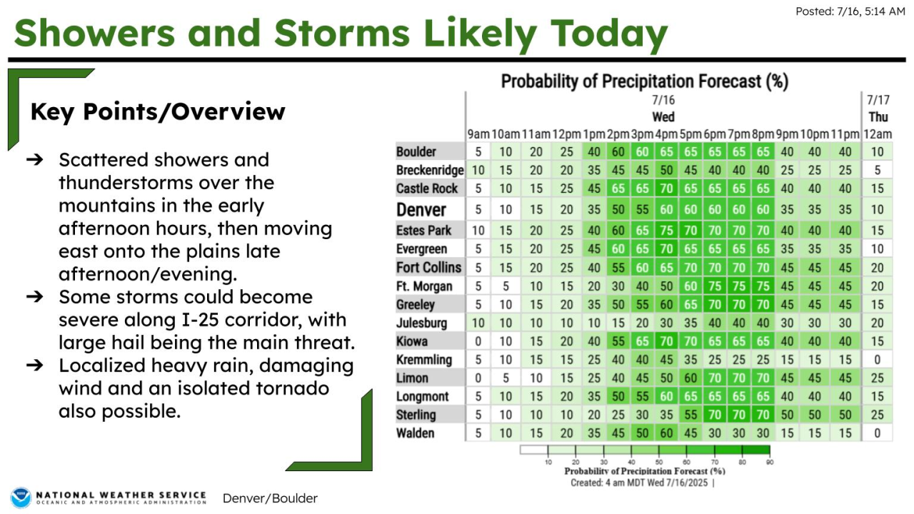
“Not everyone will see severe weather but we are bracing for widely scattered thunderstorms and showers first developing over Western Colorado in the mountains. After 3 p.m. in Denver, we are looking at that good chance of seeing storm activity and that will stick around through tonight," said LaSalle.
As of Wednesday morning, the National Weather Service (NWS) in Boulder had not issued any severe weather watches.
Denver7 will update this story if alerts are issued.

The Denver7 News team will also publish a weather blog later this afternoon to track any severe thunderstorm warnings and storm reports.
You can check latest Colorado weather alerts at this link
STORM TIMELINE
The main storm event will start to develop after the noon hour.
“In the mountains, we’ll start to see those thunderstorms form and start spreading over the I-25 corridor right around 3 o’clock. Be prepared for some wet weather and you may want to bring the car in the garage later on today, especially over the eastern plains where we could see that risk of large hail and damaging winds through tonight,” said LaSalle.
“Thunderstorms will develop over the mountains early this afternoon, and then spread across the plains through this evening. The main threat is large hail in the I-25 corridor in the mid to late afternoon. Damaging winds, locally heavy rain, and isolated tornadoes are also possible,” added NWS forecasters, which said the main threat is of large hail during the afternoon hours.

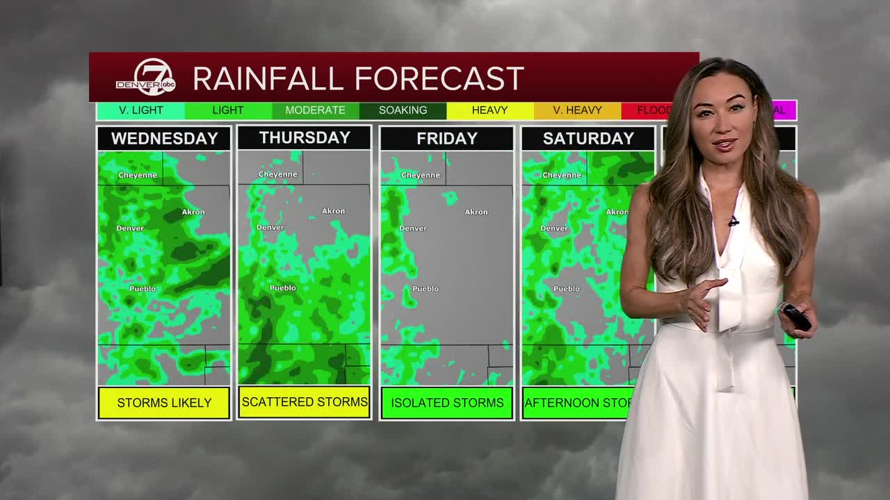
As for Thursday’s weather forecast for Denver, we should see fewer storms with an afternoon high remaining in the mid 80s.
Friday, the heat and 90s return with warmer and breezier conditions before the weekend in Denver brings the typical July afternoon storm threat and highs in the 90s.

DENVER WEATHER LINKS: Hourly forecast | Radars | Traffic | Weather Page | 24/7 Weather Stream
Click here to watch the Denver7 live weather stream.