


DENVER - Keep your eyes to the sky! The Denver metro area and eastern plains will see scattered and possibly severe storms Wednesday evening.
A Severe Thunderstorm Watch is in effect until 10pm for much of the Front Range, I-25 corridor and Eastern Plains. Large hail, damaging wind gusts and isolated tornadoes will be the biggest threats across the Front Range Wednesday evening.
Look for a few lingering showers overnight along with mostly cloudy skies. Temperatures will drop into the mid to upper 50s around the Denver metro overnight.
It'll be a mostly cloudy and hazy start to your Thursday with a few isolated afternoon storms. So far, it looks like the threat of severe weather will be much lower Thursday.
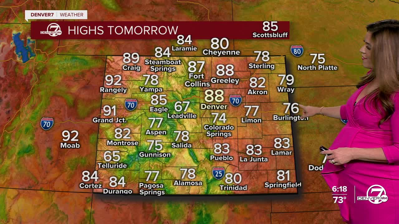
Temperatures will warm a few degrees into the mid to upper 80s Thursday.
By Friday, the heat will start to creep back in, with temperatures climbing back into the 90s and the usual pattern of afternoon storms returning. It won’t be a total washout over the weekend but storm chances will continue each day. Keep your umbrella or rain jacket nearby just in case something drifts over your area in the afternoon or evening!
Mid-90s and sunny skies are back early next week.
DENVER WEATHER LINKS: Hourly forecast | Radars | Traffic | Weather Page | 24/7 Weather Stream
Click here to watch the Denver7 live weather stream.
