


DENVER — It's a quiet, cool and hazy start to our day. Smoke is filtering in across Colorado from wildfires burning in Utah and while that's making for a pretty sunrise, it's not great to be breathing in.
Temperatures will climb into the low to mid-80s this afternoon and that heat combined with more moisture on the Eastern Plains will lead to some stronger storms. We'll see some isolated activity by mid-afternoon but there's a much better chance Tuesday night.
- Watch the full forecast in the video player below.
These cells could produce huge hail, damaging 60+ mph wind gusts and isolated tornadoes across the eastern half of the state.
We'll see a chance of severe storms across the Interstate 25 corridor and eastern plains over the next two days. There will be a lower risk of severe weather on Thursday and a better chance of getting some much-needed rain.
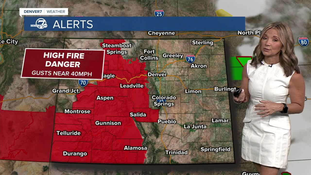
In the mountains and high valleys, elevated to critical fire weather conditions will continue at times through much of next week. While a few storms are possible, many areas will remain relatively dry. Gusty winds combined with low humidity will keep fire danger elevated as red flag warnings go back in effect for much of the day on Tuesday.
A switch up in the weather pattern arrives this weekend! We'll see more sunshine, limited storms, gusty winds and some summertime heat! Daytime highs will soar into the mid to upper 90s on Saturday and Sunday.
It looks like the warmer weather sticks around into early next week.
DENVER WEATHER LINKS: Hourly forecast | Radars | Traffic | Weather Page | 24/7 Weather Stream
Click here to watch the Denver7 live weather stream.
