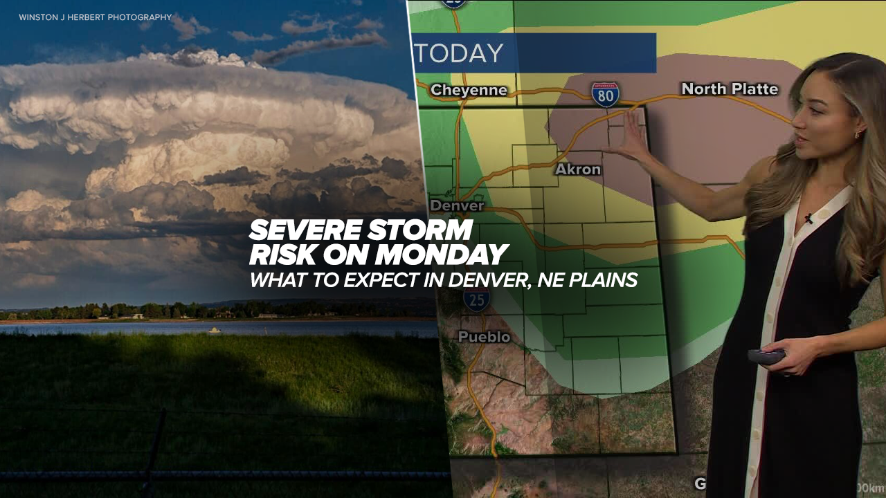
DENVER — A few afternoon thunderstorms, including a potential severe storm, are possible in Denver starting Monday afternoon into the evening hours while the risk for damaging winds, hail and isolated tornadoes is greater across Colorado’s northeastern plains.
The National Weather Service (NWS) in Boulder issued a tornado watch for Colorado's far north and northeastern counties until 11 p.m. on Monday.
Counties in the tornado watch include: Logan, Morgan, Phillips, Sedgwick, Washington, Weld and Yuma.
Along with the threat of tornadoes, the NWS said hail up to tennis ball size and wind gusts up to 70 mph were possible.
As of early afternoon, the National Weather Service (NWS) in Boulder added Denver, Boulder and Longmont to an area of marginal risk of severe weather on Monday. Fort Collins, Estes Park and Granby are under a marginal threat of a severe storm.
The severe thunderstorm threat grows further east across the state.
Check latest Colorado severe weather alerts

Fort Morgan, Deer Trail, Greeley, Limon to Burlington will be under a slight risk of a severe storm dropping hail or damaging winds.
The far northeastern corner of Colorado is under an enhanced risk of severe weather on Monday bringing the biggest threat of potentially damaging weather and isolated tornadoes.
The NWS Storm Prediction Center said a severe weather watch would be likely for portions of northeast Colorado.
The communities of Sterling, Akron, Wray and Julesburg should stay weather aware for the development of severe storms Monday afternoon.

While the NWS has not issued severe thunderstorm or tornado watches for Monday, the NWS’ risk of severe weather scale runs from a level 1, or marginal risk to level 5 or high risk.
“The National Weather Service upgraded the severe weather outlook for today and the bullseye encompasses northeast Colorado,” said Denver7 weather forecaster Katie LaSalle.
Conditions are expected to remain mostly clear and dry in Denver and the plains until later during the afternoon hours.
“The clouds build quickly and after 4 p.m. we’ll see a temperature drop which is when we’ll see our best chance for thunderstorms rolling through the metro area and out east,” added LaSalle.
Storms are expected to pop up around Greeley and march toward the northeast on Monday afternoon. While the thunderstorm threat remains in the Denver area, conditions could remain cloudy in the metro as storms begin firing on the plains.

The NWS said between 4 p.m. and midnight would be the “peak risk period” for strong storms to develop and while a few tornadoes are possible on the northeast plains, significant, large hail would be the greatest threat with severe storms that develop.
‘Large hail greater than 2” in diameter and damaging wind gusts up to 70 mph are possible,’ wrote the NWS.
Widespread flooding is not expected on Monday.
“We will still see the chance for wet weather into the overnight hours and could see a bit of a thunder and lightning show early Tuesday morning and some fresh snow at elevations mainly above 10,000 feet into Colorado’s northern and central mountains,” said LaSalle.

Weather News
Colorado weather in May: A month of extremes as severe weather season ramps up
Denver’s forecast on Tuesday shows a rainy and cooler day in store with a high of only 58 degrees expected.
While rain and slightly cooler conditions are expected in Denver on Tuesday, the severe weather threat will diminish as the storm system moves east.
Temperatures quickly rebound on Wednesday with a high of 74 degrees expected in Denver then warming to 80 degrees on Thursday, which is forecast to be the warmest day of the week.
Denver’s weather brings a few late day thunderstorms on Friday with highs in the low 70s before dry and warm weather settles in for the weekend.

DENVER WEATHER LINKS: Hourly forecast | Radars | Traffic | Weather Page | 24/7 Weather Stream
Click here to watch the Denver7 live weather stream.


