


DENVER – As temps heat up across northeastern Colorado, scattered strong to severe thunderstorms are possible starting Thursday afternoon.
While the Denver metro area is under a marginal, or lowest risk of severe storms, portions of far northeastern Colorado are under a slight risk for severe weather.
“The storms are expected to roll over the plains through early afternoon. There is a marginal risk of severe weather along the I-25 corridor with one of the bigger issues being gusty winds, especially along parts of northeastern Colorado,” said Denver7 chief meteorologist Lisa Hidalgo.
The Denver7 news team is tracking the latest Colorado weather alerts and conditions across the metro.
Refresh this page for updates and keep checking back for new details.
LINKS: Latest forecast | Radars | Traffic | Weather Page | 24/7 Weather Stream
Thursday, June 12
4:00 p.m. | Severe thunderstorm warning cancelled | Southeastern Larimer County is no longer under a severe thunderstorm warning.
3:23 p.m. | Severe thunderstorm warning | Southeastern Larimer County is under a severe thunderstorm warning for a storm located 12 miles southwest of Fort Collins. According to the NWS, the storm is moving east at 10 mph. Quarter-sized hail is possible.

3:10 p.m. | Severe thunderstorm watch | The NWS issued a severe thunderstorm watch until 11 p.m. for counties in far northeastern Colorado where large hail and damaging winds are possible with any severe storm.
Counties included:
- Logan
- Morgan
- Phillips
- Sedgwick
- Weld

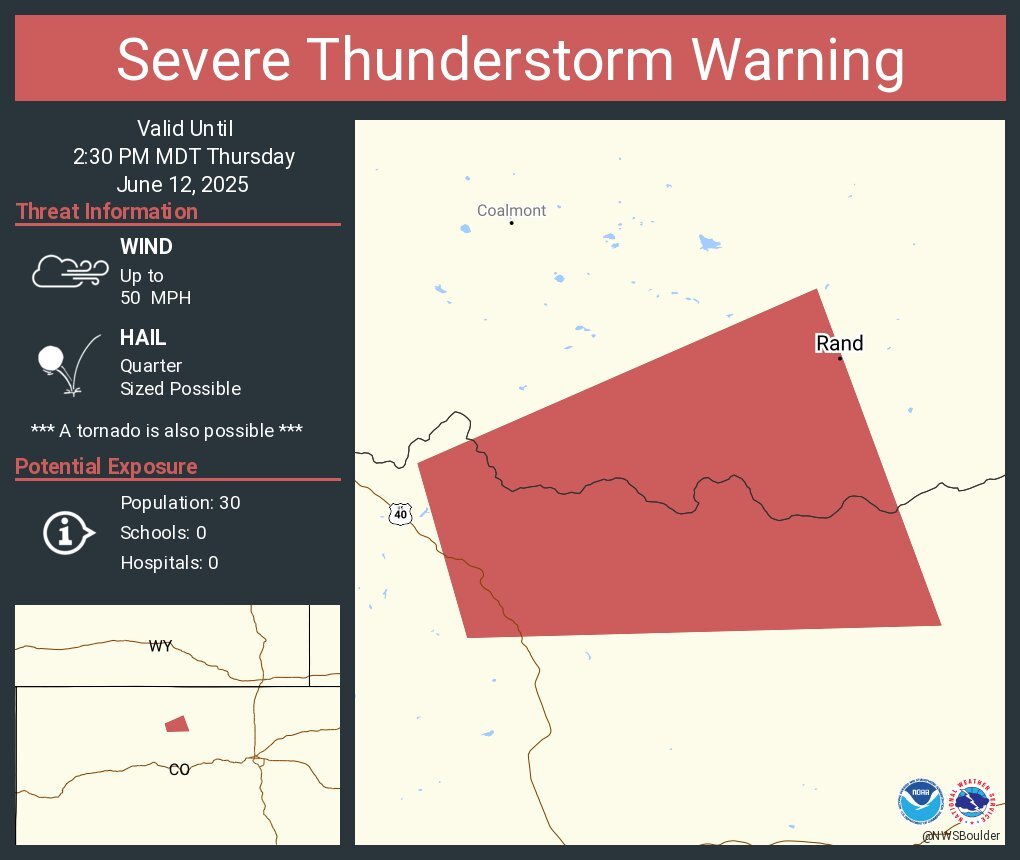
1:50 p.m. | Severe thunderstorm warning | The NWS issued a severe thunderstorm warning for NW Grand, South central Jackson Counties until 2:30 p.m. Quarter-size hail is possible.
12:30 p.m. | Severe storm chances | Severe storms will be isolated this afternoon, but Denver7 chief meteorologist Lisa Hidalgo said any severe storm that pops up could drop hail up to 1" in size with the main threat being gusty winds, up to 60 mph.
Click here to watch the Denver7 live weather stream..