
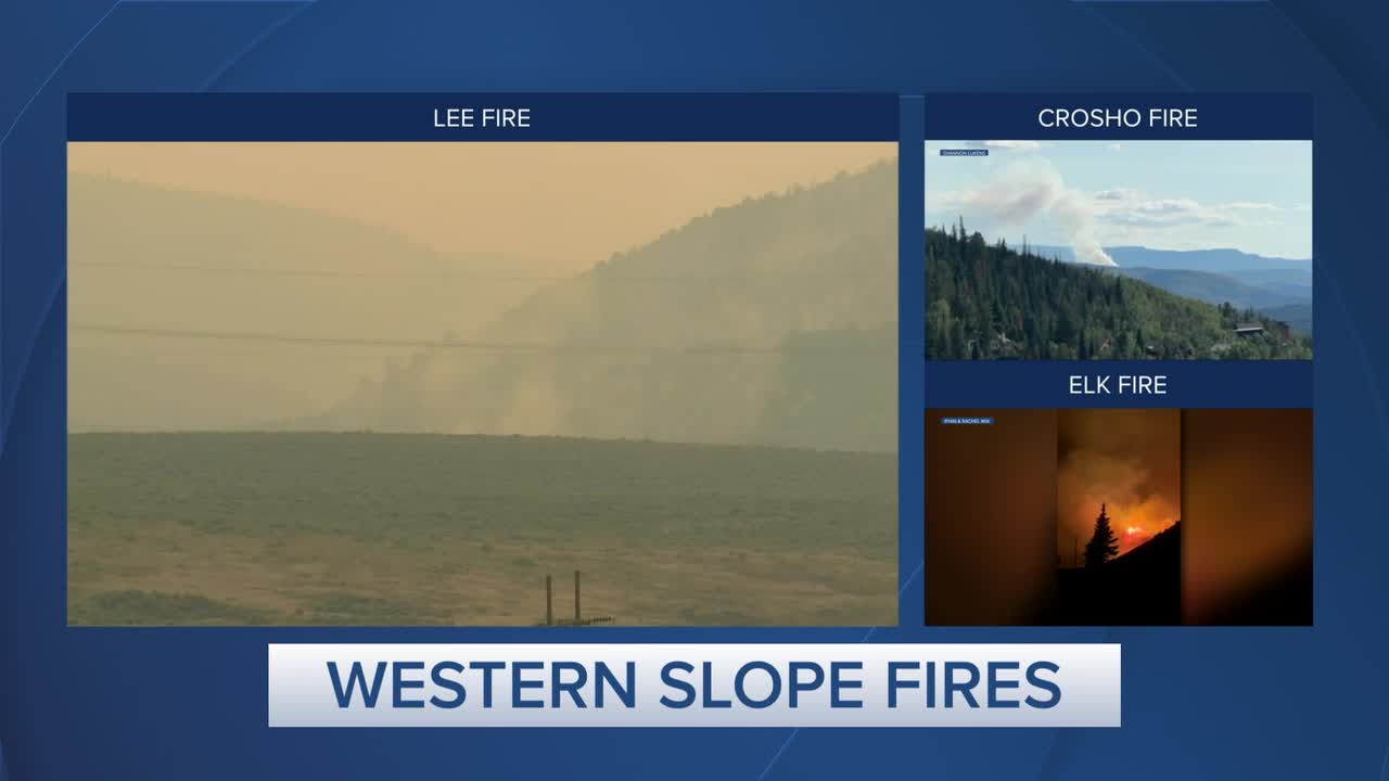


DENVER — Firefighters battling the Lee Fire in Rio Blanco County, which has grown to over 133,000 acres in size, managed to reach 31% containment on the blaze by Friday evening, according to fire officials.
On Wednesday, extreme fire behavior pushed the Lee Fire to the south near the Garfield County line, and the Crosho Fire east into Routt County.
The extreme fire behavior prompted Gov. Jared Polis to sign an executive order declaring a disaster emergency for the whole state on Thursday, which will bolster the state's response to these and any new potential wildfires. Polis has also mobilized the Colorado National Guard to support response efforts for Rio Blanco County and has verbally declared a disaster declaration for fires elsewhere in the Western Slope. FEMA has authorized the use of federal funds to help with firefighting costs.
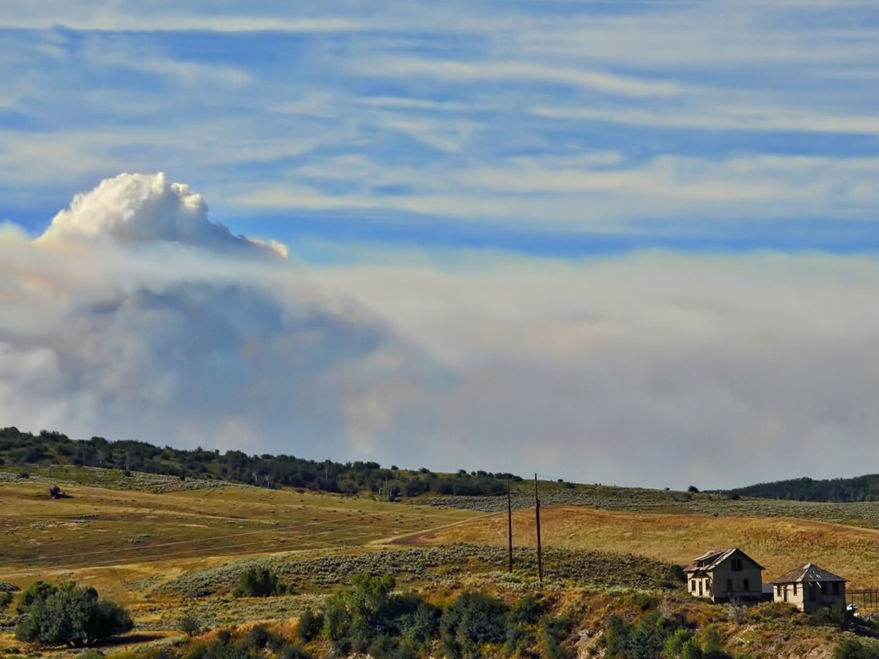
At least 15 fires have burned more than 216,000 acres across Delta, Dolores, Garfield, Grand, Mesa, Moffat, Montrose, and Rio Blanco counties, as well as in parts of eastern Utah, with the state's fifth-largest fire in history burning near Meeker.
The fires are being fueled by extreme drought conditions in the Western Slope, with a large swath of the western half of the state experiencing moderate and severe drought, according to the latest data from the U.S. Drought Monitor.
- Denver7 has created the map below to give you a better idea of where these fires are located. Click on the red dot to view more information about each one. Can't view the map? Click here to view it in full screen.
We're tracking the latest updates on these fires below.
Blue Ridge Fire
Size: 25 acres
Containment: N/A
First reported: Aug. 15
Cause: Under investigation
Location: La Plata County, Colo.
Evacuations 🏠: None at this time
Pre-evacuations: A map of the pre-evacuation zones can be viewed here.
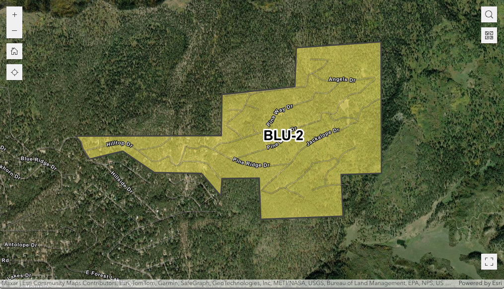
A new wildfire was reported Friday afternoon in La Plata County, dubbed the Blue Ridge Fire.
Crews have nearly encircled the 25-acre fire "with hose and/or bulldozer," according to the La Plata County Sheriff's Office. No structures are in immediate danger.
Residents in the Hilltop Drive area who were under evacuation orders are allowed to return to their homes, but the area remains on a "Set" pre-evacuation status, according to the sheriff's office. There are currently no mandatory evacuation orders in place. The latest evacuation map can be viewed through this link.
Updates posted to:
La Plata County Government
Crosho Fire
Size: 2,200 acres
Containment: 0%
First reported: Aug. 11 at 3:25 pm.
Cause: Under investigation
Location: 7.5 miles northwest of Yampa, Colo., in Routt County
Evacuations 🏠: County Road 90 to the north, County Road 92 to the west, the Allen Basin Reservoir to the south, Highways 17 and 15 to the east. A map of the evacuation zones can be viewed through this link.
Pre-evacuations: Residents in the area bordered by County Road 19 to the north, Highway 131 to the east, County Road 13 to the south and the Crosho Lake area to the west are included.
The Crosho Fire is burning immediately adjacent and north of Crosho Lake in the Routt National Forest in Rio Blanco County and parts of Routt County, according to fire officials.
Fire officials issued new evacuation orders Thursday afternoon as the Crosho Fire continued to push into Routt County. An evacuation center was established at South Routt Elementary School, located at 448 Main St. in Yampa. It will be open from 8 a.m. to 5 p.m.
In all, about 240 structures are threatened, fire officials said Friday.
Nearby landowners and ranchers were contacted by fire officials, and plans to move livestock if needed were made, they said. Transition to a Type III Incident Management Team will occur on Wednesday afternoon.
The following roads are closed, effective immediately, due to the Crosho Fire and response efforts:
- Intersection of Routt County Road 15 and Routt County Road 17
- Intersection of Routt County Road 25 and Routt County Road 132A
- Rio Blanco County Road 8 (Dunckley Pass) at mile marker 38
A portion of the Routt National Forest, the Chapman Reservoir Campground, and dispersed camping in the Crosho Lake area are closed to the public. The Medicine Bow-Routt National Forests also issued an emergency closure order around the Crosho Fire.
Updates posted to:
InciWeb
Crosho Fire Information
Rio Blanco County Sheriff's Office
Elk Fire
Size: 14,518 acres
Containment: 93%
First reported: Aug. 2
Cause: ⚡️
Location: 11 miles east of Meeker
Evacuations 🏠: No current evacuations
Pre-evacuations: No pre-evacuations at this time
The lightning-sparked Elk Fire, first reported on Aug. 2, is burning 11 miles west of Meeker in Rio Blanco County.
Two homes and two outbuildings have burned in the Elk Fire, according to officials in Rio Blanco County, who said the fire remained within established control lines with minimal to no growth on Wednesday.
Crews focused Thursday on continued patrol, mop up, and reinforcement of the lines along the perimeter, and began suppression repair work to restore areas disturbed during suppression activities.
Fire officials said Friday they do not expected to see any growth in the fire, but work will continue to reinforce firelines as they patrol and mop up hotspots inside containment lines and work on fire suppression repair.

The following road closures are still in effect, according to the Rio Blanco County Sheriff's Office:
- CLOSED HIGHWAYS: Highway 13 South Highway 13 Closure Area: in both directions between Piceance Creek Road (15 miles north of Rifle)
- RESTRICED TO LOCAL TRAFFIC ONLY COUNTY ROADS: County Road 13 (residents who live in the area).
- CLOSED COUNTY ROADS: County Road 5, 22, 33, 40, 45, 47, 49, 63, 66, 67, 117,127, 129
The Rio Blanco County Sheriff's Office said a partial closure of the White River National Forest was also in effect due to the fire within the Blanco Ranger District west of and including the Long-Lost Trail system.
Updates posted to:
Elk and Lee Fire Information
Rio Blanco County Sheriff's Office
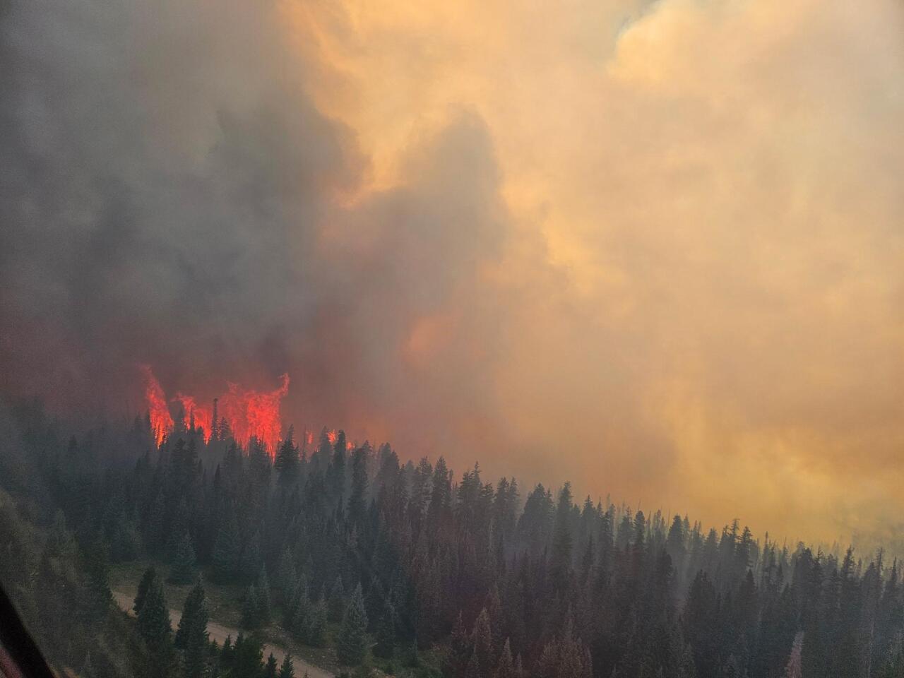
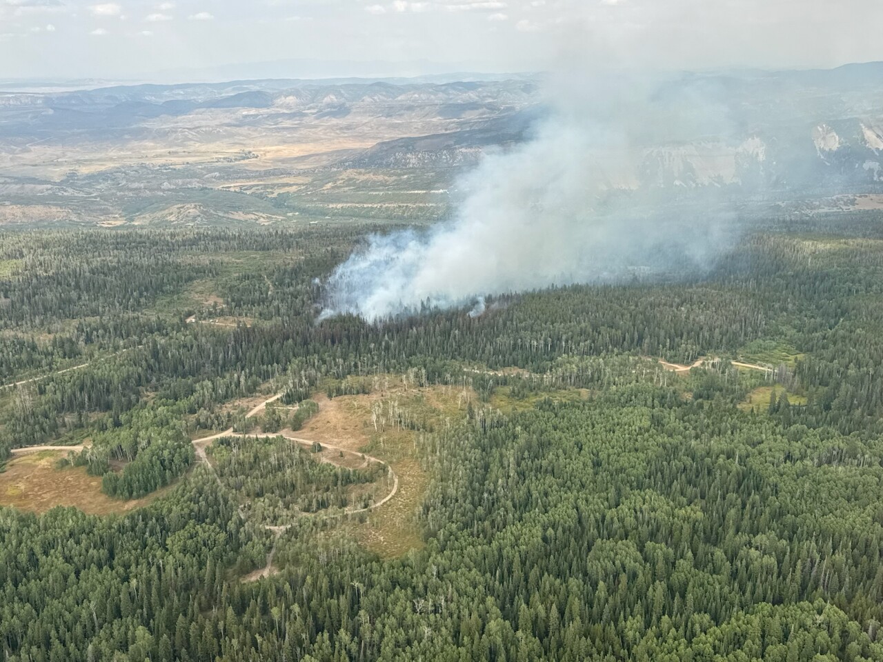
Lee Fire
Size: 133,954 acres
Containment: 31%
First reported: Aug. 3 at 1 p.m.
Cause: ⚡️
Location: 18 miles southwest of Meeker, Colo.
Evacuations 🏠: For the most up-to-date evacuation map, click here.
Pre-evacuations: For the most up-to-date pre-evacuation map, click here.
Three homes and 12 outbuildings have burned so far in the Lee Fire, according to officials in Rio Blanco County, who said firefighters made steady progress on the north side of the fire and continued to work along Hogback Ridge Thursday .
Firefighters will focus Friday on patrolling and mopping up any hotspots to reinforce firelines on the west side and along the Highway 13 corridor, with interior burning anticipated to continue north of County Road 5.
"While there is an increased chance of precipitation, critically low fuel moisture will continue to drive fire behavior," officials said, with the potential for isolated torching and spotting, particularly in unburned pockets inside established containment lines. Crews will patrol and mop up any hotspots to reinforce firelines on the west side and along the Highway 13 corridor.

The following road closures are still in effect for residents in Rio Blanco County:
- CLOSED HIGHWAYS: Highway 13 South Highway 13 Closure Area: in both directions between Piceance Creek Road (15 miles north of Rifle)
- RESTRICED TO LOCAL TRAFFIC ONLY COUNTY ROADS: County Road 13 (residents who live in the area).
- CLOSED COUNTY ROADS: County Road 5, 22, 33, 40, 45, 47, 49, 63, 66, 67, 117,127, 129
The Rio Blanco County Sheriff's Office said a partial closure of the White River National Forest was also in effect due to the fire within the Blanco Ranger District west of and including the Long-Lost Trail system.
Updates posted to:
Elk and Lee Fire Information
Rio Blanco County Sheriff's Office
InciWeb
Oak Fire
Size: 75 acres
Contained: 78%
First reported: Aug. 10
Cause: Structure fire
Location: Archuleta County west of Pagosa Springs
Evacuations 🏠: No evacuations at this time
Pre-evacuations: No pre-evacuations at this time
At least one small barn, a pump house, a pergola, a carport, and a camper trailer have sustained significant damage from the Oak Fire burning west of Pagosa Springs, according to fire officials.
No homes were identified as damaged or lost to the fire, according to officials, but Gov. Polis has declared a disaster emergency, which frees up state and federal resources, for this fire. Fire officials said on Aug. 12 that the fire had so far cost $2 million.

Evacuations issued for the blaze were lifted on Aug. 13, along with temporary road closures that were put in place by the Pagosa Ranger District.
Updates posted to:
Archuleta County Sheriff's Office
Peninsula Fire
Size: 17 acres
Containment: 80%
First reported: Aug. 8
Cause: ⚡️
Location: Specie Mesa (M44 Road) South of Highway 145, between Norwood and Placerville, Colo.
Evacuations 🏠: No evacuation orders at this time
Pre-evacuations: Laughing Dog and Peninsula subdivisions
The lightning-sparked Peninsula Fire, first reported July 31, is burning south of Highway 145 between Norwood and Placerville in San Miguel County.
The San Miguel County Sheriff’s Office reported Friday that the Peninsula Fire was 80% contained, with full containment expected within the next 72 hours, depending on weather and fire behavior.

Updates posted to:
San Miguel County Sheriff's Office
West Slope Fire Info
Stoner Mesa Fire
Size: 7,390 acres
Containment: 0%
First reported: July 28
Cause: ⚡️
Location: 20 miles northeast of Dolores
Evacuations 🏠: No current evacuations
Pre-evacuations: No pre-evacuations at this time
The lightning-sparked Stoner Mesa Fire, first reported on July 28, is burning west of Telluride inside the San Juan National Forest in Dolores County.
In a Friday update, fire officials said good progress was made Thursday to establish and strengthen containment lines. This work will continue as weather conditions into the weekend become favorable to support this work, they said.

Additionally, two structure groups have been established to assess and protect structures along Highway 145 and County Road 38, according to fire officials. These groups will continue assessments and mitigation work as needed to protect structures adjacent to the fire. A contingency line above Rico has been identified and is intended to divert potential fire impact away from the community.
The San Juan National Forest has implemented a fire area closure in the vicinity of Taylor and Stoner Mesas for the safety of firefighters and the public, fire officials added.
Updates posted to:
Stoner Mesa Fire Information
USDA Forest Service Facebook page
InciWeb
Turner Gulch Fire
Size: 31,695 acres
Contained: 75%
First reported: July 10
Cause: ⚡️
Location: 8 miles northeast of Gateway, Colo.
Evacuations 🏠: No evacuation orders at this time
Pre-evacuations: All private lands in the Big Creek and Divide Forks Campground Evacuation Zones, including private inholdings in the Uncompahgre National Forest from Forest Road 406 to 409 (seen as the Cold Springs Evacuation Zone on evacuation maps), as well as all private in-holdings in the Ute Creek Evacuation area, which includes areas in the Uncompahgre National Fores.
The Turner Gulch Fire, burning off Highway 141 northeast of the town of Gateway in Mesa County, has burned more than 31,000 acres.
In a Friday morning update, fire officials said a successful burnout operation in the Crow Creek area proved "invaluable" in stopping the spread of the fire. Crews continue to mop up and secure this section fire line, ensuring that all heat in close proximity to the line is fully extinguished.
The western edge of the fire continues to show little to no growth, but firefighters will pause work on this area of the fire due to potentially dangerous weather conditions forecasted Friday.
Niche Road is closed due to unsafe conditions, and Divide Road remains closed for safe and operational access. People who need help with sheltering large animals should contact (970) 778-0161 to be connected with options and resources.
No injuries have been reported, and no structures have been lost.
Updates posted to:
InciWeb
Turner Gulch Fire Info.
Upper Colorado River Interagency Fire Management Unit Facebook
Yellowjacket Fire
Size: 35 acres
Contained: N/A
First reported: August 15
Cause: Unknown
Location: Northeast of Meeker, Colo.
Evacuations 🏠: No evacuation orders at this time
Pre-evacuations: No pre-evacuation orders at this time
Another fire sparked near Meeker on Friday.
The Yellowjacket Fire is located northeast of the town and is estimated to be 35 acres, according to the US Forest Service.
The fire is burning in mixed conifer and aspen on White River National Forest lands, with dead and down material.
The Forest Service said two dozers, two helicopters, multiple fire engines and "hand crews" are working to suppress the fire.
Updates posted to:
U.S. Forest Service - White River National Forest
WILDFIRES THAT HAVE BEEN FULLY CONTAINED
The 107-acre Coulter Creek Fire, which is burning in Carbondale, was fully contained on Aug. 4, just a day after it was first reported by fire officials from the Carbondale & Rural Fire Protection District. No homes were lost, though one outbuilding was destroyed in the fire. No injuries were reported as a result of the blaze.
Burning in eastern Utah and parts of Montrose County, Colo., the 17,724-acre Deer Creek Fire was fully contained on Aug. 11. On Aug. 8, the Montrose County Sheriff's Office said evacuation orders for Montrose County due do this fire had been lifted.
The Leroux Fire burning 1.5 miles east of Redlands Mesa in Hotchkiss, Colo. remains 90% contained and is 195 acres in size. Fire officials said in their last regular update on Sunday that the expected full containment by the end of the week ending Aug. 15.
While not fully contained, the U.S. Forest Service is no longer providing any updates on the South Rim Fire, which is burning inside Black Canyon of the Gunnison National Park in isolated and inaccessible areas. Fire officials said the burn scar from this fire "could lead to rockfall, mud slides, and debris flows that would pose a serious risk to anyone in the East Portal." Ignited by lightning on July 10, the fire was last reported to be 4,232 acres in size and 52% contained.
The 4,287-acre Twelve Fire burning 18 miles west of Maybell, Colo. was declared fully contained on Aug. 13, according to BLM officials.
The Wright Draw Fire, caused by lightning on July 10, about eight miles northeast of Gateway, grew to 466 acres in size before it was fully contained on Aug. 5. No injuries were reported, and no structures were lost, according to fire officials.
The lightning-sparked Windy Gap Fire, first reported Aug. 6, burned 30 acres in Grand County and was fully contained on Monday, Aug.11.


Denver7 is committed to making a difference in our community by standing up for what's right, listening, lending a helping hand and following through on promises. See that work in action, in the videos above.