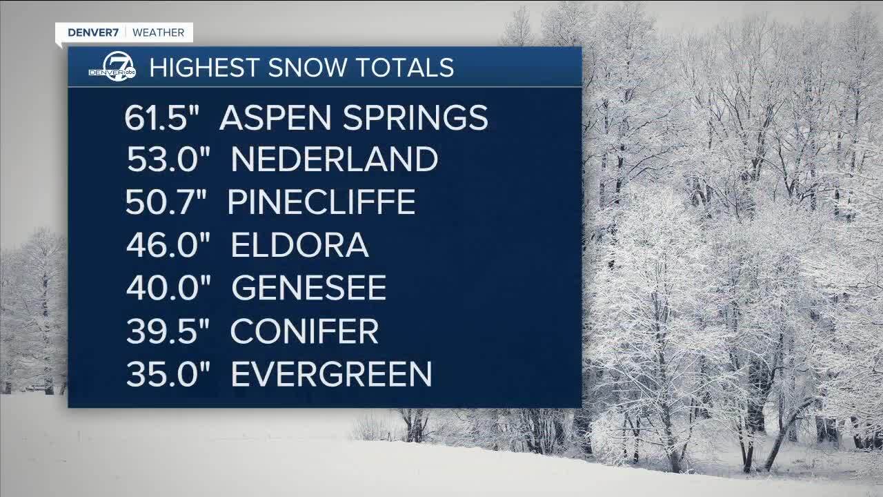
DENVER – Snowpack levels in Colorado improved in most river basins after last week’s snowstorm that dumped more than 60 inches of snow in some places.
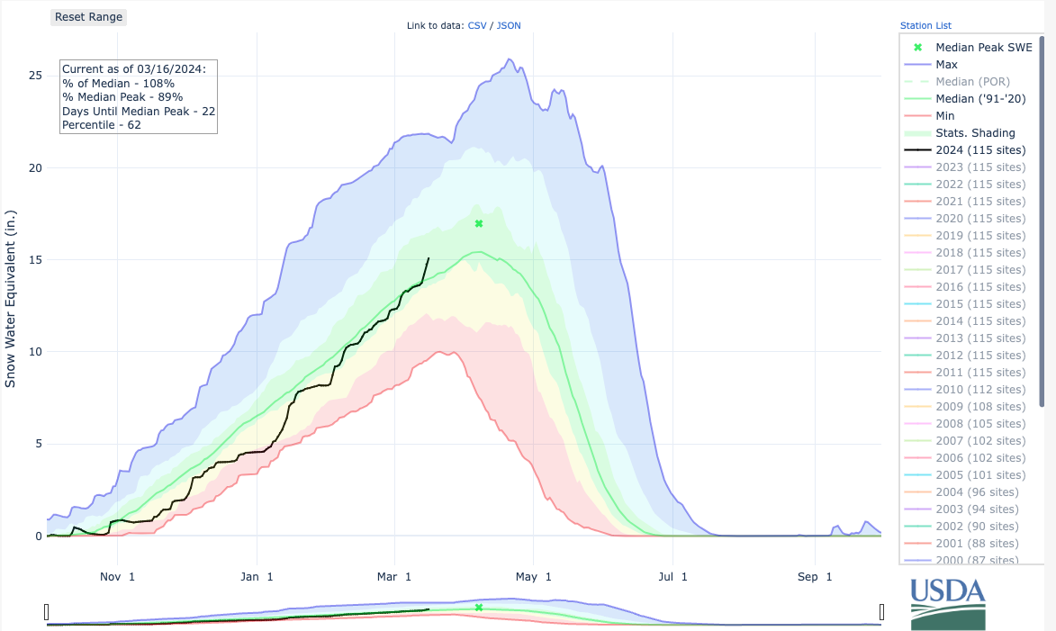
Statewide, the snowpack was at 108% of median levels compared to the 1991-2020 period on Saturday. That’s 15.1 inches of snow-water equivalent.

Two of the basins — South Platte and the combined Yampa-White-Little Snake — saw dramatic increases to their snowpack from last week’s storm.
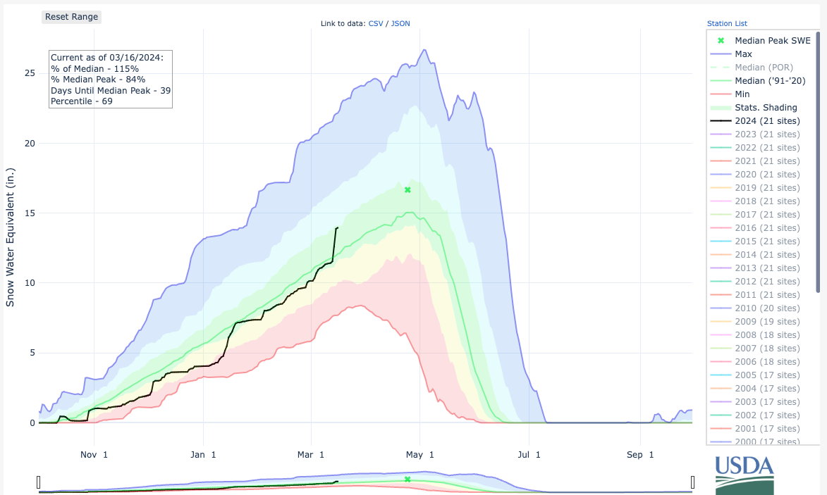
The South Platte basin is currently at 115% of median levels Saturday and now sits at 13.9 inches of snow-water equivalent, according to the Colorado Snow Survey.

The combined Yampa-White-Little Snake basin is at 113% of median levels and is currently at 20.4 inches of snow-water equivalent.
The Colorado Headwaters, Arkansas River and Laramie and North Platte basins were at 108% of median levels on Saturday, while the Gunnison River basin was at 103% of median.
The combined San Miguel-Dolores-Animas-San Juan basins were at 99% of median levels Saturday.
More than four feet of snow fell in some parts of the state on Thursday. Denver got 5.7 inches at the airport.

It’s unclear how big of an impact last week’s snowfall will have on drought conditions in the state.
The latest observation, taken March 12, shows extreme drought conditions persist in parts of Conejos, Costilla, Alamosa, Rio Grande and Saguache counties.
We'll see lots of melting this weekend. Expect highs in the mid to upper 40s on Saturday and Sunday.
Dry and mild weather is expected for the majority of this upcoming week.


