


DENVER – Another round of strong to severe thunderstorms is expected again Thursday afternoon through the evening, with the potential for flash flooding across parts of the Denver metro and the Eastern Plains due to already saturated ground, forecasters with the National Weather Service said earlier in the day.
A flood watch is now in effect through midnight for the Denver metro area and extending south and east over the Palmer Divide, Washington county, Morgan, Southern Washington and Arapahoe and Adams counties.
While not yet a warning, a flood watch has the potential to create excessive runoff that may result in flooding of rivers, creeks, streams, and other low-lying and flood-prone locations. Creeks and streams may rise out of their banks, according to the NWS.
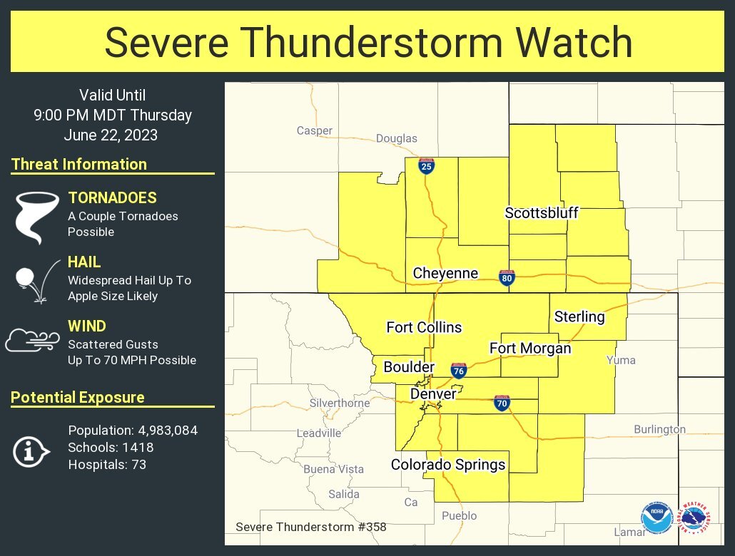
Parts of northeastern Colorado, from Colorado Springs all the way north to Wyoming, including the Eastern Plains all the way to Sterling and parts of Nebraska, were also now under a severe thunderstorm watch until 9 p.m.
Thursday’s storms, starting at around 2 p.m., “will again be capable of producing heavy rainfall which will also be a concern since areas will be extra saturated/sensitive from last night’s rainfall,” NWS officials said in their latest forecast discussion.
Hail up to two inches in diameter and wind gusts up to 70 mph are possible Thursday across the I-25 corridor and the plains, with isolated tornadoes also possible eastward.
The storms will push to the east as the sun sets and night sets in, officials said.
Chances for showers and thunderstorms will be considerably less than previous days and will cover a lesser area Friday, according NWS forecasters, with parts of the Palmer Divide and Park County experiencing drier conditions that will increase the threat for critical fire weather to portions of the high mountain valleys and Park County.
Expect highs to return to the 80s under sunny skies Friday through the weekend.
