


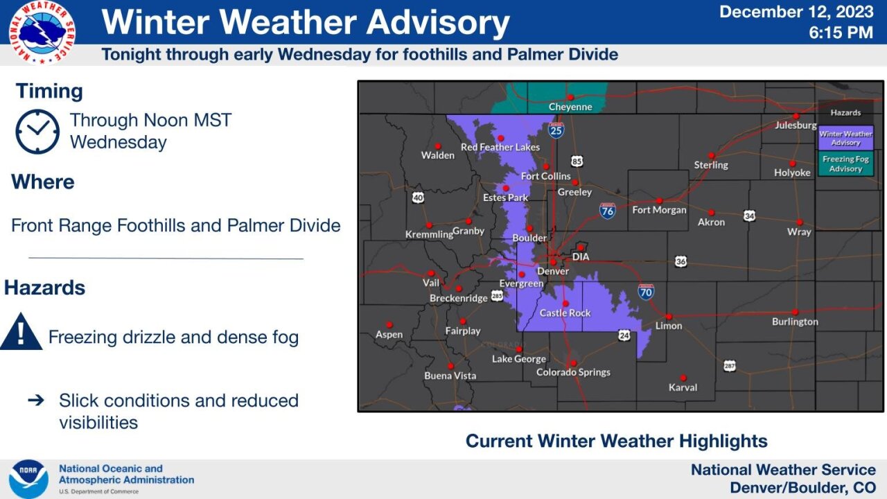
CASTLE ROCK, Colo. — Drivers in Colorado's foothills and along the Palmer Divide can expect slick roads and reduced visibility during the Wednesday morning commute, according to the National Weather Service office in Boulder.
In a social media post, NWS Boulder said freezing drizzle and areas of dense fog will stick around through Wednesday morning. A Winter Weather Advisory has been issued for the foothills and Palmer Divide through noon Wednesday.
Snow is expected for parts of the state Wednesday afternoon into Thursday morning. The system is tracking south, according to the NWS Boulder, and will bring the highest chances for accumulating snow to the areas south of Interstate 70.
The NWS is expecting one to five inches of snow from the system. Areas south of I-70, particularly Colorado Springs, Buena Visita and Fairplay, have the highest chances for 2+ inches of snow. Other areas of the state could see a trace of snow.
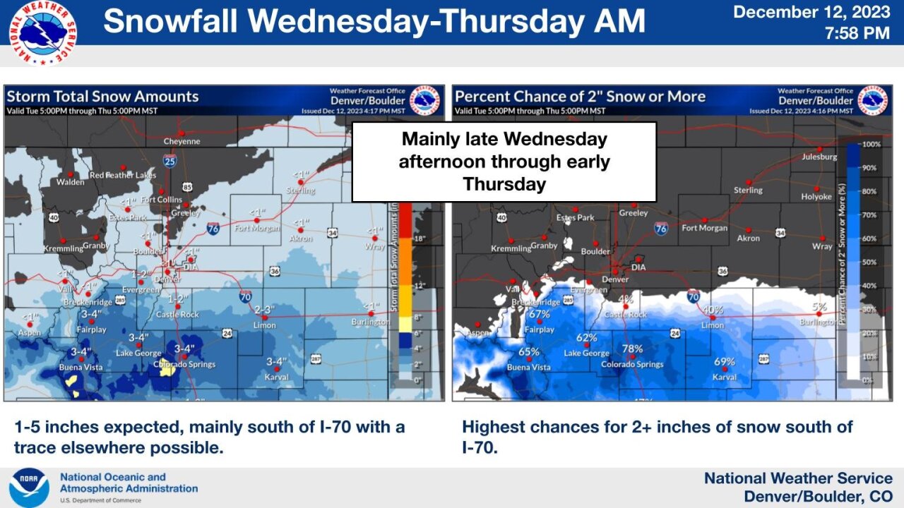
The Thursday morning commute could see minor impacts due to slick roads.
LEARN MORE: Hourly forecast | Radars | Traffic | Weather Page | 24/7 Weather Stream
Click here to watch the Denver7 live weather stream.


