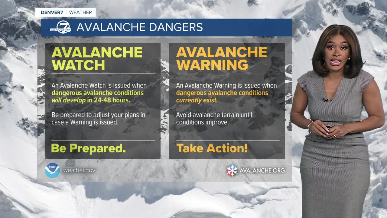


DENVER - An avalanche watch is in effect through 4:30 p.m. Sunday for the Front Range and Gore Range as avalanche danger rises to high, which is 4 out of 5 on the danger scale.

With deep new snow and strong winds, large and dangerous avalanches will be easy to trigger and may also occur naturally.
An avalanche warning is also in place through 5 p.m. Saturday for the Park and Gore Ranges, where conditions are already extremely unstable.
Saturday brings the peak of the storm, with 7–15 inches along the I-70 corridor, 4–10 inches in the mountain valleys, and 1–2 feet over the Park Range.

Gusty winds could reach up to 45 mph on the high passes, creating periods of blowing snow and near-whiteout conditions.
Snow tapers Saturday night into Sunday, but travel will remain rough thanks to drifting snow and lingering wind.
A Winter Storm Warning continues until 11 p.m. Saturday for Grand and Summit counties below 9,000 feet, where another 3–5 inches and low visibility are expected.
While the mountains get hammered, Denver and the eastern plains stay mostly dry this weekend.
Expect breezy conditions Saturday with gusts between 20-30 mph, and temperatures climbing into the mid to upper 40s.

Despite the wind, temperatures warm into the upper 40s, kicking off a milder stretch heading into early next week.
