


DENVER — After teasing us with tiny dusting last weekend, a notable snowfall is on track for the I-25 Urban Corridor, Palmer Divide, and foothills.
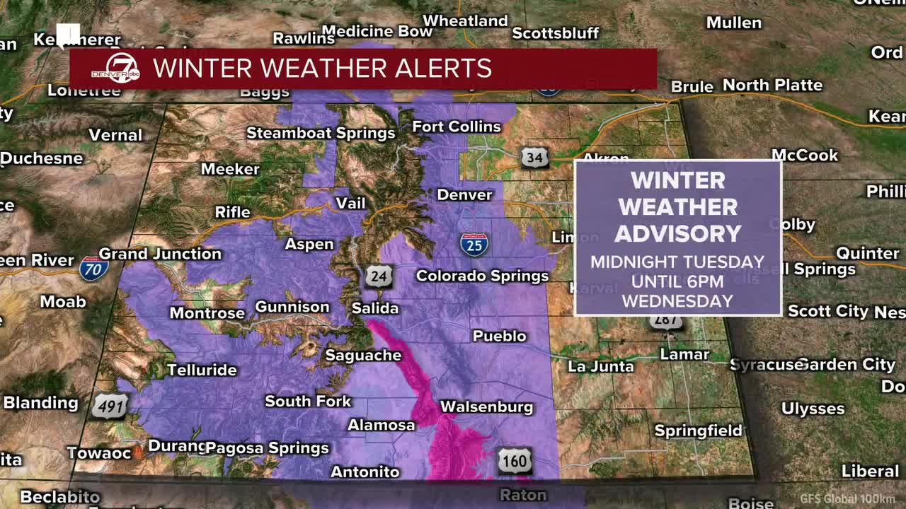
A Weather Action Day is now in effect and will likely remain in place through late Wednesday afternoon. A winter weather advisory will go into effect from midnight Tuesday night to 6 p.m. Wednesday from Fort Collins all the way down to Pueblo, according to the National Weather Service (NWS) in Boulder.
Snow will begin shortly after midnight Tuesday across the metro and foothills, with the heaviest snowfall occurring overnight and during the Wednesday morning commute. Expect 0.5-1 inch of snow per hour, especially near the lower foothills.
Roads will be slick, slow, and hazardous, so give yourself extra travel time on Wednesday morning.
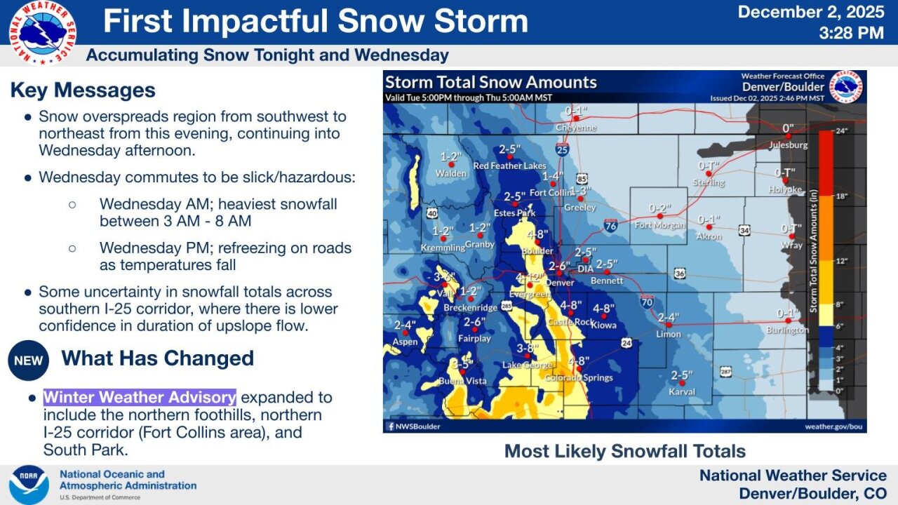
The Denver metro and Palmer Divide can expect around 2–6 inches of fresh powder, with localized amounts of more than 6 inches near the base of the foothills.
Though snow is expected to taper off by Wednesday afternoon, some areas west and southwest of Denver may see slick roads lingering into the afternoon, with weather service forecasters warning that some roads could refreeze as temperatures fall.
We'll have a nice break from the snow before the weekend with a cool but mostly sunny day on Thursday.
A strengthening northwest flow will bring mountain snow showers on Friday, mostly in the high country.
Winds will pick up Friday into Saturday, with breezy conditions and potential for downslope enhancement.
Lower elevations should stay mostly dry and milder, but a small window for wintry precipitation exists depending on developing weather systems.
This is the first real taste of winter for Colorado, so patience on the roads and hot drinks are highly recommended!
DENVER WEATHER LINKS: Hourly forecast | Radars | Traffic | Weather Page | 24/7 Weather Stream
Click here to watch the Denver7 live weather stream.
