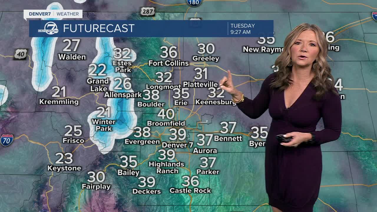


DENVER — A weak storm will roll through the region Tuesday. We're starting to see some increasing clouds from north to south and there will be a chance of light snow, but mainly in the mountains.

It looks like just a couple of inches of snow will stack up in the high country. No travel advisories are in place at this time, but the high mountain passes could get slick at times.
Rain and snow showers will move into the Front Range during Tuesday afternoon, especially south of Denver near the Palmer Divide. Off-and-on showers will linger throughout the evening but accumulation looks minimal with less than a half of an inch around the city. Temperatures will be a touch cooler, but still about 5 to 7 degrees above normal. We'll see highs in the upper 40s to low 50s across the metro area.
This storm moves out fast as sunny skies return Wednesday. Highs will stay in the mid 40s to low 50s before warmer, drier weather returns later in the week. So far, we have 60+ degree temperatures in Denver on Thursday and continuing through early next week. Enjoy the spring-like heat while it's here.
DENVER WEATHER LINKS: Hourly forecast | Radars | Traffic | Weather Page | 24/7 Weather Stream
Click here to watch the Denver7 live weather stream.
