


DENVER — The winter heat and high winds are back Thursday. Look for highs in the low to mid 60s along the Front Range with some sunshine ahead of a stronger cold front. It'll bring gusty winds starting Thursday afternoon into Friday along with much cooler and more seasonal temperatures.
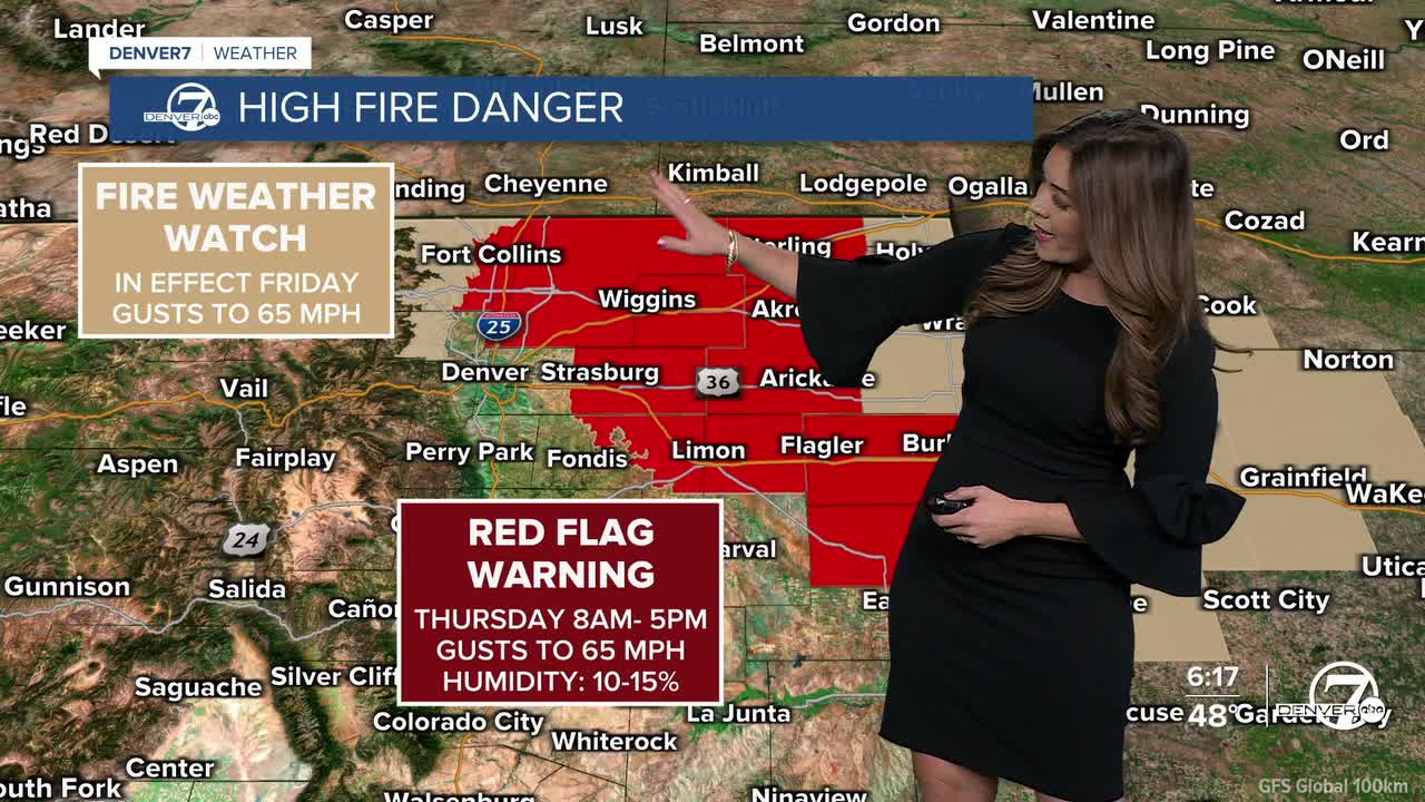
With blustery winds, high fire danger will be an issue to end the work week. A Red Flag Warning will go into effect for much of northeastern Colorado Thursday morning through the evening, with wind gusts near 65 mph. A High Wind Watch goes into effect Thursday evening into Friday across parts NE Colorado as winds continue to ramp up as the cold front surges into the state.
Along with the strong winds, look for chilly temperatures in the low 40s Friday under a partly cloudy sky.
So far, it looks like the cooler air will stay in place for the start of the weekend. Broncos fans - dress in layers if you're tailgating out at Empower Field on Saturday morning. Highs will be in the low to mid 40s with breezy winds and mostly sunny skies.
Temperatures jump back into the mid-50s Sunday.
DENVER WEATHER LINKS: Hourly forecast | Radars | Traffic | Weather Page | 24/7 Weather Stream
Click here to watch the Denver7 live weather stream.
