


DENVER – Look for a few isolated storms this evening across the Denver metro, with the strongest storms in southern Colorado. A flood watch in effect until 8 p.m. for several counties south of the Denver metro.
As the storms clear out, look for partly cloudy skies overnight. Temperatures will dip into the low 60s early Friday morning along the Urban Corridor.
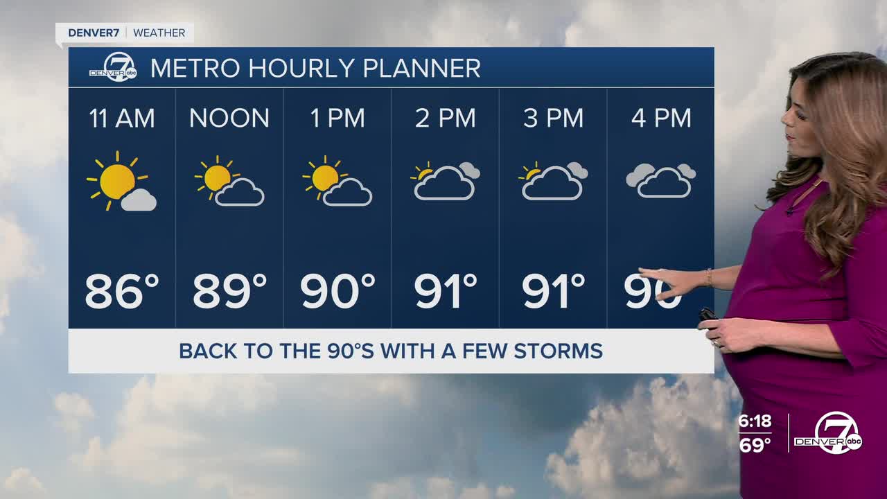
We'll wake up to a bit of sunshine around Eastern Colorado with mostly cloudy skies and possible drizzle across the northwestern side of the state. Temperatures will soar into the low 90s Friday afternoon in Denver, with just a slight chance of a brief afternoon storm.
The 90+ degree heat sticks around through the weekend, and so do the storms. They'll be a bit more widespread on Saturday afternoon but so far the threat of severe storms is low in Denver.
An isolated storm is possible in the metro Sunday afternoon, but storms will be hit or miss. Look for highs in the low to mid 90s.
Warmer and drier weather returns early next week, as highs get close to 100-degrees in Denver.
DENVER WEATHER LINKS: Hourly forecast | Radars | Traffic | Weather Page | 24/7 Weather Stream
Click here to watch the Denver7 live weather stream.
