


DENVER- Storms are popping up this evening for metro Denver and in eastern Colorado. These storms are getting some good energy from the atmosphere, which is helping them grow, but they don’t have enough wind support to stay strong for long. A few might still drop some hail around the size of quarters, and gusty winds are possible through the evening.

Another area of storms is near the Cheyenne Ridge and heading east. These storms have more fuel to work with and could join together into a stronger line as they move across far northeast Colorado. Winds up to 70 mph are possible in these areas. Because of this, a Severe Thunderstorm Watch is in effect for places along and east of I-25 until 8 PM. Denver isn’t included since it’s drier and more stable there, which makes big storms less likely.
There’s a small chance that a few storms stick around or pop back up late tonight, mostly out on the eastern plains. Whether that happens depends on how much energy is left in the atmosphere after today’s storms. Most areas will likely stay quiet overnight.

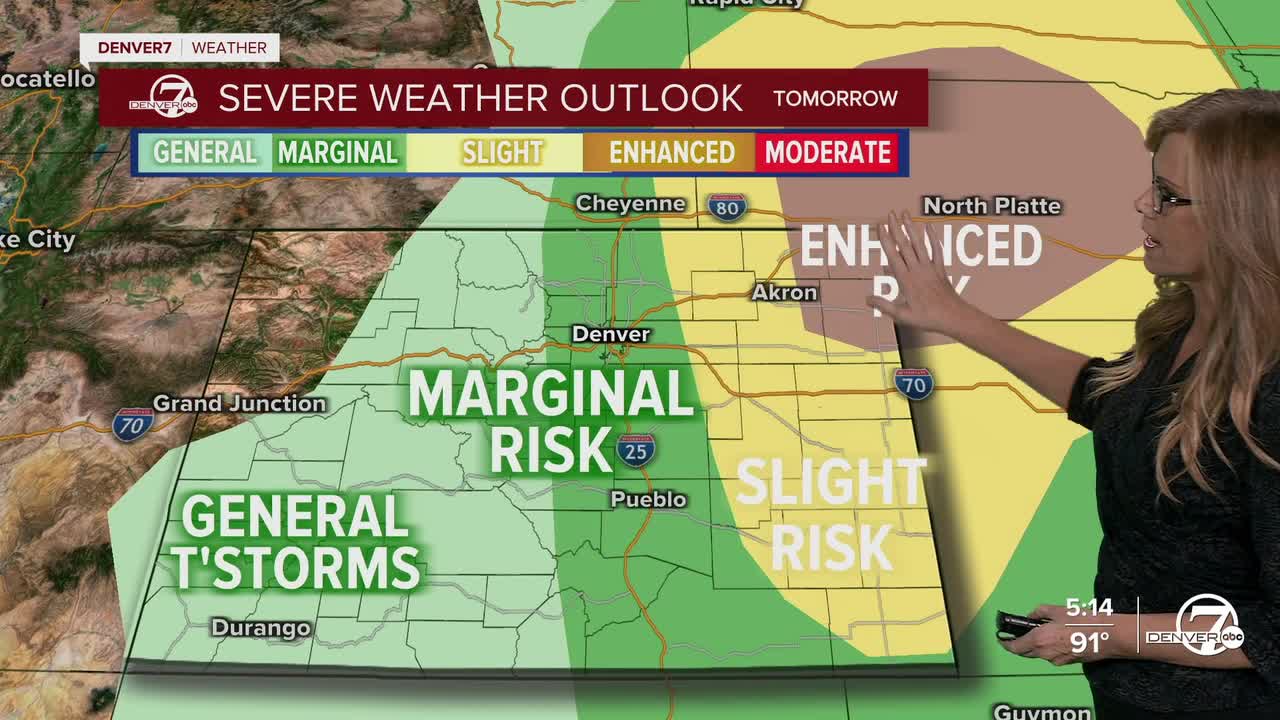
Monday brings a better chance for strong storms again, especially in the northeast part of the state. It’ll be more humid, and the atmosphere will have plenty of energy to help storms grow. Some could turn severe again, with strong winds being the main threat. Areas like Akron and spots closer to the Nebraska border are most at risk. Denver will probably stay out of the action again.
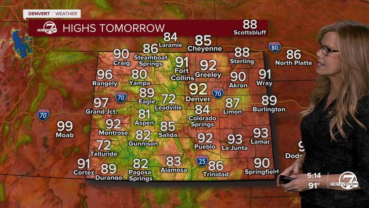
By Tuesday, things start to heat up. There’s still a slight chance for a storm near the Cheyenne Ridge, but most places will stay dry. Wednesday looks to be the hottest day of the week, with Denver getting close to 100 degrees. A Heat Advisory might be needed. A weak cold front moves through Thursday night, bringing some relief with cooler temps expected on Friday.
DENVER WEATHER LINKS: Hourly forecast | Radars | Traffic | Weather Page | 24/7 Weather Stream
Click here to watch the Denver7 live weather stream.
