


DENVER — After highs in the mid to upper 60s on Sunday, we will hang on to that warm weather for the beginning of this week. Plenty of sunshine is heading our way for Monday as we reach record territory again for our afternoon highs.

On Monday, the warm and dry pattern continues. Temperatures will climb well above normal, reaching the mid to upper 60s across northeast Colorado. Any morning high clouds will gradually thin out by the afternoon, leading to a mostly sunny day. Winds will generally remain light, except for the usual breezier spots in the foothills and mountains.

By Tuesday, downsloping winds will help keep temperatures very warm, with some lower elevation areas possibly nearing record highs. Conditions will remain dry, and winds will mostly stay on the lighter side, making for another pleasant but unusually warm December day.
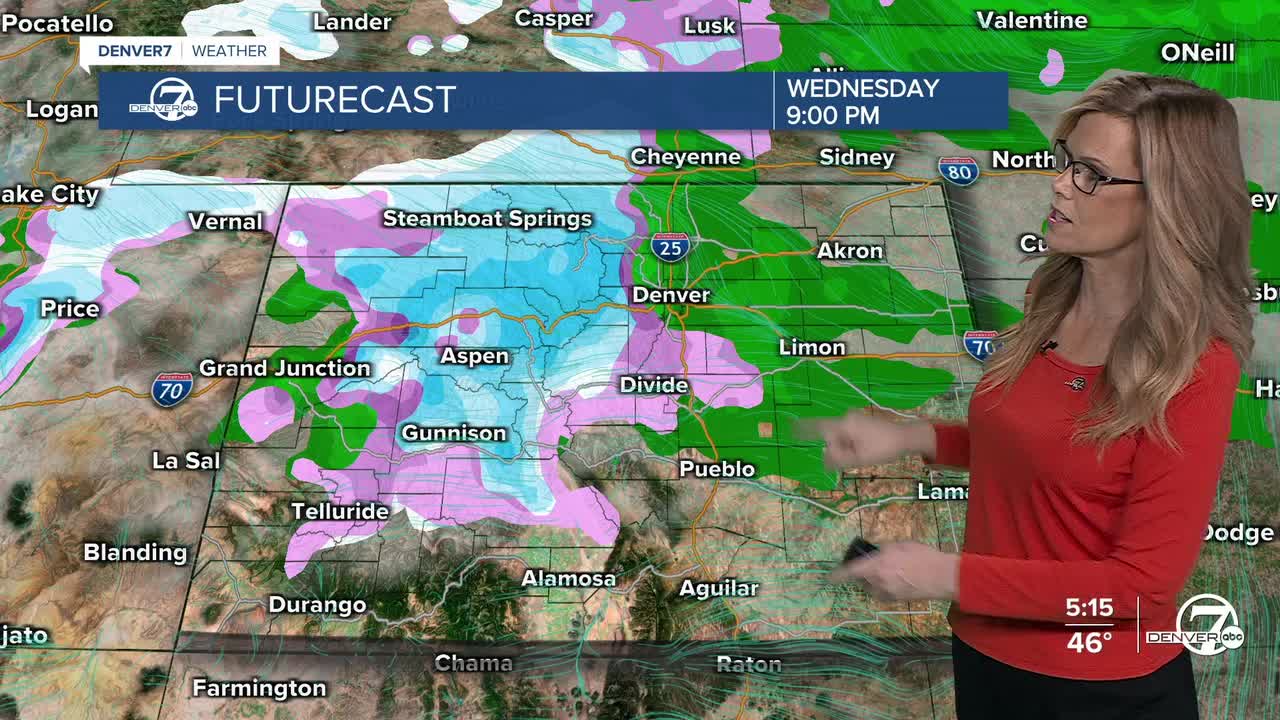
Wednesday brings a notable change, especially with the wind. While temperatures remain warm at lower elevations and dry conditions continue on the plains, strong winds are expected to develop, raising fire weather concerns in parts of the foothills and plains. In the mountains, moisture increases later in the day, and snow is expected to begin by Wednesday afternoon, becoming light to moderate through the evening.
From Wednesday night into Thursday, snow will continue at times in the mountains, especially in favored higher terrain areas. Lower elevations have chances for rain late night with temperatures cooling off quite a bit for Thursday. Looking ahead, Friday appears dry and warmer again, while another fast-moving system over the weekend could bring more mountain snow and gusty winds.
DENVER WEATHER LINKS: Hourly forecast | Radars | Traffic | Weather Page | 24/7 Weather Stream
Click here to watch the Denver7 live weather stream.
