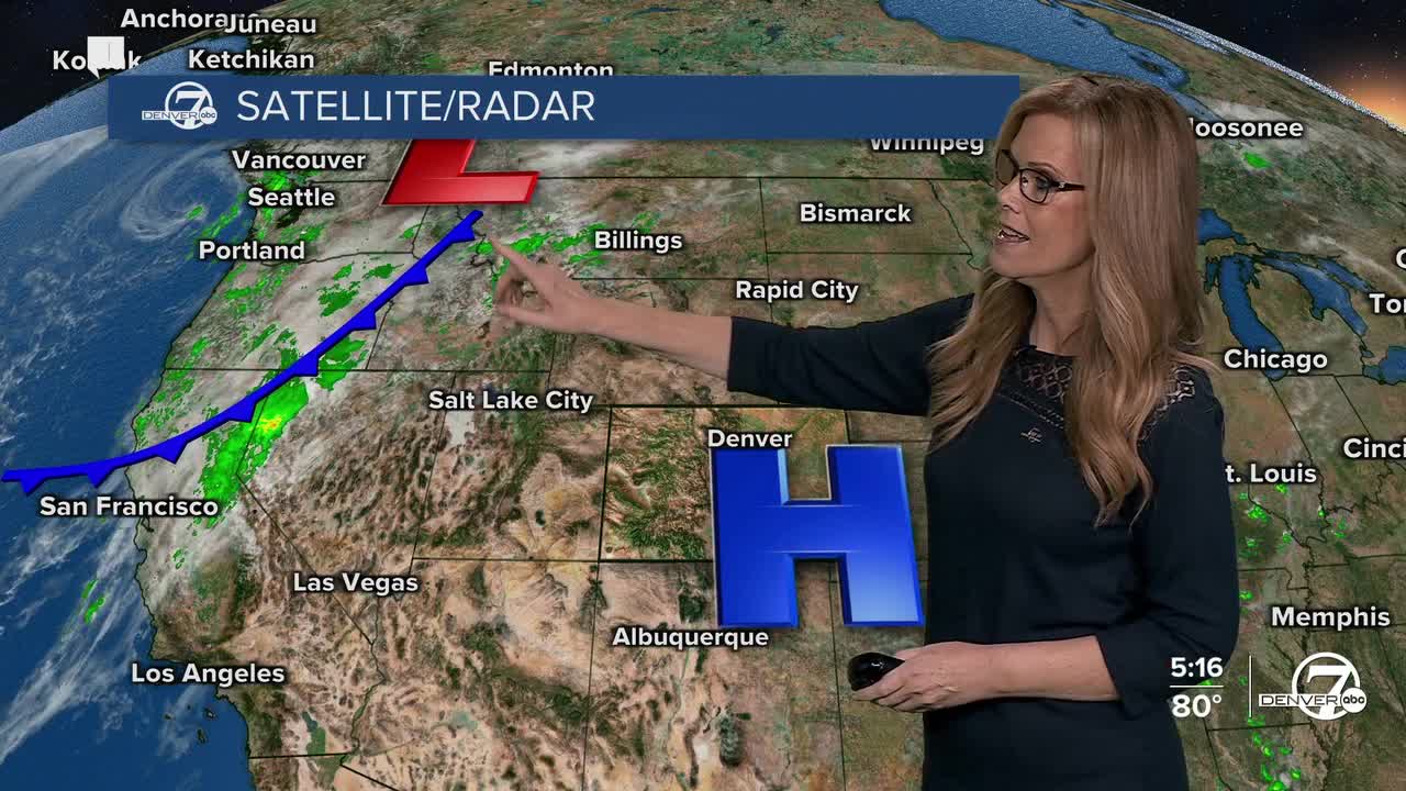


DENVER — Starting tonight, things are staying dry and mild with temperatures well above normal for this time of year. Clear skies will continue across the region thanks to a strong ridge of high pressure sitting overhead. Expect overnight lows to be similar to last night’s, comfortable and seasonably mild.
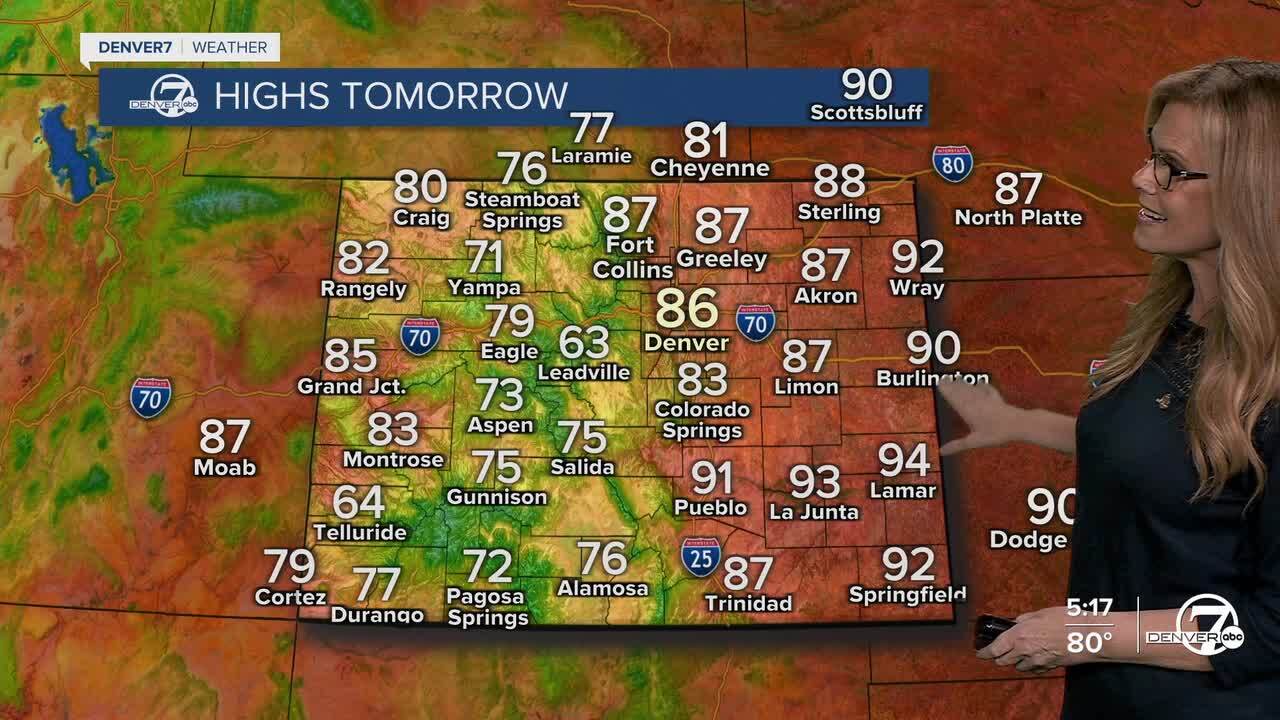
Friday will be another warm and sunny day, possibly even warmer than today. In fact, some spots on the plains could come close to breaking temperature records, with highs soaring into the upper 80s. The wind will start to pick up a bit, especially in the foothills and mountain valleys, where gusts could reach 35 to 45 mph in the afternoon.
By Saturday, we’ll see a noticeable shift in the weather. A strong upper-level system will move into the area, bringing showers and a few thunderstorms. The action will start in the mountains in the morning and spread east into the plains later in the day. There’s a chance for a few severe storms Saturday afternoon and evening, especially across the northeastern plains, where gusty winds and hail could be possible. Mountain areas will likely see some light snow, particularly at higher elevations, with a dusting expected overnight. It’ll also be breezy just about everywhere, so expect gusty conditions through the day.

Saturday night into Sunday will bring cooler air behind a passing cold front. Winds will ease up a bit, but you’ll definitely notice the temperature drop. Highs on Sunday will only reach the 60s to low 70s across the lower elevations, a significant change from the summer-like weather earlier in the week. There will still be some moisture hanging around, which could spark a few afternoon showers. In the mountains, snow levels will dip to around 10,000 feet, and some peaks could pick up an inch or two of fresh snow overnight.
Looking into early next week, cooler temperatures will stick around as another weather system takes aim at the region. While details are still coming together, we’ll likely see daily chances for scattered showers, possibly some mountain snow, through at least Tuesday. Afternoon highs will remain on the cooler side, making it feel a lot more like fall. Winds won’t be as strong, but expect some occasional breezes, especially during the day.
By midweek, models are hinting at a return to drier and warmer conditions as the trough exits and high pressure builds back in. That means a more stable pattern could set up with sunshine and more seasonal temperatures returning. So, while the weekend brings a quick taste of active fall weather, it doesn’t look like it’s here to stay for too long.
DENVER WEATHER LINKS: Hourly forecast | Radars | Traffic | Weather Page | 24/7 Weather Stream
Click here to watch the Denver7 live weather stream.
