


DENVER — Tonight will be quiet and cold after the recent snowfall. Skies should stay mostly clear, and temperatures will drop below freezing overnight. Because some of today’s melting snow will refreeze, there could be slick spots on untreated roads and sidewalks by late evening and early Sunday morning.
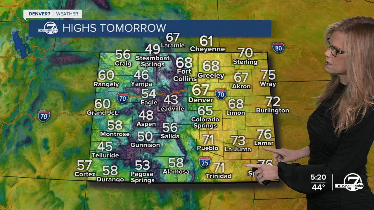
A warming trend kicks in through the rest of the weekend. Sunshine and milder air will help temperatures climb into the 50s and 60s during the afternoons, which is a noticeable improvement from the recent cold. Sunday in particular should feel fairly mild for early March, with dry weather and plenty of sun as the atmosphere settles into a more stable pattern.
The mild pattern continues into Monday. Temperatures are expected to stay above normal, and most areas will remain dry.
Our next chance for precipitation arrives Tuesday into Tuesday night. A weather system moving across the southern Rockies may bring light snow showers to the mountains and a chance for light precipitation across parts of the plains. At this point, amounts look fairly light and scattered, with many places possibly staying mostly dry.
Behind that system, cooler air returns briefly on Wednesday. After that, temperatures are expected to warm up again for the second half of the week. At the same time, winds may begin to pick up by Thursday, which could increase fire weather concerns as the warmer and drier conditions return.
.
DENVER WEATHER LINKS: Hourly forecast | Radars | Traffic | Weather Page | 24/7 Weather Stream
Click here to watch the Denver7 live weather stream.
