


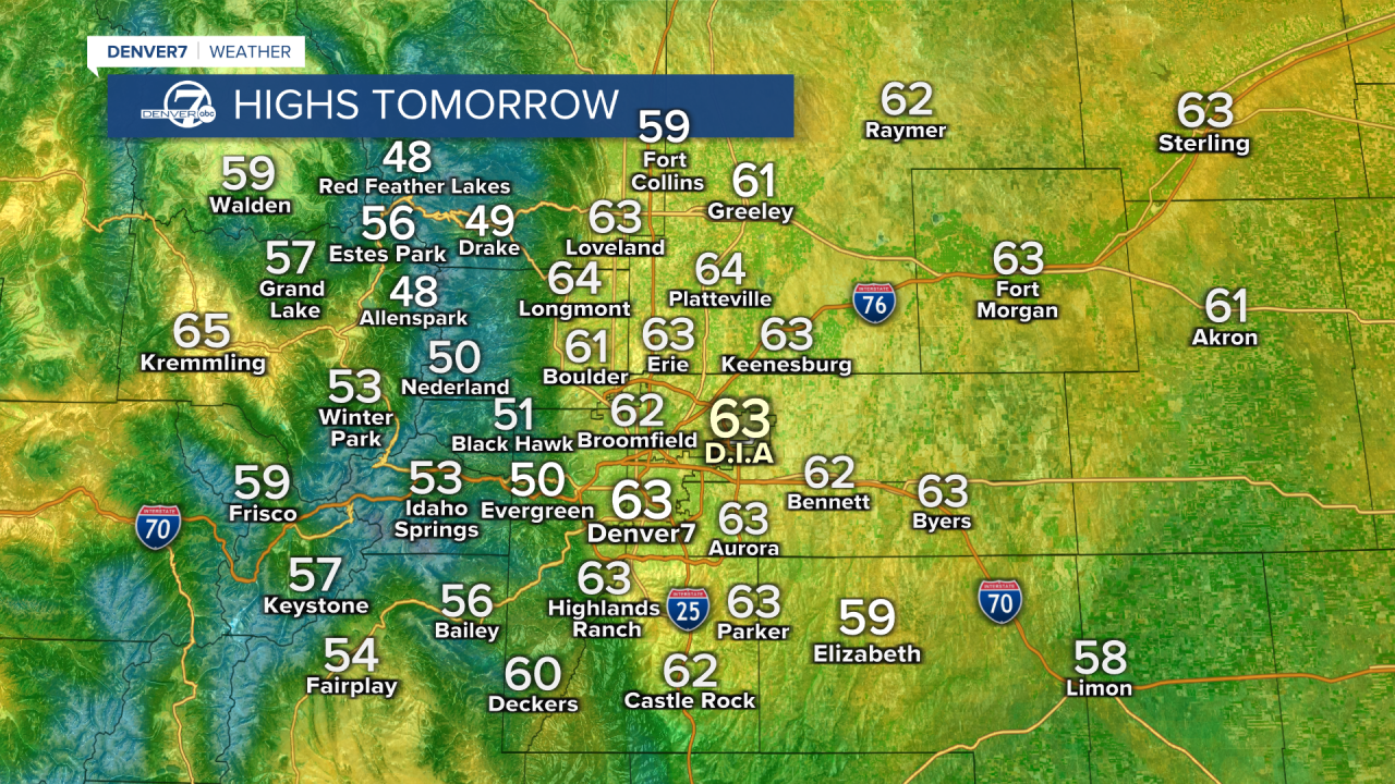
DENVER — We’re in for a nice midweek warm-up across Colorado!
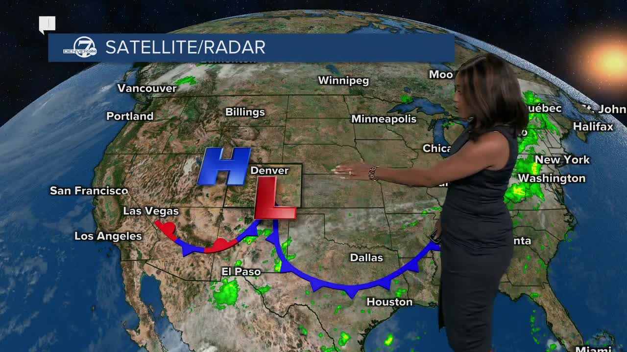
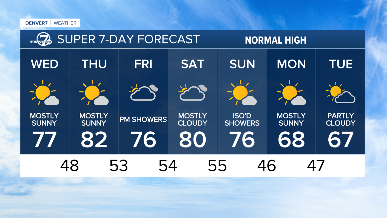
Wednesday brings plenty of sunshine and drier air as southwest winds pick up. It’ll feel warmer, but that dry air and breeze could bring brief fire weather concerns over the mountains during the afternoon.
By Thursday, an upper ridge builds in, keeping things mild with more high clouds drifting in from the southwest. It’ll look a bit hazy at times, but still dry for most areas.
Heading into Friday and Saturday, moisture starts to increase.
Expect more clouds and a few spotty showers or storms over the mountains, though most of the rain will stay light. The plains will stay mostly dry but cloudier on Friday.
Then on Sunday, a weak system slides by to our north, bringing a better chance for a few showers and a 10-degree cooldown for the plains.
Early next week looks mostly quiet again with highs in the 70s and just a slight chance of showers by Tuesday.
The National Weather Service on Tuesday upgraded the June 20, 2025, tornado in North Dakota to an EF-5, making it the first EF-5 in the U.S. since 2013.
With winds estimated near 210 mph, the powerful storm carved a path roughly 12 miles long and over a mile wide, leaving behind catastrophic destruction. Three people were killed, and dozens of homes, power lines, and train cars were destroyed or tossed aside by the violent winds.
According to the NWS damage survey, the intensity of the tornado met the highest level on the Enhanced Fujita scale, a distinction reached only about 60 times since 1950. The last EF-5 to strike the U.S. was the 2013 Moore, Oklahoma, tornado.
This marks the most powerful tornado to hit North Dakota since the 1957 Fargo F-5, underscoring both the rarity and devastation of storms of this magnitude.
DENVER WEATHER LINKS: Hourly forecast | Radars | Traffic | Weather Page | 24/7 Weather Stream
Click here to watch the Denver7 live weather stream.
