



DENVER — It was a stunning final day of summer across the Front Range! We saw plenty of sunshine and comfortable mid-70s to wind down what was a scorching hot season.
Buckle up, Colorado! The quiet start to the week won’t last long. The weather pattern is about to flip from dry and mostly calm conditions to a wetter, stormier pattern by mid-week.
Watch Denver7 Meteorologist Danielle Grant's full forecast in the video below:
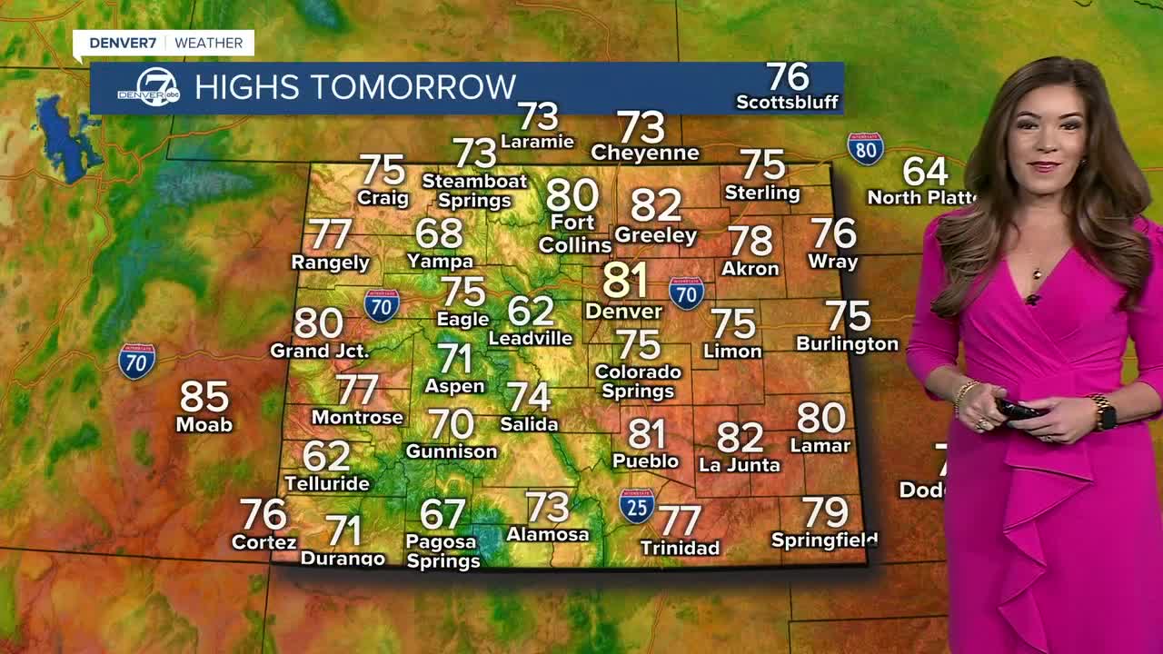
Look for a sunny start to your Tuesday in the Denver metro area with afternoon highs soaring into the lower 80s. It might feel a bit more like summer than fall as we welcome in the autumnal equinox Tuesday evening at 6:04 p.m. MT.
We're looking at a few changes to the weather pattern Tuesday. Winds aloft will turn back to the southwest as the low near California moves toward Utah, allowing more moisture to stream into Colorado. That will bring a better chance for afternoon and evening showers and thunderstorms, especially in the mountains. A few storms could drift onto the plains Tuesday evening, although they will be few and far between. The main concerns will be lightning and brief wind gusts up to around 40 mph.
Wednesday looks wetter and more active. A weak disturbance moving in from the southwest will bring even more moisture to the region. The catch? A lot of cloud cover could keep temperatures and instability down. That should limit storm strength around Denver and the higher terrain, but the Eastern Plains could see more sunshine early in the day, helping stronger storms develop in the evening.
Some storms could linger overnight into Thursday morning along the Front Range. You might have to flip on your windshield wipers on the way into work. It also looks a bit cooler as another weak trough moves across Colorado. More moisture, widespread clouds and a bit of upslope could keep highs in the low 70s. Isolated showers and storms will remain possible, especially in the higher terrain.
By Friday, temperatures bounce back into the low 80s across the plains, with storm chances focused mainly on the mountains and Palmer Divide.
The weekend looks quieter and drier as high pressure builds back overhead. A stray shower or storm still can’t be ruled out, but overall, Saturday and Sunday should be calmer with temperatures warming into the upper 70s and low 80s for the first weekend of fall.
DENVER WEATHER LINKS: Hourly forecast | Radars | Traffic | Weather Page | 24/7 Weather Stream
Click here to watch the Denver7 live weather stream.
