


DENVER — Here we go again! Another storm is moving into Colorado's High Country tonight, bringing more heavy snow and blustery winds.
A High Wind Warning is in effect through 7am Thursday for the Front Range foothills and western suburbs along with Teller County, the Rampart Range, Pikes Peak and El Paso County. Look for wind gusts up to 75 mph and the possibility of blowing dust in southern Colorado.

A cold front will push onto the Front Range early Thursday, dropping temperatures quite a bit. Look for partly sunny skies Thursday in the Denver metro area with highs in the upper 30s to low 40s. This will be the first below-average day this month.

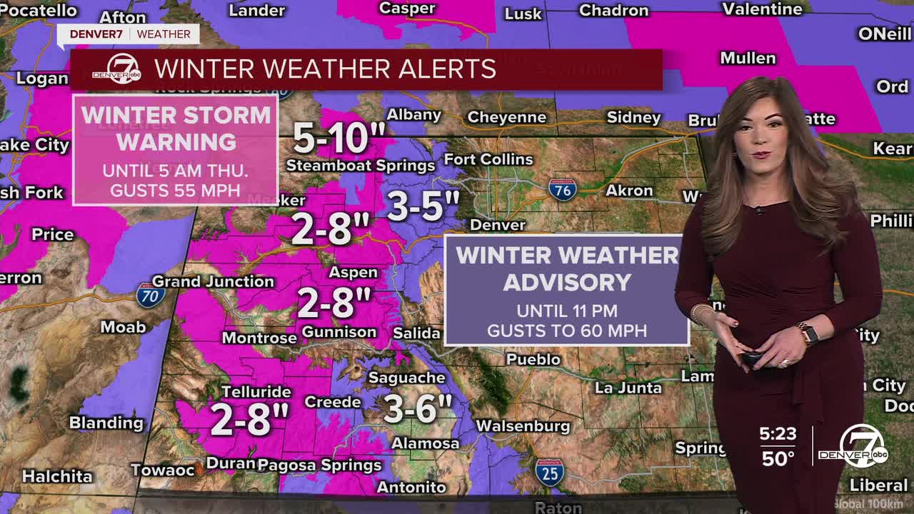
The High Country will get another round of snow overnight into Thursday morning as winter weather alerts are still in effect. Look for an additional 3 to 8 inches of new snow by morning. There will be a brief lull in the snow Thursday afternoon ahead of the next winter storm.
Early Friday, another system cruise into Colorado, bringing more snow to the mountains and possibly a few flakes to the I-25 corridor Friday evening. So far, it looks like less than an inch of accumulation around the Denver metro area.
Heading into the weekend, drier conditions return but temperatures will hold in the mid to upper 40s. Much warmer temperatures return early next week.
DENVER WEATHER LINKS: Hourly forecast | Radars | Traffic | Weather Page | 24/7 Weather Stream
Click here to watch the Denver7 live weather stream.
