

It was an incredibly warm February and ended up being the 3rd warmest February ever on record. That trend is continuing into the first few days of March. We hit a high of 64 degrees on Sunday and it's going to be even warmer today.
We'll see a mix of sun and clouds this morning, with 30s and 40s for the morning drive. Temperatures will quickly climb into the mid-60s by lunch, with highs in the low 70s by 3 p.m. The winds will remain on the calmer side, with gusts between 15 to 25 miles per hour.
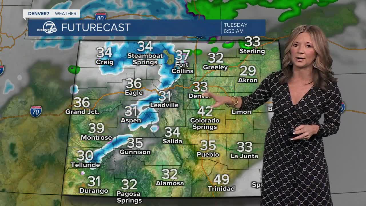
Our next storm will roll in from the west tonight! Scattered rain and snow showers will develop across northwestern Colorado and then spread east across the plains by Tuesday morning. Most of the precipitation that we'll see from this storm will fall in the mountains, but expect some wet roads in Denver and even the chance for a rain/snow mix along the Palmer Divide by Tuesday night.
Skies will clear on Wednesday and temperatures will rebound. We'll see highs in the upper 40s to low 50s on Tuesday, but then bounce back into the 60s on Wednesday.
Looking ahead to the second half of the week, the pattern stays active. Additional chances for mountain snow and lower elevation rain, and possibly snow if the colder air lines up just right, are on the table from Thursday into Friday. Details are still uncertain, including exact timing and amounts, but the overall trend suggests more opportunities for precipitation before the week wraps up.
DENVER WEATHER LINKS: Hourly forecast | Radars | Traffic | Weather Page | 24/7 Weather Stream
Click here to watch the Denver7 live weather stream.
