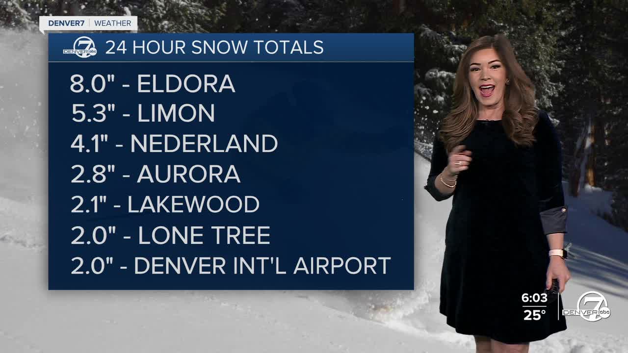


DENVER — Winter finally made a comeback to the Mile High City today! Most areas around the Denver metro saw one to two inches of snow, while the foothills saw 4 to 8 inches.
That storm is already moving out, making way for mostly clear skies tonight. Skygazers, the Northern Lights could be visible in Northern Colorado overnight! Look to the north and stay away from the city light pollution to catch the show!
Tuesday brings a quick rebound as a ridge of high pressure builds back in, bringing mostly sunny skies and warmer temperatures. Highs will be in the low 50s along the Interstate 25 corridor.
Winds will pick up near the foothills with gusts up to 50 mph. The far northeastern corner of the state will see gusty winds as a Fire Weather Watch is in effect Tuesday. Look for gusts up to 35 mph and humidity values as low as 15 percent.
It'll stay quiet mid-week with more sunshine and mid-50s. A stronger cold front moves in Thursday, dropping highs into the low 40s. Another system arrives Friday ushering in chilly temperatures in the 30s and potentially another round of snow. Stay tuned as the storm gets closer!
DENVER WEATHER LINKS: Hourly forecast | Radars | Traffic | Weather Page | 24/7 Weather Stream
Click here to watch the Denver7 live weather stream.
