


DENVER — Here we go again! Another fairly long 90+ degree heat is back mid-week and sticks around for at least the next week.
We're in for mostly clear skies tonight along with breezy southwesterly winds. Overnight lows will stay mild in the upper 50s to low 60s for the Denver metro area.
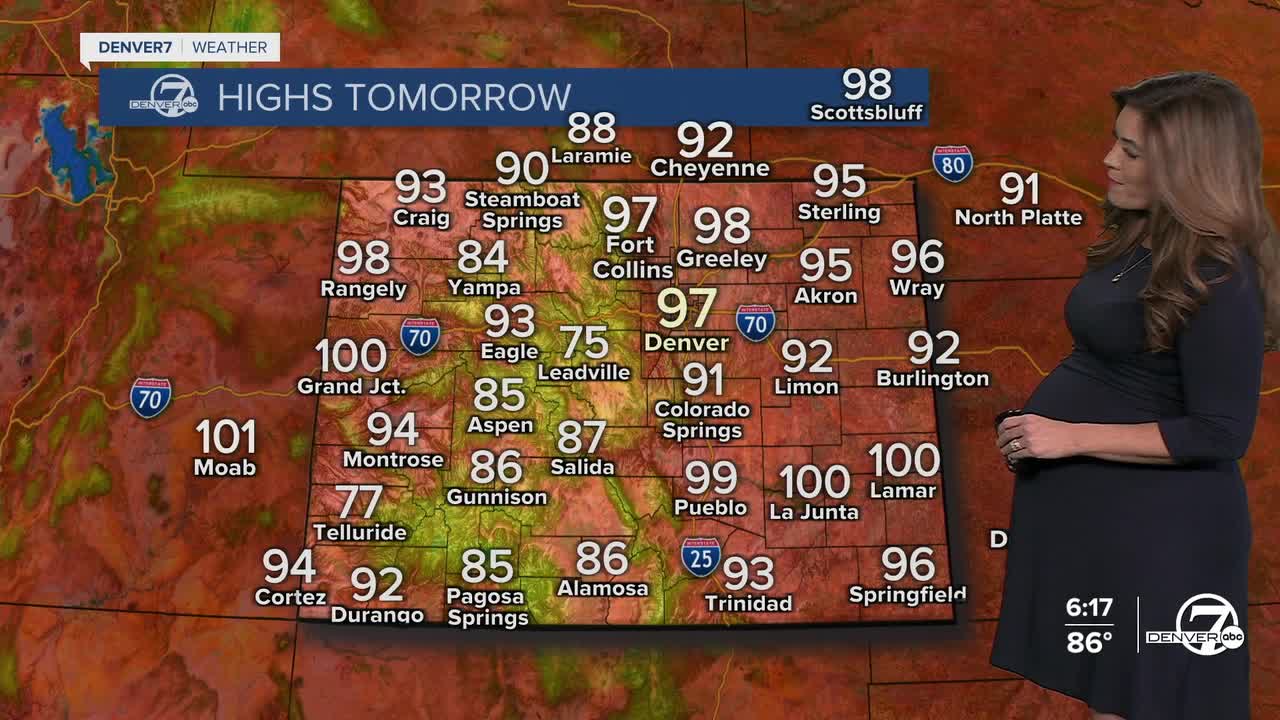
It'll be a sunny start to your Wednesday but temperatures warm up fast! We'll be in the low 90s around the lunch hour, with upper 90s in the late afternoon. A very isolated high-based gusty storm is possible, but they will be few and far between Wednesday afternoon.
It looks like daytime highs will stay a degree or two below the current record highs in Denver on Wednesday and Thursday. The current record high Wednesday in Denver is 99-degress (set in 2007) and Thursday's record is 100-degrees (set in 1962).
Fire danger will remain high across the western slope and it will get even hotter over the next few days. Temperatures will climb into the upper 90s by Wednesday, with low relative humidity, gusty winds and smoky, hazy skies. A Red Flag Warning is in effect Wednesday for the northwestern side of the state, with much of western Colorado under a Fire Weather Watch Thursday and Friday.
The next best chance of storms for the Front Range arrives Friday and Saturday afternoons. This will cool off temperatures slightly into the lower 90s this weekend. The 90+ heat and dry conditions return Sunday into early next week.
DENVER WEATHER LINKS: Hourly forecast | Radars | Traffic | Weather Page | 24/7 Weather Stream
Click here to watch the Denver7 live weather stream.
