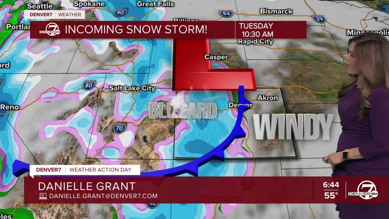


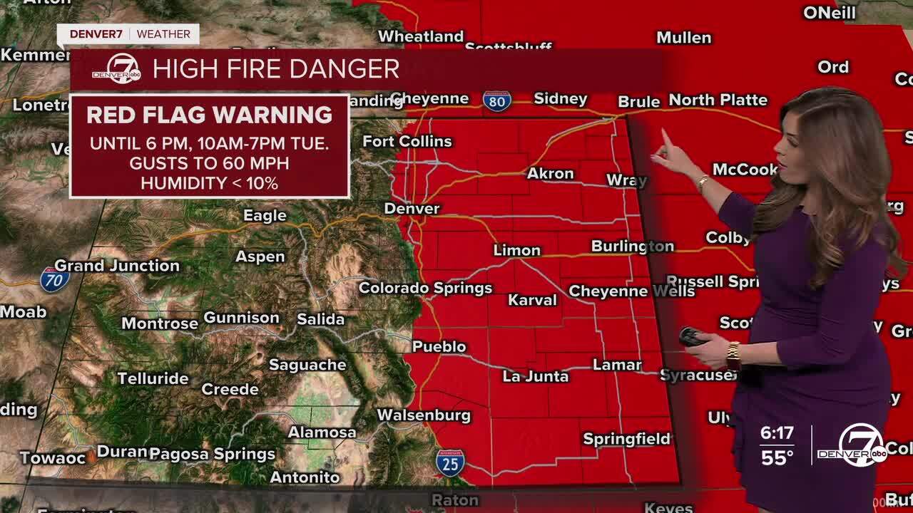
It's a tale of two sides of the Rocky Mountains as a powerful winter storm slams the state Tuesday through Thursday. Look for heavy snow across the High Country with strong winds and high fire danger in the Denver metro and E. plains.
Tonight, look for gradual clearing across the Front Range with lows dipping into the upper 30s to low 40s overnight. A cold front will race through mid-morning Tuesday, ushering in cooler temperatures and fierce winds to the Denver area. Highs will be in the mid-50s Tuesday afternoon but it'll feel cooler with strong westerly winds.
A Red Flag Warning is in effect from 10am to 7pm along the Interstate 25 corridor stretching across to the Kansas/Nebraska state-line. Look for wind gusts up to 60 mph along with humidity values less than 10 percent - the perfect combination for high fire danger. A High Wind Warning is also in effect for much of Eastern Colorado Tuesday.
As for the High Country, heavy snow starts falling very early Tuesday morning as the first storm moves through the state. With 60-70 mph gusts, blowing snow will limit visibility across the mountains so travel will be tough, if not impossible. While it'll still be snowing, we'll see lighter snow and less windy conditions Tuesday afternoon and evening.

A Winter Storm Warning is in effect for the Park and Elkheads south into the San Juans while a Winter Weather Advisory is in place for the Front Range mountains south toward the Sangre de Cristos and Wet Mountains.

Snow will continue throughout the day on Wednesday with another blast of heavy snow arriving Wednesday evening. This is much-needed snow for the mountains but avalanche danger will be very high, so be prepared if you're heading into the backcountry.
It'll be in the mid-50s with windy conditions again on Wednesday in the Denver metro with cooler temperatures in the low 40s Thursday and Friday. So far, it looks like we could see a few showers in the city late Friday but it still doesn't look like much.
Gradually warmer and drier conditions move in through the weekend and into early next week.
DENVER WEATHER LINKS: Hourly forecast | Radars | Traffic | Weather Page | 24/7 Weather Stream
Click here to watch the Denver7 live weather stream.
