


DENVER — Here comes a historic heat wave that will crush many Colorado records. A huge dome of high pressure will move into the west, ushering in unprecedented warm temperatures for March. In fact, highs will run about 30 degrees above the average for the rest of the week.
Tonight, look for mostly clear skies as temperatures fall into the upper 30s to low 40s. It'll be a mild but breezy night across much of the Front Range.
Look for mostly sunny skies Wednesday as Denver could see its first 80-degree day of the year. Typically, the city doesn't see 80-degree heat until late April!

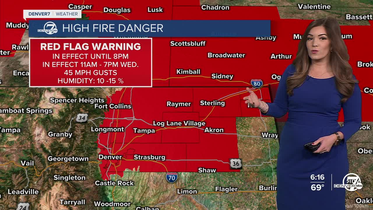
Along with the heat, very dry and breezy conditions will lead to high fire danger again across parts of the Front Range. A Red Flag Warning is in effect Wednesday from 11 a.m. to 7 p.m. for much for the Urban Corridor and Eastern Plains as winds will gust up to 35 mph.
This historic heat wave will bring temperatures into the low to mid 80s Thursday and Friday, which would easily break the current records. So far, Saturday looks to be the hottest day of the stretch with highs in the upper 80s. The hottest March temperature is 84-degrees, set on March 26, 1971. It looks like that will be crushed Friday, if not Saturday.

After a sizzling start to the weekend, slightly cooler weather arrives Sunday. Highs will sit in the upper 60s under partly cloudy skies. Even with the cool off, temperatures will still be above-average for this time of the year.
The mild and dry conditions continue into early next week.
DENVER WEATHER LINKS: Hourly forecast | Radars | Traffic | Weather Page | 24/7 Weather Stream
Click here to watch the Denver7 live weather stream.
