


DENVER — A quick round of snow rolled through the metro area overnight. You'll find slick conditions early on, with around 1 to 3 inches of snow falling across the Denver metro area. It's a fast moving system and skies will quickly clear out by mid-morning.

Because of the fresh snow and some clearing skies, Monday will stay on the chilly side. High temperatures will run below normal. We'll see high temperatures in the upper 30s to low 40s across the northeastern plains and that's a few degrees below normal.
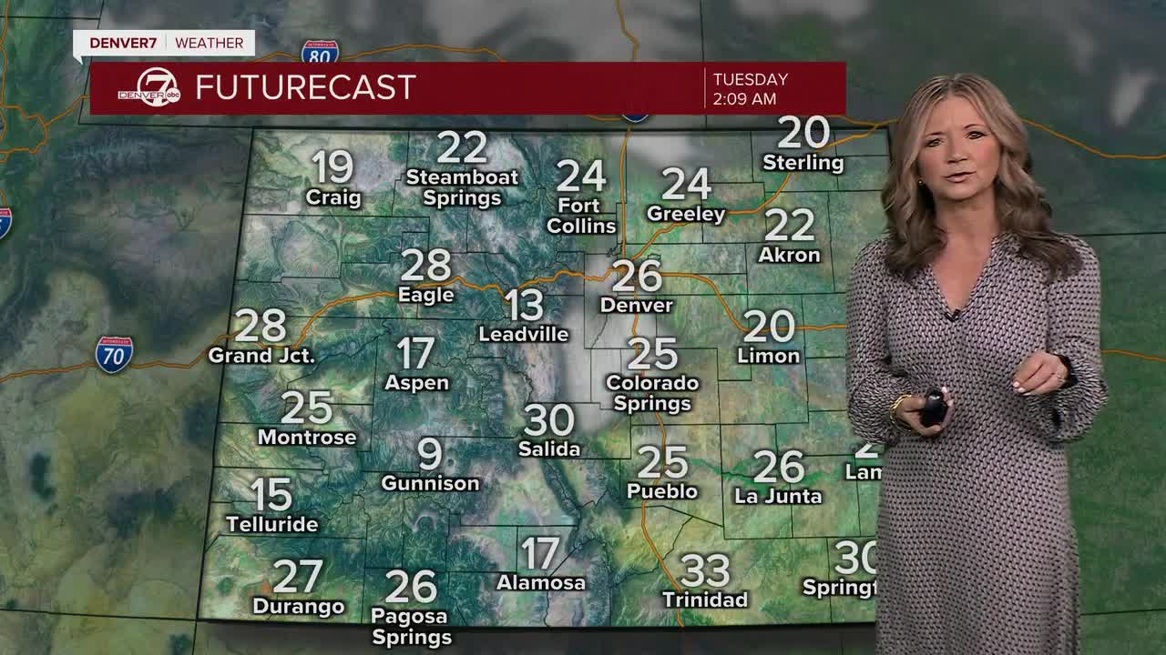
Looking ahead, things calm down nicely from Tuesday through Thursday. A brief break in the active weather sets up with generally dry conditions and more sunshine. That said, Tuesday could turn very dry and breezy, especially across the foothills and northeast plains. Winds could gust over 35 mph, and if we don’t get enough moisture from Monday night’s snow, fire danger could briefly become a concern.
By late Friday and into next weekend, a sharper blast of cold air is expected to arrive in Colorado. This looks like a brief cold outbreak, with overnight lows possibly dropping into the single digits or even below zero on the plains. There’s also a chance for some light snow, especially along the southern foothills, as that colder air settles in to wrap up the week.
DENVER WEATHER LINKS: Hourly forecast | Radars | Traffic | Weather Page | 24/7 Weather Stream
Click here to watch the Denver7 live weather stream.
