


DENVER — Finally! Winter weather is en route to Colorado tonight! Light snow showers will continue off and on this evening in the northern mountains. Look for a few clouds across the Denver metro as overnight lows dip into the mid-20s.
It'll be a tale of two sides of the Rocky Mountains. We'll wake up to sunshine in the city and see above-average highs in the low 60s along the I-25 corridor Wednesday afternoon.
Meanwhile, scattered snow showers will start to push into Colorado's High Country Wednesday morning. So far, it looks like the snow will spread from south to north, and intensify as the day goes on. The heaviest snow will arrive late Wednesday night into Thursday morning.
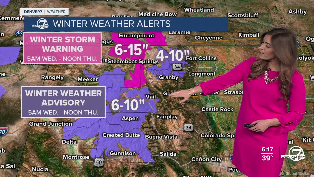
Heads up if you're traveling into the mountains! A Winter Storm Warning is in effect for the Park and Elkhead Mountains along with Rabbit Ears Pass from 5am Wednesday to noon Thursday. Those areas could see 6 to 15 inches of snow, with possibly more on the higher peaks.
A Winter Weather Advisory is in effect for the Front Range mountains and central mountains along I-70 from 5am Wednesday to noon Thursday. So far, it looks like those spots could pick up about 4 to 10 inches of new snow.
Slightly cooler temperatures in the mid to upper 50s and a chance of light rain showers return to the Denver metro area Thursday and possibly into Friday.
As that storm moves out, the warm and dry weather pattern returns for President's Day weekend. Look for upper 50s Saturday, low 60s Sunday and mid 60s Monday under partly sunny skies.
DENVER WEATHER LINKS: Hourly forecast | Radars | Traffic | Weather Page | 24/7 Weather Stream
Click here to watch the Denver7 live weather stream.
