


DENVER — A strong cold front raced into the Denver metro and NE Colorado Thursday evening, bringing gusty winds, scattered storms, dramatically cooler temperatures and even smoky skies behind it.
While the showers wind down after midnight, look for mostly cloudy skies and increasing smoke throughout the overnight hours. Lows will dip into the lower 50s by Friday morning.
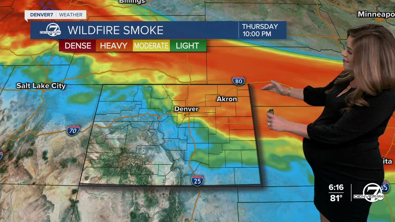
Smoke from wildfires burning across the Pacific Northwest and even Canada is moving into Colorado tonight and sticks around much of Friday. It could even linger into the start of the weekend. An Air Quality Alert is in effect for the Denver metro area until 4pm Friday for multiple pollutants (high levels of ozone and smoke).
As for the cooler air, it settles in for the end of the work week across the Eastern Plains. Look for dramatically cooler, below-average daytime highs in the upper 60s to low 70s Friday. It'll be a nice break from the heat, but it also marks the beginning of a bit more active weather pattern heading into the weekend.
A ridge of high pressure will be setting up to our west, but within that ridge, several small disturbances will move across Colorado. We'll see a few scattered storms across the High Country Friday afternoon with limited moisture on the plains. It stays dry with just slightly below-average temperatures in Denver Saturday.
Sunday will see more cloud cover and the chance for a few thunderstorms and showers for the first regular season Broncos game! Temperatures will climb into the low 80s by kick off on Sunday.
Looking ahead to early next, the ridge of high pressure will sit atop Colorado ushering in warmer weather. Temperatures are expected to skyrocket back into the mid to upper 80s - and close to 90 degrees by midweek.
DENVER WEATHER LINKS: Hourly forecast | Radars | Traffic | Weather Page | 24/7 Weather Stream
Click here to watch the Denver7 live weather stream.
