


DENVER — We're in for one more mild day across the Denver metro area before our next storm rolls in. You'll find increasing clouds, with highs in the mid to upper 40s by early Tuesday afternoon. The mountains will see some developing snow throughout the day, so you may see some slick high mountain passes.

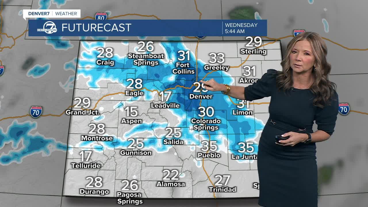
This next storm will bring us our heaviest snow of the season so far. A Winter Weather Advisory goes into effect at midnight for most of the Front Range and it includes Denver, Boulder, Castle Rock and Colorado Springs. The heaviest snow will fall through the Wednesday morning commute, with 2 to 5 inches near Denver and some slightly heavier totals along the Palmer Divide and on the west side of town.
Travel may be very difficult, especially during the Wednesday morning commute. Skies will gradually clear throughout the day, and we'll see improving conditions for the Wednesday evening commute.
Temperatures will gradually warm through the end of the week. Thursday will be chilly but dry and then, we're back in the mid to upper 40s by Friday. Mild conditions are expected through the weekend!
DENVER WEATHER LINKS: Hourly forecast | Radars | Traffic | Weather Page | 24/7 Weather Stream
Click here to watch the Denver7 live weather stream.
