


DENVER — Critical fire weather conditions are expected to continue across northeast Colorado through Friday, starting tonight with mostly clear skies and unseasonably warm temperatures. A strong ridge of high pressure remains firmly in place over the western United States, keeping our weather pattern dry and mild. Overnight, winds will gradually ease, but the dry air will remain in place, setting the stage for another elevated fire danger day on Friday.

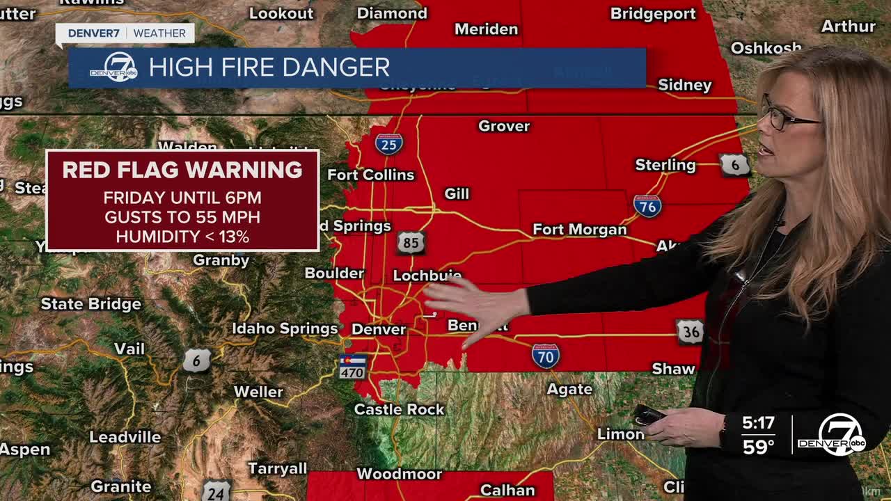
Friday will be warm, breezy, and very dry. Afternoon highs will climb into the upper 60s to lower 70s across the plains, well above normal for late February (which is 49 degrees). Relative humidity values will drop into the 7 to 15 percent range, and northwest winds could gust as high as 40 mph in some areas. A widespread Red Flag Warning is in effect due to the combination of strong winds and critically dry conditions. Even where winds are lighter at times, the overall setup supports dangerous fire behavior, so outdoor burning is strongly discouraged.
Saturday stays warm and dry, although a backdoor cold front sliding in from the northeast during the afternoon and evening will trim temperatures slightly, especially near the Nebraska and Wyoming borders. Highs will still be mild, but not quite as warm as Friday. Winds are expected to be lighter overall, though gusts up to 30 mph remain possible near the Wyoming border and in the foothills. Fire weather concerns will continue given the very low humidity.

By Sunday, cooler air settles in behind the front, with highs returning to the 50s and lower 60s across northeast Colorado. A weak easterly flow may bring a bit more moisture, and combined with passing energy aloft, this could produce a few showers. The best chance for precipitation will be across the northern mountains, where light snow is possible. At this time, only minor accumulations of a few inches are expected, and impacts should be limited.

Looking ahead to early next week, a broader pattern change appears increasingly likely. The long-standing ridge will shift east, allowing a series of disturbances to move through Colorado. The first system is expected around Tuesday into Tuesday night, bringing a chance for rain on the plains and additional snow in the mountains. Another system may follow later in the week. While temperatures should remain generally above normal, mainly in the 50s, cloudier days could keep some areas in the 40s. Overall, the stretch of warm and very dry weather will gradually transition toward cooler and somewhat more unsettled conditions as we move deeper into next week. Watch for a bigger storm potential as we head toward next Friday for Denver.
DENVER WEATHER LINKS: Hourly forecast | Radars | Traffic | Weather Page | 24/7 Weather Stream
Click here to watch the Denver7 live weather stream.
