


DENVER — After a record breaking high this afternoon in Denver- officially 68 degrees, the previous record was 67 degrees at DIA. Winds will gradually ease through the evening, and humidity levels will recover after sunset. It’ll stay mild and dry overnight under lingering high pressure, setting the stage for another warm February day on Monday.
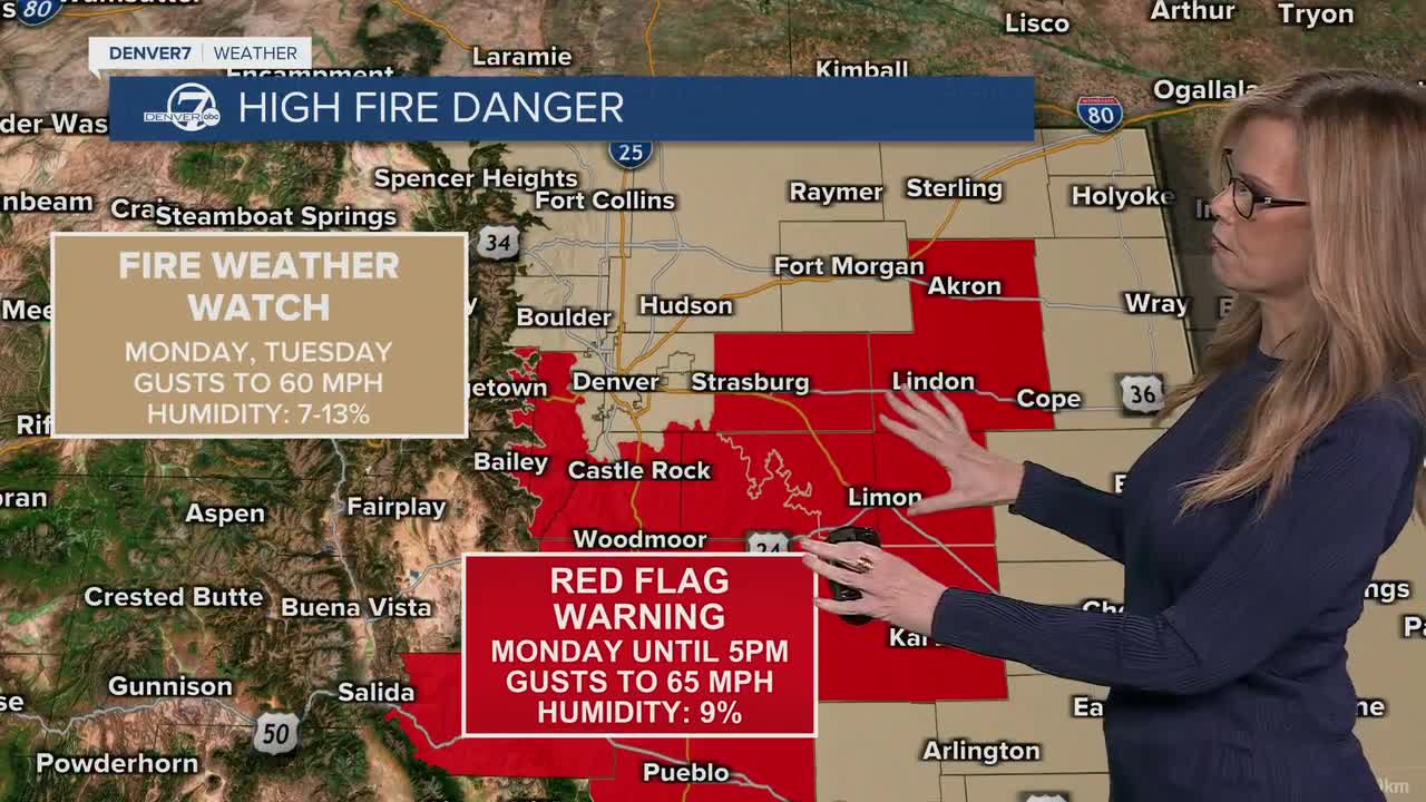
Monday is shaping up to be another fire weather day, especially across the eastern plains and along the southern I-25 corridor. A developing surface low will tighten the wind gradient, meaning some spots will see gusty south to southwest winds while others not too far away stay lighter. That sharp contrast makes the exact placement of the strongest winds tricky, but elevated to critical fire weather conditions are expected for much of the plains. Any outdoor burning is strongly discouraged.

Tuesday looks like the most impactful day of the week. Very windy conditions are likely east of the foothills, with critical to potentially extremely critical fire weather across the plains. Some southeastern areas could see especially strong gusts if higher-end wind projections pan out. At the same time, snow returns to the mountains early Tuesday, and conditions in the high country will go downhill quickly as the day wears on.
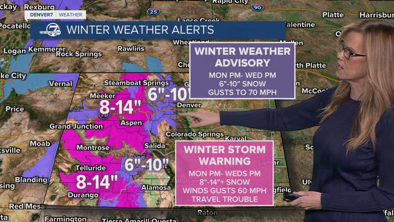
In the mountains, Tuesday will bring periods of snow along with strong winds that create blowing snow and sharply reduced visibility. Travel over the higher passes could become difficult to dangerous at times, especially during heavier bursts of snow. Accumulating snow continues into Wednesday, with additional rounds possible later in the week. While totals won’t be extreme everywhere, the combination of wind and falling snow will create impactful conditions. Winter Storm Warnings and Winter Weather Advisories are in effect from Monday night until Wednesday night.
By Wednesday and Thursday, fire weather concerns continue across parts of the plains, mainly east of I-25, as breezy and dry conditions linger. The overall pattern stays active through the end of the week, with more chances for mountain snow and even a low chance of light precipitation reaching the plains Friday into Saturday. Temperatures late week are a bit uncertain and will depend on how strong incoming cold fronts turn out to be, so stay tuned for updates as we refine the details.
DENVER WEATHER LINKS: Hourly forecast | Radars | Traffic | Weather Page | 24/7 Weather Stream
Click here to watch the Denver7 live weather stream.
