


DENVER — After a 70+ degree day around the Denver metro area, some changes are finally on the way! Look for a weak cold front to move through tonight bringing blustery winds and overnight lows in the upper 20s to low 30s.
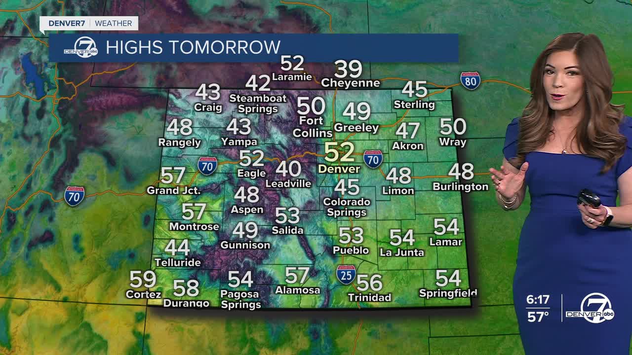
We'll start the day with mostly cloudy skies and then see them gradually clear by the afternoon. It'll be about 20-degrees cooler on Tuesday as highs will reach the low 50s, which is still slightly above-normal for this time of the year.
Look for a few light off-and-on snow showers across the northern and central mountains Tuesday.
A stronger storm and a better chance of mountain snow arrives Wednesday through Thursday, and possibly into Friday morning. So far, it looks like 5 to 10 inches of new snow is likely for much of the High Country.
While most of the moisture stays in the mountains, the Denver metro could see a few rain and/or snow showers Thursday afternoon and evening. Right now, it doesn't look like much.
It'll be a dry and mild President's Day weekend to come. Highs will sit in the mid-50s Saturday for Valentine's Day and low-60s Sunday around the city. The warm, dry weather lingers into early next week.
DENVER WEATHER LINKS: Hourly forecast | Radars | Traffic | Weather Page | 24/7 Weather Stream
Click here to watch the Denver7 live weather stream.
