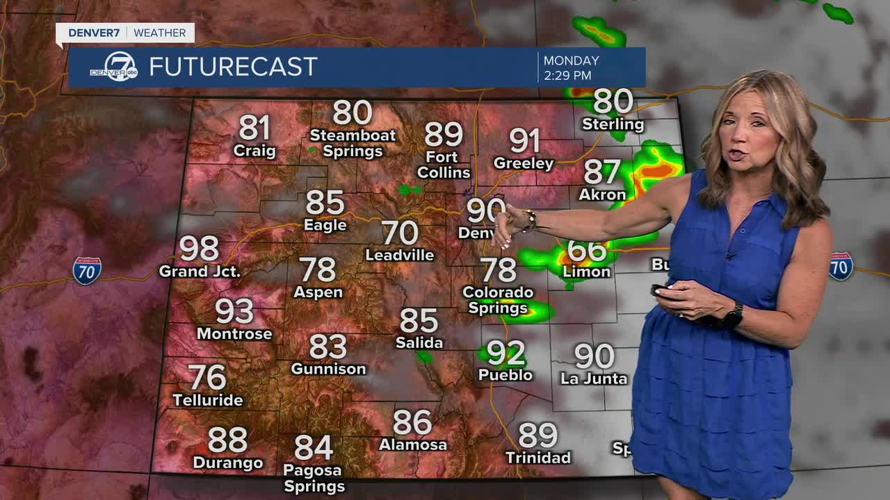


DENVER — It's a gorgeous and sunny start to the week. Monday will be the first full day of summer and it will be a pretty warm one. We'll see temperatures in the low to mid 80s by lunch, with highs near 90 degrees in Denver by 4 p.m.
- Watch the full forecast in the video player below.
As more moisture returns to the Eastern Plains, we'll see another round of storms and showers develop and roll east. These storms will likely develop around 1 p.m. along the Front Range. There is a marginal risk of severe weather along the Interstate 25 corridor but these storms will likely pick up even more steam near areas like Limon, Fort Morgan and Burlington. We could see some larger hail, gusty winds and isolated tornadoes.
We'll see a chance of severe storms across the eastern plains over the next three days. In fact, there will be a chance of storms each afternoon through Friday. We'll see some seasonal temperatures, with highs in the low to upper 80s from Tuesday through Friday.
In the mountains and high valleys, elevated to critical fire weather conditions will continue at times through much of next week. While a few storms are possible, many areas will remain relatively dry. Gusty winds combined with low humidity will keep fire danger elevated.
The atmosphere will dry out this coming weekend. We'll see more sunshine, few storms and highs in the mid to upper 90s on Saturday and Sunday.
DENVER WEATHER LINKS: Hourly forecast | Radars | Traffic | Weather Page | 24/7 Weather Stream
Click here to watch the Denver7 live weather stream.
