


DENVER — Scattered storms are gradually moving out overnight, as some clearing skies move in Thursday morning. Overnight lows will dip into the upper 50s along the Interstate 25 corridor.
Look for partly sunny skies Thursday with increasing clouds after lunchtime. The monsoon moisture makes a comeback to the state, with slow-moving thunderstorms likely along the Urban Corridor between 3 and 7pm Thursday. Heavy rain, lightning and gusty winds will be the biggest threats.
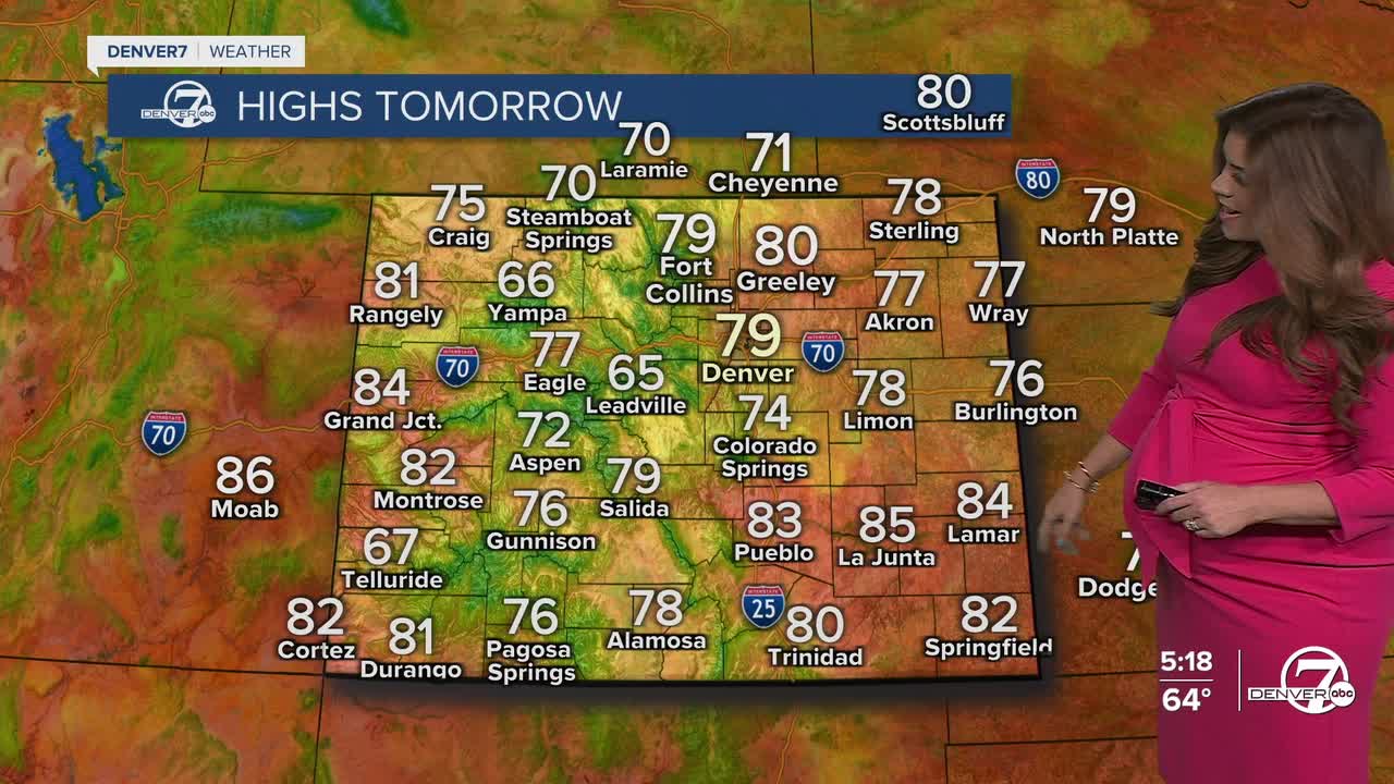
Temperatures will also remain well below normal. We'll see highs in the upper 70s to low 80s Thursday and Friday. We're in for another round of afternoon storms Friday, but they shouldn't be quite as widespread as what we've seen earlier this week.
Warmer and drier weather is back for Labor Day weekend. Look for a few storms Saturday afternoon with mostly sunny skies on tap Sunday and Monday around the Denver metro.
If you're heading up to the mountains to go camping, look for mild and dry conditions throughout the holiday weekend. Wet weather returns by the middle of next week.
DENVER WEATHER LINKS: Hourly forecast | Radars | Traffic | Weather Page | 24/7 Weather Stream
Click here to watch the Denver7 live weather stream.
