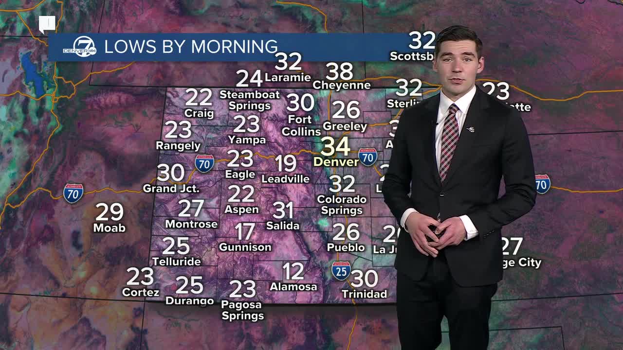


DENVER — The first weekend of 2026 will feel more like a spring weekend as Colorado's warm and dry pattern continues.
The Denver metro will see highs in the 60s both Saturday and Sunday, with the latter forecast approaching the daily record high of 67 degrees.
The warm and dry conditions will meet stronger downslope winds on Sunday, leading to higher fire danger. A fire weather watch is in place for the Front Range, foothills, Denver metro and I-25 corridor from 11 a.m. to 5 p.m. Sunday.
The fresh mountain snow that arrived this week over a weak snowpack is leading to elevated avalanche risk. The highest risks are in Park Range around Steamboat Springs, as well as the Ruby and Ragged Mountains near Crested Butte, where the Colorado Avalanche Information Center has issued a special advisory warning the avalanche risk on steep slopes is "dramatically" higher after the recent snowfall.
The mountains will see another round of snow late Sunday into early Monday, with just a few inches of accumulation expected for most areas.
The metro will stay dry through this weekend and early next week, but could see chances for snowfall late next week as much colder temperatures arrive next Thursday and Friday.
DENVER WEATHER LINKS: Hourly forecast | Radars | Traffic | Weather Page | 24/7 Weather Stream
Click here to watch the Denver7 live weather stream.
